Marcey (Updraft58) and Dennis (Mr. Waldo) came over with Ruben sandwiches to wish us farewell. My dad and I were furiously cleaning and packing, trying to get us moved out and the house ready for a showing this afternoon. My dad had just sprayed copious amounts of oven cleaner, and it was almost impossible even to walk through the house (our oven hadn't been cleaned since we moved in 7 years ago!). So we set up a makeshift table of cinderblocks and an old door, and enjoyed our sandwiches in full view of the Organs. It was wonderful to sit down with these two fine geocachers one last time. They have made geocaching in Las Cruces really fun for me, and their friendship will be forever treasured. There are many more Las Cruces geocacher's I've met or interacted with and come to love. Part of me wishes I had made an official geocaching event and gatehred everyone over for a big party. But with all the chaos of moving and getting our house ready to sell, it just wasn't feasible. To all those Las Cruces geocachers, you will be missed! If you ever passing through eastern Tennessee, come on by. I'm sure I'll have some new tough puzzle caches and mountain climbing caches out by then!
Both Dennis and Marcey took one of my new travel bugs with them as part of my TB Race to Knoxville. If you stumble across one of these bugs, help them get to Knoxville.
Thursday, May 8, 2014

Saturday, May 3, 2014
Last day in the Organ Mountains... and a special birthday FTF present.
I love the Organ Mountains. For climbing, hiking and geocaching. I combined all these activities into my geocaching series, Organ Saint. Some people, like myself are just drawn to these rugged mountains. So it is sad to say goodbye now that we are leaving New Mexico for the greener pastures of Tennessee. The only proper way to say goodbye would be one last hike and climb. I teamed up with Combatnurse2003, aka Mike, to see how many Rabbit Ears we could bag in a day. You would think a rabbit only has two ears, but not this one, there's the North Rabbit Ear, Middle Rabbit Ear, South Rabbit ear... then there's the Rabbit Ear Massif, and other lesser spires and ridges. No shortage of objectives here. And the hike up Rabbit Ears canyon is one of the best in the range.

We met at 5am at the jeep rd that starts up to the rock hut. I parked my city car, and piled my gear into Mike's sweet 4x4 jeep. We bumped and jostled our way up to the Rock hut, shaving a mile off our hike. It was still dark as we donned our packs, and we wore headlamps until we were well into the canyon. I enjoyed being the chattering guide, pointing out all the rock features and walls, places to camp and general climber's trivia. This was Mike's first trip up the canyon. Perhaps my chattering frightened the wildlife off, because we saw none, but I was happy to be in my element. At the granite bathtub Mike dropped a gallon of partially frozen water out of his pack to stash for later. I can't believe he carried so much water up here! It probably has something to do with our last big adventure in the Organs on Baylor Peak when he got pretty dehydrated. I don't blame him for carrying so much water after that experience. I should have done the same, but turns out I did almost the opposite. I had meant to take a 24 oz gatorade with me but it had jostled out of my pack on the bumpy jeep ride. So I was short liquids for the day. Bummer, but I wasn't about to let it ruin my fun.
 As we hiked higher up the canyon we debated some side objectives. The cache on the Citadel would make a great prize. I was the last find on it a few years ago. We decided that we would wait and see how felt on the way back down. It would be a significant amount of effort either way, what with a few pitches of climbing involved. Another temptation was ORP. Since we were planning on tagging the summit of the Massif anyways, we could almost justify taking the gully that one would take to go to ORP. It would only be a short side trip to that spire, then we could continue up the ridge to the massif. But we nixed this option too, thinkiong that our efforts were best spent on the main peaks. We were making good tme, reaching the saddle around 7:30am. We dropped our packs and made the quick and steep hike up to the Massif, and our first cache of the day, the venerable Labor of Hercules #10. While Mike worked that, I searched in vain for the summit register, only finding an old gatorade-powder lid. I was bummed not to find it, but there was a nice cache of water, 4 12-oz bottles. I grabbed one, knowing my own supply was less than optimal for the hot day we were going to have. Hopefully this doesn't piss someone off later, me steeling their water and all, but it was in a very obvious place where hikers go, so I figured it was fair game.

 Our next move was down to our packs and then over to the South Rabbit Ear or SRE as I like to call it. There is a short section of nasty bush whacking here which I had mostly forgotten about. No Organ Mountain experience is complete without this, and I was pleased to get one last taste, although Mike was grumbling somewhat. We dropped packs again at the col between MRE and SRE, had a quick snack and then scrambled up the easy lichen covered north face of the peak. I consider SRE to be an easy peak, and sometimes forget that even it has some serious challenges. The rock gets steep, the plants disappear and you really have to pay attention to what you are doing. This is especially true on the descent. It helped to have Mike there with me, and see the mountain afresh through his eyes. The niceties of being a guide! We didn't dally long on the summit, just enough to grab the cache, and peruse the summit register. Looks like SRE has been getting regular visits. Very cool!

 One nice thing about linking up SRE to MRE is that on the descent from SRE you can really scope out the regular route on MRE. I pointed out to Mike all the belay ledges, the crux moves etc.. and he had an absolutely clear idea of where to go. Then he handed me the rack... (just kidding, I was planning on leading the fun stuff anyways!). It's been a little while since I roped up for some real climbing. I was using my twin ropes and thin rack supplied by Mike. I knew the route, had climbed it multiple times but still got that nervous feeling in my gut... and sweaty palms. Well, that's why climbers use chalk right? Powdered courage! I stepped up to the rock and started to climb. Style, well, I've had better days. But man was it fun, and exhilarating. I think I've been missing this too much these past few years, chasing geocaches instead of technical climbs. Maybe I can remedy that in Tennessee? Who knows, but it felt real up there. Alive and one with the mountains in a way you can't get any where else. And as we climbed that sour thought kept popping into my head, "I am probably never going to see these mountains again".

We relaxed on top of MRE for a while. Mike was famished and tore into his lunch. My first priority was to look at the summit register. Marta had warned me that the jar had broken a while ago and she had replaced it, but it didn't occur to me that because it had been broken that pages would be damaged. A small animal had eaten away at the pages I left up here, making fractaled edges. And several pages were completely missing including the ones from my visits in 2011. I was a little bummed, seeing those entries is a cheap way to wax nostalgic about past achievements. The logs that caught my eye were from last weekend when Jon Tylka, Nate Fry and Glen Melin had attempted the full traverse of the Organ Needles. They ended bivying before the low horns, then fighting 70 mph winds.. all the way to NRE before finally calling it. Amazing! Another entry that caught my attention was one from March 28t where two climbers named Luke and Chance had written "Full Traverse". I wonder how many of the peaks they had actually nabbed, and if they had completed the full traverse? These thoughts distracted me for a bit, but eventually, the urge to check on the geocache I left up here grew too strong and I goaded Mike, who was comfortably relaxing, into making a search for it. He was doing what veteran cachers do, not relying on his GPSr and searching plausible locations. Except up on top of the MRE, every square foot is a plausible location. My impatience got the better of me and I pulled out my GPSr just to "check where GZ was". I was immensely pleased to see the numbers on the display drop down to zero ft as I stood directly over the cache. For only my second cache placement, I had marked coordinates very accurately!
 The cache itself was pristine. I don't know why I would worry about it, but for some reason I had imagined that either climbers would mess with it. Or maybe I had thought that the effects of ice and snow from the mountain top winters would allow water to intrude. Completely unreasonable it turns out, the little water-proof matchstick holder was untouched, and dry as a bone. The paper was still crisp and neat. There wasn't even a chew mark on the outer portion. This give me good hope that the cache will survive for many years. And why wouldn't it? Only I probably will not know because another geocacher might not be up here for several years s well. Mike sat down at the cliff's edge and signed the log in the coveted FTF spot. Today is his 39th birthday, so this is my birthday present to him. A worthy FTF prize if ever there was one.

 Eventually we felt rested and ready for some more and started our way to the north side descent. This involves a very steep down-climb to a faded orange rappel sling I vaguely remember from 3 years ago. I checked all around it and decided it was good to use, but we probably should have added a piece for back-up. I hoped on the rope first, and was quickly down to the churchkey. A bit lower I found a pair of shiny bolts, anchors that Jon had told me he had placed. Having well placed solid rappel stations made the next two rappels much nicer. I could have linked them up into a single 60m length rappel but I was worried about rope getting stuck on the stunted trees covering the middle ledge, so we broke it into two rappels to have more control over the rope-pulls. The rappels off the churchkey are fantastic, with free hanging sections, and an immense neon green lichen roof system off to climber's-left. A great mountaineering experience. As we went I pointed out route features on the north face of MRE. Mike wasn't interested in tackling the North Face directly. The long day was starting to wear on him and he was only up for the easiest possible route which would be the Davis Route. We checked the time, 2pm, and did some thinking. If we were to tackle NRE as well, it would probably be 4hrs to get up and down, plus another 3 for the return trip. That put us back after dark. Definitely doable, and perhaps if we had been younger, or more gung-ho we wouldn't even have hesitated. But the thought of a 15hr day, getting home after the family had already gone to sleep, and missing any further birthday celebration (for Mike) made our decision for us. I know we could have completed the MRE this day, but we made the wise decision to call it a day.

 The hike out was at a leisurely pace. Part of this was by necessity, the gully we had to descend was steep, loose and full of Organ Mtn vegetation. Mike took a couple of spills and bloodied himself from a close encounter with a cholla. No Organ mountain adventure is complete without someone getting intimate with the veg! At one section Mike lost his footing and came careening down on top of me, nearly bowling me over. He managed to shift his center of mass just enough to avoid a nasty collision, and halted himself without any injuries himself. This kind of stumbling is another typical feature of a long day in the Organs. Fatigue and dehydration add up and make the feet clumsier and clumsier as the day goes on. Another good reason to have called it a day instead of doing the MRE. But with plenty of afternoon daylight we could afford to take breaks, numerous relaxing breaks at several scenic spots in Rabbit Ears canyon. The ice water that Mike left by the bathtubs was divine. We chugged half of it, then decided to leave the rest as a water cache for future hikers and climbers. It is hidden away, but in a spot that is likely enough to be discovered by those who would need it. A bit further down we stopped at my favorite tree, a stunted broad-leafed tree with a canopy just my height, creating a perfect shady rest on one of the hottest parts of the approach around the Citadel. We chatted and laughed the whole way down, and I quietly said my goodbyes.
Goodbye ringtail cat, that looted our food when we camped here with a 7 month year old son.
Goodbye finger-singer, that slick 5.10 slabby test-piece that I so bravely led years ago.
Goodbye Lambda Wall, where I climbed with an Air Traffic Controller when we first moved to the area.
Goodbye Mexican buckeyes, with your startling rattles every time you are brushed.
Goodbye lonely spires, visited by the rare few who love to roam harsh terrain.
Goodbye rusted mining equipment, slowly decaying but still alluring.
Goodbye ocatillo blooms, flashing bright red buds against a see of browns.
Goodbye golden eagles, gently soaring from lofty perch to lofty perch.
Goodbye Organ mountains. My hear will forever ache for you.


Goodbye Organ Mountains....
We met at 5am at the jeep rd that starts up to the rock hut. I parked my city car, and piled my gear into Mike's sweet 4x4 jeep. We bumped and jostled our way up to the Rock hut, shaving a mile off our hike. It was still dark as we donned our packs, and we wore headlamps until we were well into the canyon. I enjoyed being the chattering guide, pointing out all the rock features and walls, places to camp and general climber's trivia. This was Mike's first trip up the canyon. Perhaps my chattering frightened the wildlife off, because we saw none, but I was happy to be in my element. At the granite bathtub Mike dropped a gallon of partially frozen water out of his pack to stash for later. I can't believe he carried so much water up here! It probably has something to do with our last big adventure in the Organs on Baylor Peak when he got pretty dehydrated. I don't blame him for carrying so much water after that experience. I should have done the same, but turns out I did almost the opposite. I had meant to take a 24 oz gatorade with me but it had jostled out of my pack on the bumpy jeep ride. So I was short liquids for the day. Bummer, but I wasn't about to let it ruin my fun.
One nice thing about linking up SRE to MRE is that on the descent from SRE you can really scope out the regular route on MRE. I pointed out to Mike all the belay ledges, the crux moves etc.. and he had an absolutely clear idea of where to go. Then he handed me the rack... (just kidding, I was planning on leading the fun stuff anyways!). It's been a little while since I roped up for some real climbing. I was using my twin ropes and thin rack supplied by Mike. I knew the route, had climbed it multiple times but still got that nervous feeling in my gut... and sweaty palms. Well, that's why climbers use chalk right? Powdered courage! I stepped up to the rock and started to climb. Style, well, I've had better days. But man was it fun, and exhilarating. I think I've been missing this too much these past few years, chasing geocaches instead of technical climbs. Maybe I can remedy that in Tennessee? Who knows, but it felt real up there. Alive and one with the mountains in a way you can't get any where else. And as we climbed that sour thought kept popping into my head, "I am probably never going to see these mountains again".We relaxed on top of MRE for a while. Mike was famished and tore into his lunch. My first priority was to look at the summit register. Marta had warned me that the jar had broken a while ago and she had replaced it, but it didn't occur to me that because it had been broken that pages would be damaged. A small animal had eaten away at the pages I left up here, making fractaled edges. And several pages were completely missing including the ones from my visits in 2011. I was a little bummed, seeing those entries is a cheap way to wax nostalgic about past achievements. The logs that caught my eye were from last weekend when Jon Tylka, Nate Fry and Glen Melin had attempted the full traverse of the Organ Needles. They ended bivying before the low horns, then fighting 70 mph winds.. all the way to NRE before finally calling it. Amazing! Another entry that caught my attention was one from March 28t where two climbers named Luke and Chance had written "Full Traverse". I wonder how many of the peaks they had actually nabbed, and if they had completed the full traverse? These thoughts distracted me for a bit, but eventually, the urge to check on the geocache I left up here grew too strong and I goaded Mike, who was comfortably relaxing, into making a search for it. He was doing what veteran cachers do, not relying on his GPSr and searching plausible locations. Except up on top of the MRE, every square foot is a plausible location. My impatience got the better of me and I pulled out my GPSr just to "check where GZ was". I was immensely pleased to see the numbers on the display drop down to zero ft as I stood directly over the cache. For only my second cache placement, I had marked coordinates very accurately!
The cache itself was pristine. I don't know why I would worry about it, but for some reason I had imagined that either climbers would mess with it. Or maybe I had thought that the effects of ice and snow from the mountain top winters would allow water to intrude. Completely unreasonable it turns out, the little water-proof matchstick holder was untouched, and dry as a bone. The paper was still crisp and neat. There wasn't even a chew mark on the outer portion. This give me good hope that the cache will survive for many years. And why wouldn't it? Only I probably will not know because another geocacher might not be up here for several years s well. Mike sat down at the cliff's edge and signed the log in the coveted FTF spot. Today is his 39th birthday, so this is my birthday present to him. A worthy FTF prize if ever there was one.Eventually we felt rested and ready for some more and started our way to the north side descent. This involves a very steep down-climb to a faded orange rappel sling I vaguely remember from 3 years ago. I checked all around it and decided it was good to use, but we probably should have added a piece for back-up. I hoped on the rope first, and was quickly down to the churchkey. A bit lower I found a pair of shiny bolts, anchors that Jon had told me he had placed. Having well placed solid rappel stations made the next two rappels much nicer. I could have linked them up into a single 60m length rappel but I was worried about rope getting stuck on the stunted trees covering the middle ledge, so we broke it into two rappels to have more control over the rope-pulls. The rappels off the churchkey are fantastic, with free hanging sections, and an immense neon green lichen roof system off to climber's-left. A great mountaineering experience. As we went I pointed out route features on the north face of MRE. Mike wasn't interested in tackling the North Face directly. The long day was starting to wear on him and he was only up for the easiest possible route which would be the Davis Route. We checked the time, 2pm, and did some thinking. If we were to tackle NRE as well, it would probably be 4hrs to get up and down, plus another 3 for the return trip. That put us back after dark. Definitely doable, and perhaps if we had been younger, or more gung-ho we wouldn't even have hesitated. But the thought of a 15hr day, getting home after the family had already gone to sleep, and missing any further birthday celebration (for Mike) made our decision for us. I know we could have completed the MRE this day, but we made the wise decision to call it a day.The hike out was at a leisurely pace. Part of this was by necessity, the gully we had to descend was steep, loose and full of Organ Mtn vegetation. Mike took a couple of spills and bloodied himself from a close encounter with a cholla. No Organ mountain adventure is complete without someone getting intimate with the veg! At one section Mike lost his footing and came careening down on top of me, nearly bowling me over. He managed to shift his center of mass just enough to avoid a nasty collision, and halted himself without any injuries himself. This kind of stumbling is another typical feature of a long day in the Organs. Fatigue and dehydration add up and make the feet clumsier and clumsier as the day goes on. Another good reason to have called it a day instead of doing the MRE. But with plenty of afternoon daylight we could afford to take breaks, numerous relaxing breaks at several scenic spots in Rabbit Ears canyon. The ice water that Mike left by the bathtubs was divine. We chugged half of it, then decided to leave the rest as a water cache for future hikers and climbers. It is hidden away, but in a spot that is likely enough to be discovered by those who would need it. A bit further down we stopped at my favorite tree, a stunted broad-leafed tree with a canopy just my height, creating a perfect shady rest on one of the hottest parts of the approach around the Citadel. We chatted and laughed the whole way down, and I quietly said my goodbyes.Goodbye ringtail cat, that looted our food when we camped here with a 7 month year old son.
Goodbye finger-singer, that slick 5.10 slabby test-piece that I so bravely led years ago.
Goodbye Lambda Wall, where I climbed with an Air Traffic Controller when we first moved to the area.
Goodbye Mexican buckeyes, with your startling rattles every time you are brushed.
Goodbye lonely spires, visited by the rare few who love to roam harsh terrain.
Goodbye rusted mining equipment, slowly decaying but still alluring.
Goodbye ocatillo blooms, flashing bright red buds against a see of browns.
Goodbye golden eagles, gently soaring from lofty perch to lofty perch.
Goodbye Organ mountains. My hear will forever ache for you.
Goodbye Organ Mountains....
Saturday, April 26, 2014
Moving to Knoxville Travel Bug Race Kicked-Off!
We're moving to Knoxville in a few weeks. We're packing up stuff, getting rid of things, trying to figure out how we're going to travel all the way across the country. And it occurred to me that this would be a perfect time to set-free a brace of bugs and see if I can capture them in Knoxville in the next few years. I give them only a 15% chance of success, so releasing 6 bugs ought to be enough to get at least one.

The 6 travel bugs being released are a Brass NM tag, a Dream-catcher, an Angry-Bird, a Magellan SporTrak, A Bonhomme and a piece of driftwood. Some of them have back-stories, and others were simply picked up at a truck stop. I hope all of them go to fun places, and eventually make it to Knoxville. I'll be keeping track of their progress and locations at this webpage which can also be accessed from the header in my blog. And if any of them beat us to Knoxville, I will be utterly floored.
The Legend of Dan Cooper
WARNING: SPOILER PICTURES BELOW
After attending a birthday party at the Alamogordo Zoo today, I dragged the family on a pursuit of Dan Cooper. This is a delightful geocaching series that can be done in about an hour with a bunch of driving around town. The write up online for each stage tells a part of the D.B. Cooper story, and the final is an awesome find in a desert barren.
This is the kind of cache that is easy to drag the family on, has lot's of goodies for the kids and is a fun story. Plus the final was big enough for both Levin and Ada to sit in while they perused the contents. The only thing that could have been better would be if the winds were not gusting 60 mph.


Thursday, April 24, 2014
Passover with Fugads... or how I managed to get almost all my relatives to go geocaching with me.
Passover has always been the big family holiday for my family. Ever since we were little, my family would drive (or alter fly) to Baltimore where my grandparents lived, where we would join up with uncles, aunts, cousins and the like for a big Passover Seder. As a kid, I wasn't so fond of these annual family gatherings. I was made to wear an uncomfortable starched shirt and clip-on tie. The reading of the Hagadah before the Seder meal seemed to take forever, and for a fidgety kid, having to sit patiently at the table for long periods, smelling dinner in the room just next door, but not being able to eat any of it was just short of torture. But the older I got, the more I appreciated these rare family gatherings. And this so even more so since it was the first Passover gathering I've been able to attend since 2011.
What does any of this have to do with geocaching? You see, that last Seder I was at was right after I started geocaching but before I had become really nutty about it. But now, a visit to a new geocache rich area gets me all fired up. So many parks to explore, puzzles to solve, new stats to earn, challenges to complete. The thing is to try to get some of this enthusiasm to spread to other members of the family. A challenge indeed.
The first geocache foray of our Passover trip was on the Saturday right after we arrived. My youngest went down for a nap and my aunt had just left to pick up my sister (and family) from BWI. That left uncle Rob, cousin Jessie my son and me with a free afternoon. Uncle Rob suggested going to what they call the "Mink House", aka Meadowside Nature Center. Not only do they have a great visitor center with tons of kid friendly activities, but they also have some rescued raptors in an outdoor aviary, an obstacle course and nature trails. I brought my GPSr "just in case" and we made the short 10 minute drive over. After enjoying the visitor center and seeing the rescued raptors, I turned on my GPSr "just to check: and what do you know, there was a cache only 0.1 miles away. Of course my son wanted to go find it, and Uncle Rob and Jessie seemed game as well so off we went. Turns out it was a bit longer walk, down a meandering trail, but soon enough we were at GZ. I had given the GPSr to Jessie and she was trying to hone in on the elusive GZ. Treecover and the hillside made it jump around somewhat. Levin and I immediately went towards a downed log over some rocks, thinking that would be the most likely spot, but as we were searching all over, Jessie yelled out. She had found it on the other side of the trail. The cache turned out to be a decent size and had a bunch of fake spiders in it, fitting since it was named Arachnaphobia. Jessie was pretty buoyant about finding the cache and was game for finding another one (only 1/4 mile away!) but Uncle Rob's knee was giving him trouble so we opted to head back up to the car. On the way, we passed an obvious plastic toolbox at the base of a tree that had the words "Official Geocache" written on it. We of course investigated and found that it had been placed by the park staff and contained some rough tools for determining the height of a tree (a straw-and-paper inclinometer and tape measure. We measured the nearest tree, which was fun but Levin was more interested jumping across rocks in the nearby stream.
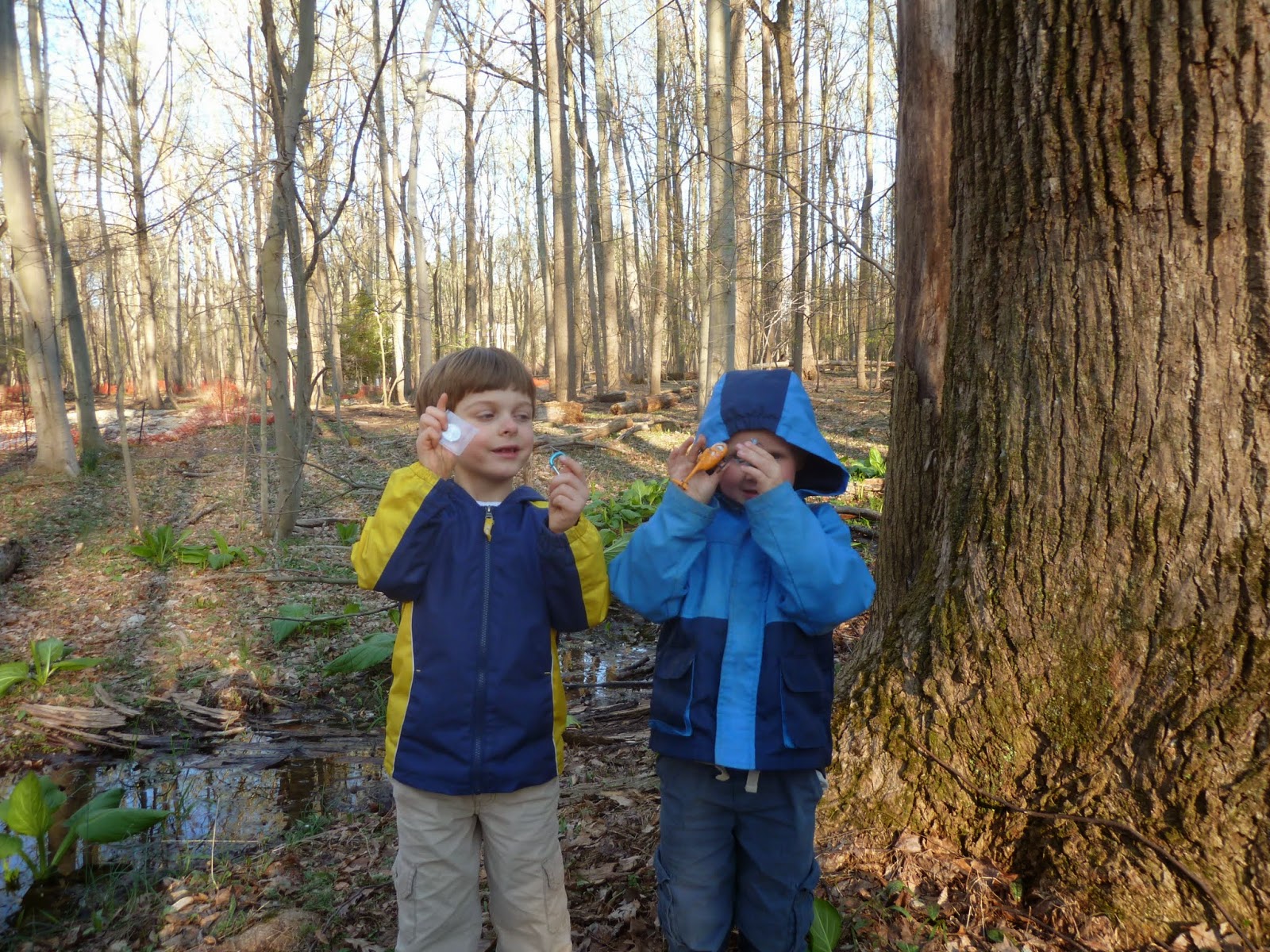 The next geocaching adventures were not even initiated by me. The park near my Rob and Kay's house hosts a nice playground, tennis courts a toad pond and... tons of caches. We visited mainly for the former, but on one of our trips Milo stopped by to find a few of the caches. Once he had found them, and the kids heard about it they had to go see them too. So the cache at Norbeck Meadow saw quite a bit of traffic. On Wednesday, I even got Alden and Levin to hike 1/2 mile with me to the cache Elephant's Trunk, which was disappointingly a micro. The trip their was awesome though, with Levin and Alden helping to figure out the best way to cross the creek without getting wet (I slipped and got wet on the return though, and almost took Alden in with me).

 Our most fruitful Geocaching foray came on Thursday when I took Levin, Sarah and Kay out for a hike. The nearby Lake Needwood had a cache that had piqued my interest, one that used Geodesy and Godzilla. How cool is that! Turns out it is a nice park for a stroll as well. We were treated with a nice large geocache complete with Godzilla stuff in it. Riding the high of such a nice cache, we decided to strike off for the next nearest one, less than a 1/4 mile away. Unfortunately, that short walk involved steep loose slopes and a stream crossing, and Sarah was increasingly concerned that Aunt Kay's knees would give out (Aunt Kay stoically said she was fine though). We did manage to get to the coordinates for the cache though. I spotted it right off, but it took the others a bit more looking, since it was up high in a tree. I own a cache similar to this one, they make for fun finds.

Everyone who found some caches seemed to enjoy it, and Jessie and Sarah even talked about doing it on their own, but I'm not convinced that they will. I kept getting the feeling that they were all quietly amused at how much I get into this strange little hobby. I mean, can't I just enjoy going someplace without having to find something? I used to... but now I just can't resist that sirens call.
What does any of this have to do with geocaching? You see, that last Seder I was at was right after I started geocaching but before I had become really nutty about it. But now, a visit to a new geocache rich area gets me all fired up. So many parks to explore, puzzles to solve, new stats to earn, challenges to complete. The thing is to try to get some of this enthusiasm to spread to other members of the family. A challenge indeed.
The first geocache foray of our Passover trip was on the Saturday right after we arrived. My youngest went down for a nap and my aunt had just left to pick up my sister (and family) from BWI. That left uncle Rob, cousin Jessie my son and me with a free afternoon. Uncle Rob suggested going to what they call the "Mink House", aka Meadowside Nature Center. Not only do they have a great visitor center with tons of kid friendly activities, but they also have some rescued raptors in an outdoor aviary, an obstacle course and nature trails. I brought my GPSr "just in case" and we made the short 10 minute drive over. After enjoying the visitor center and seeing the rescued raptors, I turned on my GPSr "just to check: and what do you know, there was a cache only 0.1 miles away. Of course my son wanted to go find it, and Uncle Rob and Jessie seemed game as well so off we went. Turns out it was a bit longer walk, down a meandering trail, but soon enough we were at GZ. I had given the GPSr to Jessie and she was trying to hone in on the elusive GZ. Treecover and the hillside made it jump around somewhat. Levin and I immediately went towards a downed log over some rocks, thinking that would be the most likely spot, but as we were searching all over, Jessie yelled out. She had found it on the other side of the trail. The cache turned out to be a decent size and had a bunch of fake spiders in it, fitting since it was named Arachnaphobia. Jessie was pretty buoyant about finding the cache and was game for finding another one (only 1/4 mile away!) but Uncle Rob's knee was giving him trouble so we opted to head back up to the car. On the way, we passed an obvious plastic toolbox at the base of a tree that had the words "Official Geocache" written on it. We of course investigated and found that it had been placed by the park staff and contained some rough tools for determining the height of a tree (a straw-and-paper inclinometer and tape measure. We measured the nearest tree, which was fun but Levin was more interested jumping across rocks in the nearby stream.
The next geocaching adventures were not even initiated by me. The park near my Rob and Kay's house hosts a nice playground, tennis courts a toad pond and... tons of caches. We visited mainly for the former, but on one of our trips Milo stopped by to find a few of the caches. Once he had found them, and the kids heard about it they had to go see them too. So the cache at Norbeck Meadow saw quite a bit of traffic. On Wednesday, I even got Alden and Levin to hike 1/2 mile with me to the cache Elephant's Trunk, which was disappointingly a micro. The trip their was awesome though, with Levin and Alden helping to figure out the best way to cross the creek without getting wet (I slipped and got wet on the return though, and almost took Alden in with me).Our most fruitful Geocaching foray came on Thursday when I took Levin, Sarah and Kay out for a hike. The nearby Lake Needwood had a cache that had piqued my interest, one that used Geodesy and Godzilla. How cool is that! Turns out it is a nice park for a stroll as well. We were treated with a nice large geocache complete with Godzilla stuff in it. Riding the high of such a nice cache, we decided to strike off for the next nearest one, less than a 1/4 mile away. Unfortunately, that short walk involved steep loose slopes and a stream crossing, and Sarah was increasingly concerned that Aunt Kay's knees would give out (Aunt Kay stoically said she was fine though). We did manage to get to the coordinates for the cache though. I spotted it right off, but it took the others a bit more looking, since it was up high in a tree. I own a cache similar to this one, they make for fun finds.Everyone who found some caches seemed to enjoy it, and Jessie and Sarah even talked about doing it on their own, but I'm not convinced that they will. I kept getting the feeling that they were all quietly amused at how much I get into this strange little hobby. I mean, can't I just enjoy going someplace without having to find something? I used to... but now I just can't resist that sirens call.
 |
| Levin at the National Zoo. Guess what, it's right near the GZ for a virtual cache. Surprise surprise huh? |
Thursday, April 10, 2014
Adopting out caches

I've started adopting out some of my caches in the Las Cruces area. It's something I've been hemming and hawing about for a couple reasons. It shouldn't be a big issue, but I've become pretty attached to my cache listings, perhaps unnaturally so. I don't want to let them go, I want them to forever be associated with my caching name, as memorials to my geocaching creativity. Utter hogwash, but sentimentality can get the best of me. It's not like I cannot still enjoy them if they are adopted out. I can continue to watch all the logs on them. But somehow the fact that those logs are no longer digitally tied to my geocaching persona irks me. Just plain silly.
I started out by adopting out some caches to the GPSmen, who a have been big fans of my Datums series. Bye bye Matter of Datums 1, 2 and 3 as well as my Las Cruces Positioning System cache. GPSmen also got my Geohashing Challenge which they have been really into, continuing to find collisions even to this day. I know those cachse will be well looked after. The Marauders offered to keep an eye on my evil substitution puzzle, The Hills are Alive.. with the Sound of CODES. I suspect that that puzzle and cache location will have little to no need of maintenance for years to come, but if they ever do it's nice to know someone will be there. One of my caches which might require the most checking in on is my Young Park Scavenger Hunt, with it's 8+ stages in a popular park. Considering it has been going for a couple years now with only minor maintenance required, I'd like to think it was pretty well designed, but I'm still happy that Sexyboo graciously offered to keep it alive after we've moved.
But that's only 7 of more than 40 caches...In the end, I think most of them I will just leave as they are and hope for the best. Many are in areas that are unlikely to be disturbed, or found often. Hopefully they will survive many years to come. And when they need help, I can call on the friends I've made in Las Cruces to see if they can't be salvaged.
But what should I do about my all important ... stats! Yes, stats, that little number that assigns value or ranking. Something that drives one to madness. I am well aware of my stats, especially on such sites as the Lonely Cache Project. Many of these caches I am adopting out will mean my stats will change. no longer will I show as owner of XX number of caches, or a 5* difficulty puzzle. And my points on LCP will drop... that is unless I log all my caches as found. It sounds really cheesy, logging my own caches as found, but in a perverted way it makes sense. Whereas once these caches of mine contributed to my stats as ones I owned, they will be converted to stats by becoming caches I've found. I solicited some feedback on the LCP forums, but haven't had much response. I'd love to hear from folks though. Is this a brilliant or foolish thing to do?
Saturday, April 5, 2014
Puzzle caching with the kids
The kids, the dog and I needed to be out of the house all day, to keep it clean and ready for showings... so we went caching of course. I had a bunch of puzzle caches that were high on my list to go after, and many of these promised to have good toys in them, so the kids were excited too.
Our first stop was at the new GPSmen puzzle cache, Feel Puzzle. Very straightforward, but I found reading the braille to be remarkably difficult, especially since you were forced to only use your fingertips. The cache was beautifully crafted, with a nice wooden box that had the entire Braille alphabet printed out in it's lid (guess i didn't need to bring that cheat sheet with me). The kdis were patient with me as I struggled to get the coords, but the desert here was friendly and they were soon playing around the creosote, and finding smooth arroyo pebbles to toss. Once I was happy that I had good coordinates, we traipsed back over to the car and drove a short ways before parking again and taking another short walk through the desert. I told Levin that he could make the find, and when we got close I was sure it was going to be under a lone scrubby tree. But it wasn't! It was close though, and camouflaged with great care. We really liked the execution, and the toys. Levin traded for the mini-cooper and Ada took a blue pebble. I left a funky magnetic clock that I've had at my desk at work for years.


On the walk back to the car, we finally wised up to the beauty around us. Funny how you can get blinded by geocaching and not see what is going on around you. Several hedgehog cacti we passed had fresh blooms. And there were massive flocks of sparrows singing up a storm. We would approach a flock and just stand nearby, quietly listening to the scores of voices trilling together.


 We drove up into Soledad canyon next where I hoped to find a couple of different puzzle caches. What I didn't count on was the wind. I had not packed windbreakers or warm jackets for the kids, and after only 15 minutes of hiking they were both whining about the wind and cold. We got to the first puzzle cache I had solved, relatively close but up a steep hill, and were rewarded once again with nice toys. After making some more trades, we started off to the next solved puzzle, but the winds on the ridge-top were fierce and it was cold. We bailed about halfway to the next cache. It was too early in the day to have miserable kids. ON our way down we spotted a sheltered cave that looked just perfect for a lunch stop. It was difficult getting the kids to it, since it involved steep loose slopes, but when we finally got there it was perfect; completely sheltered from the wind, a nice flat pebbly area to relax, and interesting cave "drawings". Good thing the kids aren't savvy to graffiti yet.
Once we made it back to the car, I wasn't exactly sure where we should go next. So we ended up puttering around the campus of NMSU, finding a few of the new caches there (and not finding a bunch more). These caches weren't of much interest to the kids though, so once they started getting cranky, I called up our favorite Mexican restaurant and ordered lunch. We picnic'd on our front lawn.


IN the end, the house stayed clean, the kids got new toys, and I found 3 puzzle caches that were high on my list. Not too shabby.
Our first stop was at the new GPSmen puzzle cache, Feel Puzzle. Very straightforward, but I found reading the braille to be remarkably difficult, especially since you were forced to only use your fingertips. The cache was beautifully crafted, with a nice wooden box that had the entire Braille alphabet printed out in it's lid (guess i didn't need to bring that cheat sheet with me). The kdis were patient with me as I struggled to get the coords, but the desert here was friendly and they were soon playing around the creosote, and finding smooth arroyo pebbles to toss. Once I was happy that I had good coordinates, we traipsed back over to the car and drove a short ways before parking again and taking another short walk through the desert. I told Levin that he could make the find, and when we got close I was sure it was going to be under a lone scrubby tree. But it wasn't! It was close though, and camouflaged with great care. We really liked the execution, and the toys. Levin traded for the mini-cooper and Ada took a blue pebble. I left a funky magnetic clock that I've had at my desk at work for years.
 |
| Can you spot the cache? |
 |
| Ada's blue pebble |


On the walk back to the car, we finally wised up to the beauty around us. Funny how you can get blinded by geocaching and not see what is going on around you. Several hedgehog cacti we passed had fresh blooms. And there were massive flocks of sparrows singing up a storm. We would approach a flock and just stand nearby, quietly listening to the scores of voices trilling together.
We drove up into Soledad canyon next where I hoped to find a couple of different puzzle caches. What I didn't count on was the wind. I had not packed windbreakers or warm jackets for the kids, and after only 15 minutes of hiking they were both whining about the wind and cold. We got to the first puzzle cache I had solved, relatively close but up a steep hill, and were rewarded once again with nice toys. After making some more trades, we started off to the next solved puzzle, but the winds on the ridge-top were fierce and it was cold. We bailed about halfway to the next cache. It was too early in the day to have miserable kids. ON our way down we spotted a sheltered cave that looked just perfect for a lunch stop. It was difficult getting the kids to it, since it involved steep loose slopes, but when we finally got there it was perfect; completely sheltered from the wind, a nice flat pebbly area to relax, and interesting cave "drawings". Good thing the kids aren't savvy to graffiti yet.Once we made it back to the car, I wasn't exactly sure where we should go next. So we ended up puttering around the campus of NMSU, finding a few of the new caches there (and not finding a bunch more). These caches weren't of much interest to the kids though, so once they started getting cranky, I called up our favorite Mexican restaurant and ordered lunch. We picnic'd on our front lawn.
IN the end, the house stayed clean, the kids got new toys, and I found 3 puzzle caches that were high on my list. Not too shabby.
Subscribe to:
Posts (Atom)