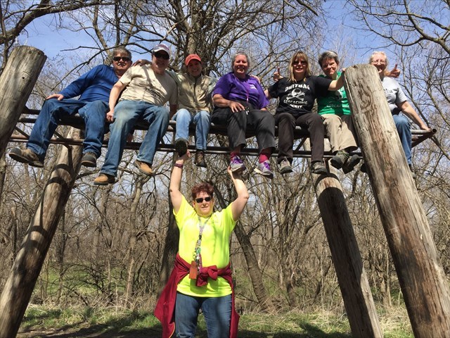
Thursday, May 3, 2018

An Update on my TB projects

It's been a while since I've checked in on my two TB races that I started years ago. I created separate pages for each race, The Lonely TB Project and the Moving to Knoxville TB Race. I guess the first one isn't really a race, but the latter one was... and it mostly flopped. I think all of the TBs went missing within a year or maybe a little more, and one never even left Las Cruces, getting lost by the geocacher I handed it off to.  Two of the TBs actually made it to an adjacent state to the final destination, but none were ever close enough for me to go out and try to retrieve. I think I'll go ahead and retire the TB race page... it is no longer relevant.

Moving to Knoxville TB Race Stats


Track Hops Status Current Location Interesting Notes
Fugads' Angry Bird TB61NER 0 Missing??Released 5/7/14 to Updraft58 Las Cruces, NM Declared missing. Don't know why Marcy never logged this one somewhere.
Dream Catcher TB61NF1 21 Missing. last seen in the hands of champster850. North Carolina Climbed 5th class rock to reach MRE. Given to Combatnurse2003 and taken east to North Carolina.
Bonhomme de Quebec 2001 TB61NEZ 4 Missing? Last seen in GC1AH1B Washington Finally moved after months of sitting in Alamogordo.
Land of Enchantment TB61NE3 41 ?? VirginiaReleased 5/10/14 at the Cadillac Ranch. Visited Reno, NV, then to East Coast somehow.

Lost GPSr:Magellan SporTrak

TB61N3V 21 Missing? Perhaps in the hands of Tayl0rr0se Texas Released 5/7/14 to Mr. Waldo, placed in a cache that was disabled! Then retrieved by CO. Given to Anymoore, who I met at an event last fall.

Just Drifting Along

TB61NEQ 1 Missing El Paso, TX Reported as no longer in the cache I dropped it in. Marked as missing.

The Lonely TB project has fared a little better, but then, I expected these TBs to last a little better since they are intentionally left in Lonely Caches. Of the 4 Lonely TBs I released, only two have moved. Two are still in ridiculously remote and difficult terrain geocaches that honestly, might never be visited again. Who knows? One got moved a little bit around the Las Cruces area but ended up in one of my complicated multi-caches there and has since settled in for a good long wait. The alst one I might actually see again, as the geocacher that picked it up is going to mail it to me. He had good intentions to put it in a really lonely cache, but his health took a turn for the worse and he hasn't been able to get it out. I appreciate that he is mailing it back to me. I have no doubt that I will find another good lonely spot for it.

Lonely TB Project

NAMETrackLonely Caches visitedAccumulated LCPsCurrent LocationInteresting Notes
DNBOE lonely cache hunterTB4KGCR
6
492
Prospectors: CYOAMy first of these that was actually moved to a new lonely cache
Lonely Cache Hunter: Hollow PointTB56QGV
8
617
A22A22 is one of the loneliest caches in NM, after 2 years it has still only been found by one person, ME!
Lonely Cache Hunter: SharkTB4J2AN
6
269
Rattle Snake RidgeCurrently in a 5/5 cache.
The Turtle Lonely Cache VisitorTB54TD3
9
489
With SirChrisRey
Was moved around a lot by SirChrisRey, but for health reasons he ended up mailing it back to me.

It's hard to find much satisfaction from either of these TB projects. The Knoxville race seemed like it really just didn't get anywhere. The Lonely TBs are kind of doing what I expected them to, hanging out in lonely caches for extended periods of time, but I was really expecting them to move around a little bit. I guess the Lonely caches I placed them in were a little too lonely.

Tuesday, May 1, 2018

Some thoughts on Geocaching "Haters"

On one of my recent geocache finds (GC1DX1Z), there was an interesting exchange between some person who repeatedly visited the geocache and left notes in it, and the geocachers who came out to actually find the geocache. This person obviously does not think highly of geocaching or geocachers, but it seems odd that they would bother at all writing notes in this geocache. To make things even more interesting this cache is located pretty far out in the wilderness. You are looking at a minimum of a 7 mile hike, some of it off trail, and with a good amount of elevation climb on top of that, all at elevations above 10,000 ft! It got me thinking about what kind of person would leave such notes.
The first log entry by this mystery person appeared in 2014, where they call the geocache trash. The next entry by this person, some time between 2014 and 2015, threatens to remove the geocache. The next geocacher to find the cache in 2015 actually comments on the previous logs, asking the guy to chill out. The next log, from our mystery person, responds to this, and then proceeds with insulting people who geocache. They probably realize that each geocacher that finds this and leaves a message is unlikely to ever see the response, but maybe not. In general geocachers do not return to such wilderness caches for repeat finds. Just reading through the logs gives some semblance of a dialogue. And this made me smile because it is a dialogue between this one angry person and many geocachers who will probably never see the responses.

The next geocacher to find the cache in 2016 leaves a polite response to our mystery person, which then has a retort later that same year. This time the tone of the retort is more along the lines of geocachers not being able to find joy out here in this amazing spot, because they are blindly following their GPS devices to predetermined spots. As if the act of going to this amazing place would be better if someone came to it by some other "pure" motivation. This retort is followed by what appears to be another visit from the mystery person that same year bemoaning that the geocache is still in place and being found by "robots".

Three geocachers find the cache after this, a pair in 2016 and one in 2017, and the mystery person leaves another note after these finds that simply reads, "Connected Lemmings Suck.. try something on your own". It sounds like the issue this person is having is that people are using electronic devices to get out in the wilderness? If someone found these locations by map and compass, or just by following a trail guide, would that be ok?

It is at this point that I signed my own name to the logbook, and added a little note to the "conversation". Being curious about this whole exchange, and having had one of my geocaches targeted by someone opposed to the game in Tennessee, I left a note to this mystery person to contact me so we could talk... maybe over beers at a local watering hole. I figure it is a pretty remote chance that they will actually contact me through my geocahcing email, the last time I reached out to someone like this (the stolen cache in Tennessee) I got no response.
Ridge line within <.1m from geocache, and overlooking Nambe Lake below.

So who is this person and what is their beef with geocaching? Given the remote location of this geocache, and significant hike, this person is probably an avid hiker and lover of the Pecos. The Nambe Loop hike is probably one they do a couple times a year, and since 2014 they seem to check on this specific geocache whenever they pass by. And each time they find it they seem to be incensed by the presence of this geocache. It doesn't appear that it is just because the geocache brings people to this location, this person appears to be ok with people hiking and exploring the wilderness. Just  as long as they are doing it for some other reason beyond geocaching. The fact that people come to this cool spot because of the geocache appears to somehow taint the hike in this person's mind. They refer to geocachers as sheep, robots and "connected lemmings", all negative views that somehow people visiting this location cannot really enjoy themselves because they either lack the mental capacity to come here independently. But what would constitute coming here independently? Would doing this hike with a meet-up count? Would reading about this hike in a trail guide count? I find it hard to believe that this attitude can be strongly held without also disparaging all the other hundreds of people that come out into this wilderness under all sorts of different circumstances. To discount geocachers from being able to enjoy this route is to open up a door to discount many others. So despite the appearances of this person's comments, I have to conclude that their beef isn't really the fact that geocachers come to this spot.

The other main point this person has about not liking this geocache is that it is trash polluting the wilderness. I think this is likely the stronger sentiment, and one that I can relate to to a certain degree. My fondness for geocaching tinges my view that geocaches are not trash, but I do wrinkle my nose with disgust when I see trash carelessly left somewhere in a remote and beautiful wilderness. And when this happens, I ask myself, "who would leave this trash behind?" Seeing geocaches as trash in the wilderness I feel is a very legitimate sentiment and one that I think geocachers should attempt to reconcile. My own thoughts on this hinge on the fact that geocaches are hidden and meant to be found only by those seeking them out. When properly created in this fashion, they do not create the kind of visual pollution that even I find unpleasant. That doesn't mean they won't be stumbled upon by non geocachers though. And when this occurs it is not surprising that they often go missing. When considered from this point of view, a geocache is a mark that humans were here and how you respond to this can depend a lot on how you view the impact of humans in the local environment. There are loads of ways that people mark there presence on a landscape, both historically and in modern times. Aside from any practical reasons (like marking a trail, or giving signs for other to follow) I think many people feel an innate urge to mark their presence, a response to some kind of existential thought, that by marking your presence, you validate your own existence and experience. What you think when you encounter one of these markings can really vary. I'll give a few examples of the ways I see people leaving their mark on an environment:
  • Leaving a summit register
  • Posting about a route/location online
  • Hiding a geocache
  • Building a rock pile (cairn)
  • Building a wooden cross
  • Making a pattern in the dirt
  • Cutting initials into a tree
  • Chipping words or pictures on a rock
  • Graffiti
  • Building a small shelter/fort
I'm leaving out littering and other signs that are not intended to be found and recognized by future travelers. The above list shows actions that I believe are meant to be discovered by others, things that people do in part so that others can see that they were in a place. I have personal opinions about the items on the list, but they aren't black and white opinions. For the most part, I find graffiti and scarring a tree deplorable, and like the mystery person remarking how this geocache is just trash, I would probably judge folks who partake in these activities pretty harshly. A lot of the other items I find mostly harmless or even beneficial. I regard summit registers and online postings very positively, as a historical record of what people achieved, and how the experience was enjoyed. These can inspire others to explore and visit these locations. But I can see how some would find even these markings of a passage as something to avoid. In the end, I feel like everyone develops there own sort of sense for what human leavings are tolerable. And it is this spectrum that I think would be a good conversation to have with the mystery person, or even with other geocachers, hikers, bird watchers, city dwellers, my kids.... anyone.

Sunday, April 29, 2018

Out for the solitude on the Nambe Lake Loop

Even More Solitude.. looking west towards Tesuque Peak, deception peak and Lake Peak.
 No big surprise here, but I often go out hiking by myself. It's not that I don't enjoy hiking with others, I usually do. But I also don't seek out hiking buddies. I like doing my own thing out on the trail, going after lot's of remote geocaches, pushing myself to take on more miles than maybe is reasonable, and not worrying about whether the person I'm with is having a good time or not. Plus I like the solitude. That said, one of the hikers that I got along with pretty well here in the Santa Fe area I met through my wife's work, and when I found out he was a geocacher I tried to rope him into all sorts of crazy hikes. I think he was a little bit like me though, wanting to go off and hike on his own, but he soon started placing geocaches in all sorts of cool areas that I have wanted to explore. And I've been going after a lot of them. He moved last summer though but not before dropping a handful of wilderness caches including one titled Even More Solitude. This cache was located on a ridge south of Penitente Peak which I had hiked back in August 2016 as part of my trip out to Santa Fe bald. It looked like a pretty cool spot to visit, and I mentally filed it away as a half-day hike I could do on a weekend.

I never ended up getting out there last summer/fall, and then the snows hit, making this geocache pretty impossible to find. But the snows weren't heavy this winter, and by April the peaks were looking bare and ready for hiking again. And I got to thinking about a long morning hike out to this lonely spot. As an added incentive I decided I would place a new geocache at Nambe lake which surprisingly does not already have a cache at it. Maybe there used to be one there? My route would take me up Raven's ridge to Deception Peak and Lake Peak. I would then skirt around Penitente Peak to head south and find "Even More Solitude" on an un-named peak on the ridge line. That would be my turn-around point, after which I would return to lake peak and descend a ridge north that I had skipped a few years back as being too out of the way. This would put me right above Nambe Lake, which I would somehow descend to and then take easy trails back to the trailhead at Santa Fe Ski basin. Sounded like as good a plan as any.

As with my trip to this area a few years back, I got a pretty early start, leaving the house at 5:30 am and hitting the trail as early as 6:10am. At least this time I didn't have to hike by headlamp, not that I mind that kind of thing. I made quick time up Raven's ridge, stopping to check on a few of the geocaches I had previously found. Every cache I stopped to check on was there and in good shape, although not with many more names in the logbooks. These are pretty well traveled trails, but not by geocachers. I was startled by two hikers and their three dogs as I made the climb up Lake Peak. I was a little surprised that spomeone would be out on the ridge this early, it was only 7:30 am! They had risen well before me and hiked up to the peak to watch the sunrise and moon-set. I'll have to try that some time. They asked where I was heading and I pointed out to the un-named peak and ridgeline to our east, mentioning that I was going after a geocache out there. One of the guys asked what geocaching was and that launched me into a spiel about the hobby. I enjoy talking about this game I play, and they seemed genuinely interested, but maybe I came off as a little too enthusiastic. I mean... did I really have to take the ammo can out of my back-pack to show them what a geocache can look like? Who knows, maybe they'll actually look up the game and give it a try.
Near Deception Peak

After tagging Lake Peak, I made my way down the skyline trail and around the flank of Penitente peak to the point on the ridge where I would have to break off and go cross country towards the solitary geocache to the south. I had hoped this would be relatively easy hiking, and turns out I was right. While the ridge was wooded, it was an easy open woods, with little to no understorey or downfall. The only real impediment to fast hiking was a bit of snow that lingered in the shade under the trees. But even this was pretty easy to walk over without post-holing, or avoid. I made quick time to the geocache and took a nice break there to eat a snack and enjoy the views of the Pecos wilderness. I was making good time, it was only 8:40 am.
Snow wall beneath Penitente Peak

Turning around, I quickly made my way back to Lake Peak, opting to avoid tagging Penitente in the interest of time. Not that I needed to be back for anything in particular, my wife and kids were spending a relaxing morning at the house doing their own thing and seem happy enough when I leave them to their own devices. But I had a self-imposed deadline to be back by noon, and I was determined to keep this commitment. Before reaching the top of Lake Peak, I decided to try to short cut around a topo-line around the peak to save myself some elevation climb/loss. This turned out to be more challenging than I thought it would be since there were still significant snow drifts on the north-est sloped of lake Peak. I slowly post-holed my way over to the north ridge, and finally made it to the Nambe Loop geocache. This cache took me a while to find, maybe 20 minutes. There was a picture hint in one of the old logs, but I hadn't downloaded it to my phone and there was no reception out there, so I just had to search around... you know the way geocachers are supposed to. After expanding my search are a bit, I did finally locate the cache, which was in good shape. reading through some of the logs, I noticed something interesting... there appears to be a dialogue of sorts going on in this logbook. Someone who doesn't geocache, and looks unfavorably upon the game, found this geocache back in 2014, and left some disparaging comments, even threatening to take the geocache out as trash. Obviously he/she didn't, but after nearly every entry from a new geocacher in the logbook, there is an entry from this same person, talking about how geocaches are ruining the wilderness, and how geocachers are sheep blindly following their GPS devices, and not really exploring anything. I found this all very interesting and might even write a separate blog post about it. What kind of person would come to this spot repeatedly and write negative comments about geocaching?
Looking down at Nambe Lake

Descending down to Nambe lake was the biggest unknown for my loop hike, but it turned out to be striaghtforward. From the Nambe Loop cache, there was a steep trail that took me directly down to the lake, and only a small amount of snow made this at all challenging. I wandered around the frozen  lake for a little while, looking for a good spot to hide my ammo can and settled on a spot with an excellent view of the lake. Unlike some of my other wilderness caches, this one is located in a spot that will be very easy to get to for anyone who makes this hike, and I am actually a little worried that it will be too easy to find. This lake is a pretty popular day-hike and backpacking destination and it won't surprise me at all if hikers/campers find this cache. I just hope that they will read the Cache note and respect it. I could have hid the cache in a much more out of the way spot to avoid this, but I decided to take a chance this time. The spot where it is hidden is very beautiful and the cache is tucked away far enough back in a rock crevice where I think it will be safe. Time will tell.
Sun-washed shot of Nambe Lake
The hiding nook at Nambe Lake

I passed a few more hikers on my way out down the Nambe Lake trail and Winsor trail. It was a beautiful morning after all and this is where I expected to see people, but hey, did they realize they were busting up my "solitude". The nerve! The forest smells amazing right now, with the sap running in the trees, but the aspens not yet starting to leaf out. I was feeling pretty good too, and even broke into an easy trot for parts of the trail back. I got to the car at 11:10am, making the whole loop in 5 hours.

Some final stats:
  • Geocaches found: 2...well 2 new ones. 
  • Geocaches found again: 3 all in good shape.
  • Geocaches placed: 1
  • Miles hiked: 9.4
  • Elevation gain (Max-Min): 2092 ft
  • Hours of solitude: ~5
Looking up at SF Baldy on my way out

Saturday, April 14, 2018

MOGA 2018: Part 3 Competition Day

Lincoln Capitol Building on a dreary morning
 Saturday morning I woke up early to a cold and windy capitol. I couldn't even tell if the sun was up or not, it was grey and dreary out my hotel window. I had originally thought I would be competing in similar clothes to the previous night, but the fierce winds had me throw my jacket in along with the rest of my gear. I don't like to run in rain gear as you sweat more, but it looked like the kind of day where sweating wouldn't be much of a problem. The real problem would be the wind and rain, which would chill you to the bone even if you were running hard.


MOGA that away! A bleak morning at Pioneer Park
I pulled into Pioneer Park right around 7am, an hour before the competition was scheduled and there were already a handful of vehicles at the starting area. I could have been a bit earlier but I decided to stop at a grocery store and buy some cocnut water and a dozen donuts for the race officials. Donuts.... a good race fuel! The race officials had a trailer that they used as the race headquarters and it is a good thing, because it was the only shelter around. There was a pavillion not far away, but with the winds being what they were, it wouldn't have kept anyone warm or dry. The competitors crowded into the trailer to get the waypoints and punch-cards. The race officials did a really great job with the maps/cards this year. Instead of two separate sheets, the map and competition punch card was on one sheet and it was printed on Tyvek paper, basically rip proof and impervious to water. Excellent choice, I applaud them for this foresight. Not only did you not have to worry about separate sheets of paper, but you also didn't have to worry about them getting wet and destroyed. Not that I worried about this too much in previous competitions, but given the weather we were having, it was nice to not have to worry about the cards/map. I got the waypoints loaded into my GPSr and also had the GPX file emailed to me so that I could have the points in my phone as a back-up. The competition map was pretty good as far as showing terrain and the main roads, but it didn't show all the trails that went around the park. My phone did have all these trails on its map, and knowing where these trails were helped me plan my route. By now, I've done enough comps where selecting my route is pretty easy. I almost always pick a route that will take me off on my longest un-interrupted run first (un-interrupted by having to stop for caches). This way I have pretty fresh legs and can push through quickly. I then circle around in whatever way best approximates a loop, sometimes skipping caches that are close to the finish line since I know I can get those on my race towards the end. Usually, the later bit of my route has higher cache density, which means more stops between burst of running, and more opportunity for me to catch my breath. This has worked pretty well for me in the past, so why change now. The course consisted of thirty geocaches spread out roughly a mile in either direction from the race start.
Statue located near the race start/finish.

The race started promptly at 8am, after only a brief spiel from the race officials, mainly about how you absolutely needed to check in at the finish area before leaving or they'd send out search and rescue, but also pointing out some areas that were out-of-bounds and that we could be disqualified if found crossing into these areas. The wind and rain lashed at all of us, wrapped up in all our layers. I had on my rain jacket, which I hadn't planned on racing in, but was absolutely necessary. The weather was miserable, and the temps were dropping. It was only a matter of time before the rain would turn to sleet, and then snow. I actually hoped that would be soon, I much prefer running around in snow to rain, you actually stay a lot dryer. The horn sounded and we all took off, about 20 competitors in all.

My first long run took me west and heading directly into the wind. The terrain was easy running though. Pioneer Park is very open, and instead of running through brambly woods like the previous night, I was mostly running over mowed fields and meadows, dodging between only occasional trees. My first caches were out in a wide open prairie and were the wind was fiercest and my face stung from the freezing rain hitting it. It was out at one of these prairie caches that I discovered the first wrinkle that the course planners had in store for us. The cache was obviously located on this lone tree in the middle of the field, but a quick glance around the tree did not reveal its location. It wasn't until I looked up did I spot it, about 12 feet up in the tree. Having to climb trees for the competition was a new thing, and I heartily approved, I love a good tree climb. The rain and wind though made this a little bit more difficult than it should have been though, and hanging off a branch with one arm while trying to punch the competition card with the other is not the easiest.

At punch 62 (63?). The only picture I actually took during the comp.

After this first surprise I settled into a pretty steady rhythm of running between caches, making a quick find and then pressing on. At one cache, labeled as SI062 on our maps, the punch was marked 63, which caused me to scratch my head a little bit. And another cache, SI052, took me a bit longer to find as it was tucked underneath a steep embankment and nestled into some protruding roots. These were minor delays though and I was making great time. I didn't really run into many other competitors until I got out to the eastern part of the course, near the park entrance, and where there was a dense cluster of 6 geocaches. Here I passed several other cachers, and even had to wait in line to punch my card at one geocache, SI121. The wind and rain made things bad, but not miserable. Running around kept me warm enough and my rain coat shielded me from the worst of the rain. As I passed the 1-hour mark, I realized that I was pretty close to finishing the course. I pushed through, finding the last geocache which had a throng of other people at it, but not competitors. The punch location was in the same copse of junipers as one of the Kids Event geocaches, and there were a few families in there finding it. I punched my card with the last geocache while the kids were screaming about Hello Kitties, and then made the final sprint to the finish. FTF again (First to Finish)! And there were even a few donuts left, so I chowed one down while chatting with the volunteers manning the finish line. They had a nice propane burner going in the trailer and it was toasty warm in there, out of the wind and rain. I hung around for a while, waiting for a few other people to finish, but was pretty darn wet, so I didn't linger too long. I finished in around an hour and 20 minutes, pretty good time. That meant I'd have a little extra time to go back to the hotel, eat lunch, and try to dry some of my gear before the next race.
Between the races... near entrance to Pioneer Park

Drying my clothes became a priority for me. Once back at the hotel, I realized that I only had one more pair of dry socks, and if I raced in them, I wouldn't have anything dry for me feet for after the competition (or my trip home). So I furiously tried to dry out both my socks and shoes with the hotels little hair dryer. I spent a good hour doing this and it helped some, but in the end I had to resign myself to putting on wet gear before the next comp. Oh well. I managed to get in touch with the my team for the afternoon competition. Brad and Tom were in town and agreed to meet me for lunch at the hotel's restaurant. Laura had competed in the morning competition also, and had decided to take a hot shower back at their camper, and we would meet her back at the park before the next race. I found out later that she had ran the morning course alongside the other woman in her age group, and had helped that woman with all the tree climbing caches, and then let the other woman finish ahead of her to take first place. She is too nice... I mean isn't this a competition? Actually, I am really impressed with her kindness and generosity. It is a bit cliched, but geocachers really are super nice, and it is acts like hers that people remember most when they think about how friendly and helpful geocachers can be.

I gave Tom and Brad the low-down on our afternoon race. This would be their first MOGA comp, and they were keen to hear what it would be like. It was great to have them join our team, they are both veteran geocachers in the Albuqurque area, and well known for finding just about every geocache out there. We were feeling pretty good about our chances for taking the cup. After a nice hot lunch, I changed back into my damp racing gear, and drove back out to the park where teams were all getting the coordinates for the team competition. I was curious how the course setters would make this race difficult, as it seemed like there was only a limited area in the park where caches could be hidden, and that this area wasn't large enough for a full 2.5 hour race. The answer was that they extended the race area to outside of the park. A bunch of the geocaches for the team comp were located about 3 miles from the starting line, in the area where the previous night's competition was, Wilderness Park. To get there, we would have to run for miles along a bike path which connected Pioneer park to Wilderness Park. As my team all got their coordinates and we met up in Tom's truck to divy up the caches, there was never any doubt who on our team would be doing the furthest run... yep they'd fall on me.

The rest of the course divided up pretty logically into 4 sections. Two of the sections each involved about 5-6 caches and would be around 4 miles round trip. These each went to Laura and Brad, as our next two fastest members. There was one oddball geocache at the park's north entrance which was about a mile out, and this went to Tom, our oldest member. There was then a huge cluster of geocaches located in the park's east entrance, and Tom and I divied these up between us. Tom would have the shortest overall route, around 2.5 miles, and he would try to get as many geocaches in the big cluster as he could while I was coming back from the really far geocaches. My route coming back from the furthest caches took me right through this cluster, so I would help clean-up any one's Tom didn't get when I was running back through. If we timed things right, we would all end up back at the finish line in around an hour's time. At least, that's what we were shooting for. There were two geocaches located near the finish that we left for whoever ended up getting back the soonest.

The weather had only gotten colder, and the rain had turned to sleet, but not quite snow yet. The team competition usually has the most people in it, but this year, probably due to the weather, the crowd was pretty small. Still we gathered around for a group photo, and then they sounded the starting horn and we were off. I had three miles of road running to start with so I settled into a steady pace, kept my head down against the wind, and plowed on. And my pace was fast enough, that I mostly was running all by myself. I finished the three mile run out to the furthest geocache, and then started finding these remote caches on my way back towards Pioneer Park. As far as race courses go for MOGA, this was my least favorite. Running along a paved bike path for miles and miles just doesn't feel much like a wilderness race. I like backwoods trails, and even off trail running, I just find it more fun as a race. But it was pretty understandable why the course setters set it up this way... it was the most logical way they could get a big enough race course given the constraints of the parks we were near.

As I was heading back towards Pioneer park, a couple other racers passed me still heading out. I had a good few minutes on them, but I knew that I probably also had to make up for that time by finding more of the geocaches located closer to the finish area. It would be a close race. I called up Tom as I re-entered Pioneer park, after 5 miles of running. He had completed all his objectives. Given how close we both were to the finish, I told him to immediately head back to the finish, and that I would clean up the rest of the eastern cluster on my way back. I would have to run hard to meet him, and run is what I did. I got stalled out though at one of the geocaches, ST049, which was not a quick an easy find. There was a tall evergreen next to a large fallen deciduous tree and I was convinced the cache had to be hidden in the evergreen, but after circling it many times I could not locate it. I then started checking out the fallen tree, and still was coming up empty. It wasn't until I crawled and climbed into the middle of the fallen tree that I spotted it, hanging up high on the fallen tree in a spot where you had to walk out on the tree trunk to get to. In my opinion this was the most difficult hide.

After punching that I raced back towards the finish line and saw that there was a little bit of confusion among my team as to who would be getting the last two geocaches near the finish. Brad and Laura both said they could get them, but they appeared to still be fairly far off, coming back from their zones. Tom could get them, but he was already at the finish, and I was passing right by them, so I called out over our group text that I would pick them up, and everyone else should make a bee-line to the finish. I grabbed these last two caches and raced to the finish area arriving at just the same time as the last member of another team finished. The other team was elated, having completed the course first. Tom was already there, but Laura and Brad were still not in sight. We scanned out in the direction they would be coming from and within a minute we saw them coming across the field. We both cheered them on and they put on a little extra speed to reach the finish where we consolidated all our cards and handed them in to get our official time. We couldn't have been more than a few minutes behind the other group.
The Volunteer Chile Cachers Finish Strong!
All in all, it was a good race, and we were all happy with our finish time. Plus there was plenty of time for us to clean up, get warm and dry, maybe even find a few caches and eat dinner before the award ceremony later that evening. Which is what we all did. After taking a hot shower and getting out of my wet cloths, I realized that I no longer had any dry long sleeve shirts or jackets. Just about all the clothes I had brought with me were wet, except for a pair of underwear, socks, pants, t-shirt and down vest. This wouldn't have been a terrible thing except the weather outside was even colder, with snow and wind making it seem like blizzard conditions. Not t-shirt and vest weather, but I wasn't about to put on wet clothes... so out I went in a tee-shirt into the snow. And crazily enough, I decided to go after a few more caches before meeting up with my team for dinner at the Blue Blood Brewery. Can't let the snow stop you right!

I was able to grab a few caches before dinner with the team. The pub food was delicious and I was regaled with all sorts of crazy stories from Millasmommies12. Brad and Tom had their fair share of wild geocachnig yarns as well. We made a good team, and there was talk about getting together again to compete next year. I know I'll be there. The award ceremony was kept pretty short. With so few competitors this year, a lot of medals went unclaimed. The team that won the MOGA cup was actually the only 4-man team in the 30-49 year old age category. How is that possible? I always figured that this category would have the most turn out, but I guess geocacher demographics skew to the 50+ age group, the only category to consistently have more than three teams. It actually made me feel a little sad about the state of affairs for the MOGA competition. In the last three years since I've competed, it seems like the # of competitors gets fewer and fewer. It almost makes me feel that it is not worth competing in... almost. The competitions are what I like about MOGA, and I guess some people have felt that MOGA has grown into more of a MEGA event geared towards putting on a good event for all the non-competitors. Next year promises to be different though. They are calling it a "back to its roots" MOGA, it won't be a MEGA event, and it will supposedly be all about the competitions. Maybe that will mean fewer geocachers overall showing up, but it might mean more competitors, people that actually are just coming to run around in the woods for fun. And if that's what it's going to be about, then count me in!
Bringing the Feldmeier Cup back to Santa Fe for another year.

Friday, April 13, 2018

MOGA 2018: Part 2 Night Competition

Post Race Dirtiness 

I showed up for the night competition an hour early, as they said to do on the competition info, so that I could get the coordinates loaded into my GPSr and figure out what the course would look like. My fears about the Garmin In Reach not working for the completion turned out to be warranted, the race organizers couldn’t seem to get the coordinates onto the device. Luckily my 60Csx was working and they loaded the points into it and I was good to go. I tried to also get the points loaded onto my phone as a back-up but couldn’t figure out how to use their mobile hotspot to download the GPX file. I didn’t try that hard though. I had a map in hand, and coords on my GPSr, I was good to go. The course promised some good obstacles, the biggest being a river. 11 of the 13 geocaches were on the side of the river where we currently were, but two were placed on the opposite side (of course there were 13 geocaches, it was Friday the 13th afterall). There was a bridge to cross the river, but it was a good half mile or more from where you wanted to cross the river in order to have an efficient route. This meant competitors would need to choose, attempt a night river crossing to save time, or go the long way and stay dry. Before the sun went down, I walked over to see what this river looked like. Rivers in New Mexico are often not much of an obstacle at all, and I was hoping it would be relatively small and easy to cross. The river, actually known as Salt Creek was about 30-40ft across, a muddy brown color and hard to tell how deep. The section where I scouted it out looked fairly deep actually, maybe over one’s head, but looking at some satellite images of the river further downstream, there were some bends where the river might be shallower as indicated by some logs in it and rippling water. At least that’s what I hoped, because I was ready to cross the river for this race.

More and more people showed up as the race time got closer and the sky grew darker. Right around 8pm the race officials stood up on a table and gave us the run down for the course. It was mostly the usual spiel about making sure you punch the right spot on your map, and checking back with the race officials before leaving so that they don’t send search and rescue out after you. But they also warned us that these woods were filled with spooky stuff and to be very cautious of what we might run into in the night. It wasn’t too hard to guess what this meant… they had volunteers out in the woods waiting to scare us competitors. This could be interesting. The starting horn sounded and I took off at a quick run, getting ahead of the group and then settling into an easy jog down the main road. The route I had selected was to go south along the road first to a large group of caches that were furthest from the start/finish area. I also wanted to tackle the river crossing before it got totally dark, or at least see if I could tackle that.

Getting to the first cache was actually pretty rough. After a nice easy jog over roads and open space I had to plunge into a thick wall of young evergreens. It was not easy to push through and I almost had my headlamp yanked off my head a few times as branches snagged on the power cord that fed from my camelback up to the lamp. The brief struggle was soon rewarded with the first cache location, and unsurprisingly, there was a figure clad in dark clothing, crouched down near the coordinates. I said my hello, but mostly ignored the person as I searched for the first cache. I vaguely recall them saying something like, "we weren't expecting anyone this soon" but maybe I imagined that. I found the cache, punched my card, and bid the ghoulish figure adieu as I raced off to the next cache. The same thing repeated itself at the next cache. When you are expecting people to be loitering around GZ it's difficult to get scared. Plus, I found it actually kind of helpful that someone was at GZ as I could zero in on where I needed to go from further away. After the second cache I veered off towards the bank of the river and started following it looking for a decent place to cross. The bank was pretty muddy, and slick, I couldn;t always stay right on it as the embankments often rose up quite steeply. Eventually I found a spot that I thought would be suitable and tested the water. After a few steps in I was upto my waist, but the redt of the crossing looked shallower, so I forged ahead and was soon on the opposite bank and clawing my way up the mudddy wall there. Once on top it was pretty easy to jog to the two caches located on this side of the river, there were no "scarers" over here. I then ran back to where I had originally crossed. I could see other competitors on the other side looking for a way to cross, but it did not appear that anyone was willing to get wet. They had more sense then me I guess. I slid down the embankment, quickly crossed and then was off running again through briars and brambles.

The rest of the course went pretty smoothly. I was wet and muddy, but didn't care much because running kept me warm. The woods were dark and full of brambles. There was a good network of trails in the area, but neither my GPSr nor the competition map showed these, so I often was off trail, cutting through the woods directly towards my next objective. At most lcoations, spooky decorations and volunteer zombies helped me zero in on the cache. Some volunteer monsters were more helpful than others, offering words of encouragement, Others were really in it for the scaring. At one cache, there was a flashing beacon near GZ which attracted me like a moth, as I got within a few feet, two people came out from nearby hiding places to sneak up on me... luckily I wasn't too surprised. My biggest shock came at one of the last geocaches of the course, which was tucked among the routes of a fallen tree. There weren't any halloween decorations at this one, and after finding the cache, no one came out to scare me, so I put my GPSr down to punch my card. It was right after I punched the card, that a voice whispered in my ear. and caused me to jump, knocking my GPSr into the weeds, That guy got me good, and I then had to search around for a few seconds to find my GPSr before I could continue.

The only real hiccup I faced was when I slipped over a log and hit my GPSr hard against the log. The display went blank. This could have been a disaster for me, I still had a couple geocaches left to find, but didn't have the coordinates downloaded in another device (like my phone). So if my GPSr was dead, I would have been out of luck as far as finding the last caches. Lucky for me, a quick toggle of the power switches resulted in the display coming back to life, and I continued on without hardly a minute;s delay.

Coming into the finish zone, I put on a burst of speed. There was no way of knowing if other competitors were close by, but I figured I might as well try to finish strong. I rushed over to the race official and slapped down my competition card, and was greeted with surprise remarks to the effect of "we didn't expect anyone this early. Yep, I had a good time, and was by far the quickest finisher. I was wet, muddy, and covered in burrs, but happy at my finish.

I loitered at the finish area for a while chatting with the race organizers and waiting for other competitors to come in. One person came by, but passed the finish area in order to go to the bridge that crossed the river. He had decided to not get wet, and instead opt for the long route to those two caches. Perhaps he was the wiser person. I now had to deal with wet and muddy clothes and shoes, and likely would be wearing some of this wet and dirty gear the next morning in the cold. Those thoughts, plus the seeping cold of the night, had me saying my goodbyes to the race volunteers, and heading back to the hotel to clean up and prepare for the next day.

I practically jumped in the shower with all my clothes on in order to scrub out the mud. I then spent almost an hour using the hotels hair dryer on my shoes, gaiters and other wet clothes. I had some extra race clothes for the next day, but not I really did not want to start of the morning with wet shoes, so I focused my drying efforts on those.
My shoe drying set-up

Some final thoughts about the night competition

I have to say that I thought the night competition was an excellent addition to the MOGA comps. I also think it was the most fun competition. I appreciate that it was shorter than the day competitions, since it was pretty late already. The shorter course was not without challenges though, especially the river crossing, and I like that you had to decide how you want to run the race around these challenges. Having to make course decisions is one of the aspects of these races I like best. It's not just about everyone running the same race/route. You get to choose how you want to tackle the course, figure out how to play to you strengths, and ultimately hope that you can gain some advantage by making wise/foolish decisions. In this case, my foolish decision to cross the river worked in my favor. I can see other circumstances where it wouldn't. But aside from just the course itself, what made the night race extra fun was all the volunteers that came out to give the Friday the 13th theme a little extra punch. I couldn't help but smile each time someone popped out from behind a tree to scare me. I give the Nebraska Geocachers huge props for pulling this together and making a very memorable race.

On to Part 3: Saturday's Comps 

MOGA 2018 - Part 1 The Preamble

This year MOGA was in Lincoln, Nebraska. Home of the Cornhuskers… It was far enough away where driving up there and back just to compete in the Saturday competition really didn’t make sense, but after competing the last two years I wasn’t about to miss out, so I registered and made plans to fly out. No family would be coming with me, and my team-mates from the previous two years also wouldn’t be coming out. So it was looking like kind of a lonely affair for me. Flying out by myself, to compete in the individual race and defend my title from last year, but not really knowing people at the event, or having anyone to hang out with. Not that I mind, I’m kind of a loner anyways, preferring long solo hikes in the wilderness as my way to relax after a week of work. But it felt a little strange to be going to an event with hundreds of other geocachers and not really have folks to meet up with and do geocaching stuff.
Lincoln Capitol Building
A month before the event, I decided I should at least try to put together a 4-man team and started contacting some of the Albuquerque area cachers that I thought might be interested. After sending out several emails I got responses from a couple geocachers saying that they would be interested and that we could talk about it during an event in ABQ that I was planning on attending. It there that I got my first two recruits, Budabelli (Brad) and Thoehn (Tom). Both are hard-core geocaches that have thousands and thousands of finds. Both are retired and have free time to take last-minute trips to far away states. And both are excellent hikers. I know this because the two of them are the first finders of all my long hiking geocaches that I’ve placed around the Santa Fe area. With them on-board, we almost had a team, but still needed a fourth person. I practically begged a few other local cachers to join us, but in the end it was an old caching buddy from back in Tennessee who heeded the call. Millasmommies12 (Laura, Tracee and Camilla) were planning on being at MOGA already and were not already part of a team. Laura jumped at the opportunity to join our team, and the Volunteer Chile Cachers were born.

The few weeks leading up to the competition I did my best to prepare myself and also our team. Brad and Tom had not competed at MOGA before so I gave them a run down of how the competition works and my general strategy. Laura knew the drill, having competed and medaled in previous MOGAs.  I started running more regularly, trying to get in better shape for what I figured would be a long day of competing. This year, there was an added competition Friday night, a night race through the haunted woods. I had registered for this on top of the regular individual and 4-man comps which meant I would be running myself ragged. To train for that I literally ran myself ragged, pushing myself into dangerous dehydration the week before the competition while out trail-running on St. peter’s Dome. That certainly was not one of my better training ideas. My biggest concern going into the race was actually a technical one. My tried and trusty Garmin 60CSx was on the fritz and I wasn’t sure it would work at all. My new GPSr, a Garmin In Reach, somehow doesn’t lend itself to getting GPX files loaded easily. That left only my phone, which I generally don’t like geocaching with because I don’t trust the compass or GPS accuracy that much. Maybe that’s not fair of me though, I’ve certainly found a lot of geocaches with it now, but I much prefer a handheld GPSr.
View from my hotel window

I flew out early Friday morning and arrived to sunny and hot weather in Lincoln Nebraska. I’ve driven through Nebraska before on various interstates, but never stopped longer than the time it takes to fill up gas. Not sure what I expected. Corn I guess, but early April is not prime corn tourism time. Fields were only just getting prepped for planning. I got my rental car and stopped at grocery store to get some sports drinks for the competition. There was a geocache across the street from the grocery store so I went over to score my first geocache find in Nebraska… only to DNF the little cache. I only searched for about 10 minutes though, I wanted to check into the hotel and figure out what I was going to do for the rest of the afternoon before the first competition. I arrived at the event hotel, got my room and texted Brad, Tom and Laura to see where everyone was and if I could meet up. Brad and Tom were west of town doing an immense (300+) geo-art in the shape of a hand. I wasn’t keen on power-trails so said I’d catch up with them alter. Laura and her family just got back from something called the WIG trail and were getting lunch. I had already eaten lunch, so I decided to head out on my own and check out some of the Lab Caches. Every MOGA event that I’ve been to has had Lab Caches associated with it. These are special temporary virtual caches that are set up to introduce folks to some of the areas cooler spots. In previous years, I’ve been too busy with the competitions to bother with the lab caches, or was tagging along with other geocachers who had already done them, so this year I decided to give them a shot. I ventured south of the downtown area and stopped at four lab cache locations, all sites where supposed paranormal activity has taken place. The locations were ok I guess, but I wasn’t all that impressed with the lab caches in general. They were the easiest sort of virtual cache, show up at a spot, find a key word or count something, answer a single questions on a website and BAM… cache complete. I’m not sure if lab caches are like this for every mega event, but if so I’m not really sure they are my thing. They are a quick smiley, and get you exploring the town, but I’d prefer to target interesting caches. The problem was, I hadn’t really prepared a geocaching itinerary for my trip. I had solved a few puzzles, and browsed a few of the high favorite caches, but never actually created a list of spots to visit. So instead of drive around and try to figure out where to go, I decided to just hang out in the park where the last Lab Cache took me, Wilderness Park. This park appeared to be a pretty large woodland with loads of walking trails and paths. Considering I hadn’t seen much woods anywhere else while driving around, this seemed like a pretty good place to walk around and stretch my legs. Plus, the night competition was going to be in these woods so I figured that getting familiar with the terrain could be a nice boon for me.

I ended up walking a little mile or so loop and finding a series of geocaches called the Witch of the Woods. This series was about a supposed with who lived in these woods and preyed on children. You had to find 4 shrines to various children that went missing in order to get parts of the coordinates for the final. Tossed in the middle of these geocaches was a an odd D/T rated cache called upper body strength (D/T=5/4). I would have rated this cache a 1.5/4.5, but then I have no problem pulling myself up on some monkey bars and finding the rather obvious nano cache on top. Others might have more difficulty and right as I was coming down from finding this cache a group of cachers showed up with a collapsible ladder and proceeded to have a merry old time climbing up and taking a big group photo. They were a friendly lot and we talked for a bit until we found out we knew some of the same geocachers, they knew the some of the TVG cachers pretty well including Diggin up Bones, BlackDot and QuarterMaster. It was fun to chat about the geocaching scene down in oak Ridge for a bit. In general, all the geocachers I ran into were very friendly and up for chatting, and I ran into geocachers all over the place. I did not run into any at the final for the Witch of the Woods though. This turned out to be a really cool final cache, with a sort of field puzzle where you had to find the right key out of a chain of 50 keys to unlock the container. Took me a while but I persisted.
Cachers I met at GC3XXTH, Upper Body Strength

After a few hours out, I headed back to the hotel to get ready for the competition, stopping only briefly to pick up a quick dinner consisting of a footlong black forest subway sandwhich. I only ate half though, because it’s no fun running on a full stomach, and then geared up for the night competition.

Friday, April 6, 2018

Fugads vs Dehydration

Some of the worst/scariest geocaching adventures I have had were due to dehydration. Well... dehydration and my often foolish/ambitious decisions to chase one too many geocache. Back in 2011 I got severely dehydrated on on particular outing in the Organ Mountains, linking up a bunch of different peaks and grabbing a bunch of geocaches along my way. I knew these mountains well, knew how difficult they are to get into, and how quickly one can run out of water... but I still went out. I ran out of water at the very top of the last peak that was my goal for the day... and then I had at least 3 hours to get back to my vehicle, in the hot afternoon sun. Unsurprisingly, I got badly dehydrated, to the point of nausea and dizziness.  It was not fun, and even a little scary. In my view, dehydration is the most real hazard of geocaching and hiking in the desert southwest. Finding water is basically out of the question... you either bring enough for your trip, or you suffer. After that trip, I was usually much better at gauging how much water to bring, only getting mildly dehyrdated over all my adventures in the following years. And dehydration as seemed like less of an issue up here in Santa Fe where I am living now, especially on the long hikes in the national forests, where there is almost always several reliable streams flowing cold clear mountain water.

My hike yesterday was a kick in the butt reminder that sometimes I still get into trouble with dehydration. It was my off-friday from work, the kid were in school, my wife at work and I had the day to myself to do whatever adventure I could think of. I had my eyes on a hike just south of Bandelier NP, up a desert peak called St. Peter's Dome. There were a handful of geocaches along a remote section of trail that I was targeting and I thought I'd tackle them as a trail run. I figured the total distance of my run would be around 12 miles, tough but doable for me. I had my standard running camelback which holds about 24 oz of water, and usually gets me through 4 hours of hiking/running pretty well. The first sign that things would be more difficult than expected where when I got to the Dome Rd, the first dirt road off the paved roads in Cochiti Pueblo. Last time I was here (previous summer) the road was open to traffic. Not today, a locked gate blocked the road and a sign stating the road was closed to prevent road degradation was what I was met with. So the first decision I had to make was... do I continue on with my plan anyways? Checking my map, it looked like I would have an additional 3 miles of running to reach my planned trailhead. That would add an extra 6 miles to my overall run, not an insignificant amount. And this is where I probably should have thought harder about what I was getting myself into... but I didn't and decided to go for it. I have been doing a fair amount of running recently, although usually only 1-1.5 hour runs... and was feeling pretty good about what I could handle. I figured I could fly up and down the 3 miles of road, and it wouldn't add that much to my overall trip. That turned out not to be true.
Early in the run at Sanchez canyon, still feeling good

Actually, the jog up the road wasn't bad. This was when I was at my freshest, and despite the steady climb (XXX elevation gain) I was feeling pretty good about the it. I grabbed my first geocache,GC5TVKK ,and kept going on the actual dome trail. The sign at the trailhead said the Dome was 6 miles, and at this point I was feeling pretty good about getting there and back. After a little over a mile on the trail I came across another geocache at a small waterfall where there was a bit of water flowing. The water actually surfaced just before going over the edge of the waterfall, so I took mental note that this would be a good water source on my return, "just in case" I ran out. I scored another geocache here Through Fault of Fire, which was placed a year ago and still hadn't been found. Always a good feeling to get one of those. AS I kept going up the trail, the trail started getting fainter and harder to follow. It eventually turned up a canyon towards Cerro Picacho and once in the canyon became impossible to find. I slowed down a lot here, not just because the trail was hard to find, but also because I was climbing up the side of the mountain now and it was hard to jog. I was still making pretty good time though and arrived at my next two caches on Cerro Picacho which took me off the trail and up the steep slope of this ancient volcano. The actual St. Peter's Dome trail skirts around Cerro Picacho, but of course I had to get the geocaches, GCTYQH and GC5JF8R. The first one actually took me quite a while to find because the coordinates were on a rock out-cropping with a tall cliff, and I expended a lot of effort searching around the bottom of the cliff, when it turned out the cache was on top. This cache was a good old one though, and well stocked with toys. I left a nice entry in the logbook and made the steep climb up to GC5JF8R, which was at the summit. Nice views and all, and I saw a small herd of dear, but now I had to descend down to the saddle to the north. And I was starting to feel real tired.
FTF in sanchez cayon

The trail between Cerro Picacho and St. Peter's dome was a bit easier to follow once I got back on it. It also wasn't too steep, and would have made for good jogging, but I was only able to jog portions of it. I was beginning to feel the effects of my earlier exertions. Still, I was feeling pretty good and simply hiked when I couldn't jog. I ran up and tagged St. Peter's Dome and ate the small snack I had with me, a handful of dried apricots and salted almonds. It was at this point that I realized my water was actually pretty low. The weight of my camelback was a little deceptive since I had a few extra items stuffed in there for my run. I also realized that it was more than 6 miles to the top of St. Peter's dome, since the trail ended nearly a mile below the summit, and the trail sign didn't account for this extra distance/climb. But I was already out there and there was only one more geocache to find, GC29EDH, which was another mile further away on mostly level trail. Really, alarm bells should have been ringing. I was almost out of water and I had a long way to get back, but I forged on jogging over to this last and final cache on Boundary Peak, a cool little volcanic mound overlooking the Bandelier NP. Looking at my maps, I noticed that there was a trail that went down into the national park from here, and that connected to a trail which would take me back to my original trailhead. I considered that the trail up Cerro Picacho was hard to follow and that this one would be easier and better maintained, being in the national park... and that it also looked to be about the same distance back. So off I went. Looking back now, it's hard to say if this was a bad idea. It certainly added more mileage to my route, despite looking like it was about the same as what I had come up. The trails were in decent shape though, but the mileage... oh that mileage... became a problem.
St. Peter's Dome Lookout Tower

Looking out over Bandelier NP from the Boundary Peak

I jogged down the boundary peak trail to the first junction within the park, Turkey Springs trail. I ran out of water here. The sign said Turkey Springs was 2.5 miles away and if I could have kept jogging I probably would have made it pretty quickly. But I had been rationing my water for a while already and despite only just running out of water, I was already on the edge of dehydration. To add to this, I had no idea what to expect at Turkey Springs, but the water source that I knew of was at Sanchez Falls, where I scored an earlier FTF, and it looked like that water was at least 5 miles away. I slowed down... a lot. Running along a trail dehydrates you much faster, and since it wasn't too warm out and the sky was a bit overcast, I figured I'd do better just hiking and trying to kept myself from sweating much. Even so, the signs of dehydration all started appearing, cotton mouth, dry skin, slight wooziness... and I was slowing down.  To make matters a little worse, I was getting anxious about when I would get back to my car and Santa Fe. I hadn't thought I would be out so long and was planning on picking up my kids after school, and then resting up before my orchestra rehearsal alter that night. Looking at the time and my slow progress it seriously looked like I would not make it back in time for either. Luckily, my new GPSr allows me to contact my wife, which I did. I tried to convey as much as possible in a few sentences, telling her not to worry and that I was taking care of myself. Which I guess I was... but there isn't a whole lot one can do int this situation. Worse case scenario is I would have to stop altogether and call for help... which I could have done, but I wasn't too that point yet.

I pushed on and finally made it to Turkey Springs which to my great joy, was a nice bubbling creek of cold water. Normally I would never drink from a stream without filtering, but this was an emergency so I drank up and refilled my camelback. I was honestly expecting to bounce back after getting rehydrated... but that didn't happen. As I force marched myself down the trail again, I still was slow and woozy. I threw up two times along this section of trail, losing all my snack from earlier and also some of the water I had just consumed. It puzzles me why my body would react to dehydration by vomiting. I mean, wouldn't it react to my need of fluids by not expelling a bunch of them from my stomach? Maybe it has something to do with the rehydration process, as I only vomited after I was able tog et some fluids back into my body? I don't know the answer, but I did know that I was weak and going slow. I did not "bounce back" as hoped, and it continued to be a struggle to force myself to continue down the trail. But at least I had water now. I sipped and hiked, sipped and hiked... and eventually made it to Sanchez falls, where I was able to drink some more nice cool water from the stream there. I still had a good amount of water in my camelback, and it wasn't easy to fill without getting tons of algae in my camelback, so I decided not to refill here (mistake again). I still had 5 miles to go to get back to my car. It was getting later in the afternoon, but I felt that I would make it out. My wife had responded that she could get the kids, and I still had a glimmer of hope that I'd make my orchestra rehearsal.

That glimmer faded as I continued along the last 5 miles. I was still slow, and it hurt to walk. I am pretty sure my body was telling me to take an hour long rest, but I was afraid if I stopped moving my legs would seize up entirely and I would have to call for help. So I kept on walking. It was agonizing. To help keep my mind off how much I ached, I started listening to podcasts on my phone. This helped take my mind off of my misery a little bit. Funnily enough, one of the podcasts I listened too was about geocaching burn-out. Will this dehydration experience lead me to geocaching burnout? I think not, but I am definitely going to learn a bit about my hikes before heading out. This one turned into a much bigger fiasco/adventure than I had bargained for.

With two miles left to go, I ran out of water again. Should have refilled at Sanchez falls. At this point though I was less dehydrated from before, having consumed a decent amount of water. But I still ached something fierce, and my body was telling me to stop. Stop I didn't and eventually, my car came into sight, and I felt some relief that it was all over. The time was 5:45 pm. My 5 hour, 12 mile trail run had turned into a 9.5 hour, 24 mile fiasco. But it was done. I fired off an email to my orchestra music director, letting him know I would not be playing tonight. I was in no condition for that at the moment. I let my wife know I was out and heading to the closest convenience store to get some electrolytes and more fluid. And most importantly, I could let my body relax. No more slogging for now.  Definitely some lessons learned on this adventure.

Just before reaching my car... dehydrated and exhausted and in oh so much pain, but safe at last.