Sunday, May 10, 2015

Karst-astic! Virgin Falls Hiking Trip


I've been eyeing a hike to Virgin Falls for a while now, and after hearing some local geocachers talk about how incredible the hike is, I decided it was going to be the location for my next solo day hike. I got an early start, hitting the road before sun-up and pulled into the trailhead while it was still early and cool. There were a couple other cars parked there, from weekend backpackers, but I was the first dayhiker. Off we went (the dog and I) down the trail. The trail towards Virgin Falls has quite a few geocaches to find along the way, most of them regular sized traditional, but a few earthcaches and virtuals thrown in as well.
I found the first two caches easily, then struck out on the third one which was placed after a stream crossing. I then reached a fork in the trail and opted for going up to the Caney Overlook.  Going up to the overlook used to be a loop trail that connected back with the main trail near Big Laurel Falls, but is now only an out-and-back since the second half of the loop is not maintained. I wanted to make it a loop hike anyways, I hate backtracking, so I searched for the old trail, and followed some kind of trail for a while, passing an exquisite campsite before starting a steep descent back into the gorge below. I lost the trail quickly and ended up just cross-country traveling. Luckily, I didn't cliff out and managed to get into a streambed that would take me down to the falls.

While rock hopping down the streambed and chanced upon a tall cairn marking the entrance to a cave. Actually two entrances. I only had a tiny LED flashlight with me, but that was enough for me to poke my head in and get a little look. I bet the cave exploration here is amazing, and wet. A stream was flowing down through one of the cave entrances and I'm sure any exploration would get you totally soaked. In the other entrance, I crawled under a low passage and into a large chamber that had a skylight window on one end and a drizzling waterfall on the other. In here I spotted a cave salamander, which made my day, since they are just about the coolest salamanders I've ever seen.


Only a short distance further and I was at Big Laurel Falls, which was pretty amazing. The water flew out over a giant sandstone rock house. The shelter behind the waterfall was large enough to camp several groups, and had a large flat sandy area that looks perfect for it. Camping underneath the waterfall would be especially novel and cool, but I bet it would also be kind of loud and damp, not to mention dark. I hung out here for a while, gathering info for the earthcache and looking for a traditional that was really hard to find. Not only was the signal poor near the waterfall, but the area was festooned with stinging nettle and poison ivy, and I was in shorts and a tee-shirt. Eventually I gave up looking for the geocache and continued on my hike.
The next feature along my hike was the Sheep Cave, another karstic feature. First I came upon the gigantic sinkhole near the cave. I spotted a faint path leading into the sinkhole and decided to check it out. It was steep, muddy and treacherous. A few tattered hand-lines helped me get down (and back up) and once at the bottom I took out my flashlight and entered a cave. ONce again I wandered only a short distance down the passageway. This time no salamanders. This cave had a much cooler feel to it though, being positioned at the bottom of a sinkhole.
After climbing my way up and out I hiked up to the "actual" sheep cave, a nice horizontal tunnel leading directly into the hillside, and flowing almost wall to wall with a small stream. Nature's drainage tunnel! The water, after exiting the cave, went over a series of cliffs and down into the sinkhole where I had just been. I explored into the tunnel a bit, but again, not very far. After the Sheep's cave it was only a short ways over to the prime attraction, Virgin Falls, and it was there I ran into some other people for the first time all day. Two groups of backpackers had camped at the falls and were packing up as I arrived. I stayed out of there way and found a good place to eat lunch while gazing out over the waterfall. The waterfall is quite large, with a 100+ foot drop. What makes it special is that at the top, it comes out of a cave similar to the Sheep's Cave, and at the bottom it disappears into a sink. There is no stream to follow above or below the waterfall, it just is there, a massive flow of water coming out of the ground and then plunging back under again.
The traditional geocache here is an older one (2001) and has been visited by some notable geocachers, including Jeremy Irish (one of the founders of geocaching.com) and Moun10Bike (creator of the geocoin). I got a special thrill out of seeing there names on a logbook.
After a nice break, I started my return trip, which is mostly on the trail you come out on. However, I quickly found a detour that led me down to the Caney River, and a superb campsite and swimming hole. I couldn't resist the siren call of the rope swing and soon I was swinging and plunging in the water repeatedly. Sasha even joined in for a bit.


Feeling refreshed I decided to pick up some camp trash that was there before resuming my walk. I am always ashamed of people that would leave camp trash in such wonderful areas, but usuaklly I don't have a trash bag to carry out. This time I did. I began to see more day hikers on my way out, and told anyone that would listen to go down to the Caney and take a swim. I don't think anyone did, Virgin Falls makes for a much nicer destination. I had several more geocaches to find on my way back, so I marched along happily, trying to find them all. I found the one by Big Laurel Falls, which seemed almost like a miracle. Then I found an easy one and was on my way to the enxt when a rain storm started up all of a sudden. I happened to be near a rock shelter so I decided to wait it out. The shelter also happenned to be <100 ft from a geocache, but my GPSr was pointing me to the top of the cliff and uphill. I searched in the rock shelter while waiting, thinking it might be down there, but never found anything. After the rain let up, I went to the top and searched some more, but had to finally give up and call this one a DNF. I found out alter when I got home that it was indeed in the rock shelter and I jsut hadn't been looking in the right spot. GPS signal bounce can be a real pain on cliff-hides. After giving up and hiking for a bit, I realized I had left my bag of trash back at the rock shelter, so I quickly returned to get it. This would not be the last time I did that. The next and last cache of my hike,w as the one at the stream crossing that I had failed to find in the morning. I put down my gear and made another thorough search, but failed to find it again. And once again, after giving up and hiking on, I realized I had left the trashbag behind. I briefly contemplated leaving it, since it was at least further out of the natural area, and someone would surely carry it out. BUt that just seemed lame, why carry out a bag of trash for miles only to elave it a few miles from the parking area. So I went back to get the trash, and the funny thing is, after picking up the trash, I found the geocache there. It only took 3 tries!

The rest of the hike was uneventful, and I was back at the car around 4pm. Total mileage was a bit over 12 miles, I had poked my head into several caves, swam in the Caney River, scrambled around 3 waterfalls, found several salamanders.. all in all a good day out. Oh right, I also found 2 virtuals, 2 earthcaches and a handful of nice old traditional caches. And I still had time for a few bonus caches on the drive home, like the notable Sunset Rock Earthcache at cliffy rock overlooking the Cumberland Plateau out to the west.


Sunday, May 3, 2015

Exploring Fall Creek Falls State Park with a little help from geocaching

Rock house Cr Falls and Cane Cr Falls

Our first family camping trip of the year was to Fall Creek Falls State Park, an absolutely gorgeous area of deep river gorges and tall waterfalls. There are only a handful of geocaches in the park so it was feasible for us to visit them all: a couple earthcaches, one rather well liked traditional, and a virtual cache at a fire tower. On our first day we parked at the busiest area, the Nature Center, and hiked to 3 different waterfalls and multiple gorge overlooks. I was navigating us towards an earthcache at Fall Creek Falls itself, but by the time we got close to it, the kids were too tired to tackle a steep descent into the gorge. After we got back to the car, we drove around the scenic drive at the park and stopped for one of the earthcaches overlooking the gorge, a nice little lesson in how the gorge is formed.
"Gorge"ous overlook

We got an early start the next day to tackle the hike down to the base of Fall Creek Falls, and the earthcache there. Getting an early morning start was an excellent idea, since we managed to have the overlooks and trail nearly to ourselves. The earthcache requires visiting both the top and bottom of the falls, which is a steep hike, but well worth it. However, I can see how we might have skipped the hike down if it weren't for the geocache enticing us. On our way back up from the bottom, we ran into a group of geocachers that I recognized from a CITO I held at Potters Falls last year. I called out, "You look familiar, are you Lost_Sole", and he looked surprised before replying he was. He, Geofairy and a few other cachers were also spending a weekend in the area, hiking to waterfalls. It is really rare for me to run into geocachers I know (or geocachers period) so this was pretty neat for me. We chatted for a little and they shared some beta on a nearby cave cache where they found salamanders, alerted us to a pair of mating copperheads a bit further up the trail (which we saw) and mentioned a geocache nearby involving rappelling into a giant sinkhole that they thought we could meet up to tackle later in the year. I'm all game!
Fall Cr Falls

Mating copperheads
We completed our hike around 11 and the crowds were just starting to show up at Fall Creek Falls. luckily we were headed elsewhere. Our next stop was at a letterbox at a "secret overlook". We pulled over at an inconspicuous gravel spot by the side of the scenic drive, then followed a good trail. The trail had gold and yellow glitter on it which was curious, but we soon found out the reason why. After only a short walk the trail opens up at a nice overlook where there are rows of benches arranged much like a small outdoors chapel. People must hold weddings here (among other events) and the glitter is from decorations for the ceremony. What an amazing place to get married, that we only found because of the letterbox hidden here. 
Letterbox
Our last stop in the park was at Piney Falls where there is a relatively old geocache called Piney Falls Bridge. Besides being a favorite among geocachers, this cache also has a 4.5/4.5 D/T rating and is placed up in a cliff, qualities I usually enjoy. The cache is placed almost underneath a long suspension bridge, and the coordinates take you right up to the cliff's edge. I suppose it would be possible to rappel down the short cliff, but no one bothers with this. Instead we walked across the bridge and then made our way back to the cliff by the stream, which also happened to be a nice spot for our picnic lunch. Sasha and I crossed over and scaled up to the hiding spot, and I made the find quickly, retrieving the cache and bringing it down for the family to open together. It didn't have any trade items of interest, so we added a small Playschool figurine. It then occurred to me that Lost_sole, Geofairy and crew would probably be showing up soon and I better replace the cache in its spot so they could have a proper hunt. I missed a golden opportunity to mess with them a bit, I could have hidden the cache in a different (and harder) spot and really drove them nuts searching, but that didn't occur to me until later, when they indeed showed up and began searching. I stood on a boulder across the stream as they looked, grinning the whole time as the spread out across the cliff face and searched in mostly the wrong places for a few minutes. Geocaching as spectator sport!
Piney Cr

Piney Falls Bridge

Geofairy, Lost_sole and crew at the geocache

Our weekend trip was almost over, and we drove out of the park to pack up our tent and get ready to go home. But we had one more geocache inspired stop for the way home, cave cache called Cave Rat's Nest. When Lost_sole mentioned they had visited it and seen salamanders, the kids eyes lit right up. The description stated that it wasn't very deep into the cave so I thought it would be a fun little adventure for us. We drove over and found out the cave was literally right off the road, without even enough space between the road and the rock face for a car to pull off. We drove a few hundred feet past the entrance of the cave to a pull-off, then Levin and I geared up with flashlights and headlamps for our spelunking adventure (Ada and Liz decided to wait this one out). We walked back down to the cave entrance and I was a little unsure if we were in the right spot since my GPSr was telling me we were a good 80ft off. I have had a bad experience entering the wrong entrance to an underground cache before, so I was a little leery, but we decided to go for it. I had to crawl in through a jagged opening, kind of like squeezing underneath a kids table. Doable but uncomfortable. Levin came in next, having an easier time. We were then in a small antechamber that had another crawl-way leading away from it. Levin began to get a little spooked at this point, hut I coaxed him to follow me and we started making our way down the passage, me crawling and Levin squat-walking. We saw no salamanders, and Levin was getting progressively more wigged out the deeper we got. After a ways the cave appeared to open up and I wriggled my way into the opening only to discover it was a well-like drop straight down for 30+ feet. I definitely did not want Levin getting close to the edge so we turned around there. We didn't find the cache, or any salamanders and Levin wanted out, so out we went. Once we were safe outside, we explored around the cave entrance a bit, trying to get closer to where my GPSr was indicating GZ was, and looking for another cave entrance. I was thinking that perhaps we had gone into the wrong entrance. But we couldn't find any other spot to access the underground cave.
Cave Rat's Nest entrance

My impression of a cave rat

I took Levin back to the car, but wanted to go back for one more look just on my own so I wouldn't have to worry about Levin's well-being while having a good look. I entered the small cave again and this time, I discovered a spot near the beginning of the crawl-way where I could stand up in a narrow crevice, and there was the cache! Woohoo! I took it down and opened it up right there in the cave, making a few trades and signing into the logbook. It was around this time that I noticed the cave salamander on the rock in front of me. A gorgeous slender salamander climbing along the wall. I quickly stashed the cache back in its spot, then found a small ziploc baggie that I could put the salamander in to take it outside and show the kids. There was no way I wasn't going to show them this little beauty. The kids each took a turn holding the salamander, letting it crawl around on their arms. Liz also took a turn, and looked just as excited as the kids. Finding this salamander became one of the highlights of the trip, and I'm so glad we decided to stop here to search for the cache. After taking plenty of pictures, I ran the salamander back to its home. And then we were off to our home as well. Happy from all the adventures we had on our first camping trip of the year.
Cave Salamander!


Sunday, April 19, 2015

My lament over a stolen geocache

Geocaching is about finding hidden containers, most definitely. But a huge aspect of the game is not finding geocaches, but hiding them. Creating a geocache can be as fun, or more fun than going on a hunt. You get to be creative, a tour-guide, cheeky, playful... there are no limits to what can be imagined. And simply creating the geocaches isn't the only fun about being a Cache Owner (CO), receiving messages on your caches is also good fun. Sometimes, people will post lengthy accounts of their hunt, other times they will go off on tangents, and commonly people will simply not write much at all. But getting those logs and interacting with geocachers finding your hides is fun. And there is a special excitement over a new hide. Waiting to see who might go after it first, and what they will have to say. I certainly felt this way about my most recent geocache, GC5Q84J, or Oak Ridge "Power" Trail. A few week-ends ago, I carefully put together the containers for a long multi cache that would take folks the entire length of the 8+ mile North Ridge Greenway Trail in Oak Ridge. I had a nice big final container, with some good swag that runners and mountain bikers should appreciate. Then all the other stages were preform tubes, painted green. I set off with all this stuff and had myself a good little run, stopping every 3/4 mile or so to hide a stage. It was wonderful, and the geocache got published pretty quickly too, which I was surprised about, since I figured I would have at least one proximity conflict somewhere along the trail. The cache was published 3/30/15, just two days after I placed it.

On March 31st, just a day after the cache was published, I checked on the final for the multi-cache while walking with my daughter to find a letterbox nearby. Everything was in good shape.

The next day, April 1st, I received an email from the first geocacher attempting the cache. This geocacher is relatively new to town, and had hiked the entire length of the trail looking for my cache. He had made a transcription mistake at stage 7, and thus couldn't find stage 8. I gave him the correct coordinates for stage , but also went out to check stage 7 just in case I had the wrong numbers written in it. Nope, it was correct, and the stage was right where it was supposed to be.

A few days later, April 5th, we were out of town, but I received an email from another geocacher who couldn't find the first stage. I thought this pretty odd, since the first stage should have been pretty easy to spot. I wrote her back telling her what the stage should have looked like and letting her know I'd check up on it. I wasn't seriously worried that it was gone, the cache hadn't been active for a week yet.

On, April 11th, I receive an email from the first geocacher to attempt the multi. He found the piece of concrete tube at stage 8, where I had hidden the preform, but there was no container to be found. He mentioned that the area looked pretty torn up, like perhaps an animal had been digging around there. Now this was sounding strange, so I decided to take the dog for a run to see what was up with the cache. We started at the end of the North Ridge Trail, and made our first stop the final container. Before I even got close I could tell something was wrong. The rotten tree that the final was hidden in had been ripped apart in many places. Wantonly destroyed is how I would put it. There was no sign of the Plano Ammo container and it was pretty clear to me that this was not the work of an animal, but a person.

I ran over to stage 8 and verified what had already been told to me. The container was gone. There wasn't even a sign of the fishing line that I had used to tie the container to a nearby vine. Everything was missing. I didn't have time to run the entire trail today, but instead drove to the start of the trail, since it is on my way home. After a short jog over to the coordinates for the first stage, my fears were confirmed. The stage was completely gone. This stage had a copious amount of fishing line securing it to a cradled hiding spot out of view. Since stage 2 was less than a half mile away, I decided to run to it as well. This stage was pretty far off the main trail tied to a rock placed in a hollow tree. And it was gone as well. not even the rock remained.

All the excitement I had about someone finding this cache was sucked out of me and replaced with anxiety. Someone has taken it upon themselves to remove my cache. Who would do this? Why would they do it? As I pondered these questions I jogged back to the car and passed by another geocache on the North Ridge Trail, North Ridge Loggers Camp. That cache was present and in good shape. I checked the logsheet on the off chance that someone would have written their name on it in the last few weeks. There was a name on it from last Sunday, but it was the geocacher that had emailed me about not finding the first stage.

Verified stages 3-4 were missing on April 13th. I also checked 4 other geocaches along the trail in this area and all 4 were in place. Those caches were closer to the trail and more obvious than mine. So it seems rather unlikely that whoever took my cache is targeting all geocaches along the trail. Just mine for some reason. Either just happens to be one they stumbled upon, or some other reason, I don't know yet.

On April 14th, I left a note at the stage one location, hidden in a spice-jar where the original stage was hidden. The note is my attempt to reach out to whoever took the cache. It reads:

Hello Stranger,
If you have found this note while looking for my geocache, GC5Q84J, Oak Ridge Power Trail, I’m sorry to say that the geocache is no longer active. Someone has removed all the stages. If you are the person who has removed the geocache, this note is for you. I do not know who you are or why you have removed my geocache, but I would like to reach out to you. I would love to talk or email with you to get your opinions and thoughts on why this geocache should not have been placed here. You can reach me at ...[phone and email]. I hope to hear from you.
Sincerely,
Aaron (aka Fugads)

I'm not very optimistic that I will get a response, but I thought it was worth a shot. EDIT: I checked back on this note on May 22 and it was gone. My hunch is whoever took the rest of the cache took this note too, and never bothered contacting me. Oh well, it was worth a try.

I verified stages 5-7 were missing on April 16th. I also checked two other geocaches in rock nooks along the trail, both of which were present. At this point I've verified all stages are gone and am left to decide whether to try to replace the cache, or abandon the idea. I really like this kind of multi cache, but it also seems like the kind of cache that will require a lot of maintenance checks. I did my best to design the hides that they would last a long time, tethering all of them with sturdy fishing line, and I think if it weren't for someone cutting them out, this method would have worked pretty well. Unfortunately, with someone taking an issue with me placing a cache on this trail, there is really not a whole lot I could do. And even trying something else might just inflame this person more. So right now I am leaning towards archival.

Pictures of the cache stages

Since all the original hides are gone and replacing them i the same locations would be foolish, I might as well post some pictures of how the hides looked so I can remember how this cache was designed. Sorry, there is no picture of stage 6, I must have forgotten to snap one.
Stage 1: "Cradeled" underneath a dead tree

Stage 2: Tied to a rock and dangling in a hollow tree stump

Stage 3: Hard to see, but tied off to part of the hollow tree and dangling inside it.

Stage 4: Maybe the most obvious, but it is well back away from the trail and facing away from the trail. 

Stage 5: Tied to a low horizontal log and dangling behind a larger dead tree, again, well back from the trail and out of sight.

Stage 7: Another dangling hide inside a hollow tree.

Stage 8: Underneath the piece of concrete tube and tethered to the vine with fishing line.

Final Hide: This log was completely ripped apart when I visited last.

Final hide close-up.

Summary

A small recap of the facts:
  • Cache was in place on April 1st.
  • Stage one reported not found April 5th.
  • Final stage and some others verified missing April 11th.
  • All stages verified missing with fishing line tethers cut and all signs of cache placement erased.
  • All other geocaches along the same trail as this hide were verified to still be in place.,
It seems clear to me from these facts that the cache was removed between April 1st and April 5th. Whoever removed the cache was thorough in removing all evidence of each stage. Also, whoever removed this multi-cache walked right by several other caches along the trail and left them alone. This indicates that the person was only going after my cache and is either intentional ignoring the other caches along the trail, or is unaware of them. Base don this I find it unlikely that this person is using www.geocaching.com to get information about geocaches along the trail, and instead stumbled upon the first stage of my cache and took it upon themselves to remove the whole thing. This person most likely enjoys hiking and wild areas and may have been offended that a geocacher would place so much "litter" on their trail.

Saturday, April 18, 2015

Trailbuilding on the CT

I've been wanting to volunteer to help build the Cumberland Trail ever since I started hiking the trail. I had even published a CITO event last fall to try to et other geocachers involved in building the trail. The CITO event had minimal interest, but the CT Rangers ended up canceling trail building for that day anyways due to a snowstorm moving through the area. Still, I wanted to volunteer and help build what promises to be a great trail through the state, so when I saw they were looking for volunteers again this spring I signed up for a day and put it on the calendar. I didn't bother making it a CITO event this time, but I did post about it on the geocaching facebook page in the hopes that some cachers might want to join me. Again, little interest. Oh well...

I showed up at the Ranger Station and filled out some waivers then stood around while a bunch of people showed up. I was pretty impressed by the number of volunteers who were there, and all of them looked like kids. I was just starting to think to myself how great it was that so many kids around here are into hiking and volunteering, when I learned that all of the volunteers were indeed university students, and that they were volunteering as a requirement for their degree programs or courses they were taking.  This diminished my view of them slightly, they were here because they had to be, not because it was something they really wanted to do. Still, I bet they had choices about where they could volunteer and the fact that they chose back-breaking manual labor speaks well of them. I was the only non-student volunteer. This made me both feel old and young. Old because I was over a decade older than all the other volunteers, and had a lot less in common with them. Young, because, hey, I was hanging out with a bunch of young college students! Made me feel like a student again.

The Rangers took us up to a section of trail being built from Woodson Gap, near the coordinates N36 27.512 W84 00.747. We worked on side-hill digging on a 200 ft section of trail, and spent a good 3 hours doing so between breaks and instruction from the Rangers. For the number of manhours we put in, the amount of trail we built was pretty disparaging. At this rate, the CT might never get finished. But I think also that the Rangers did not want to push us "students" too hard, or give us too much responsibility. By keeping us all fairly close, they could keep us under close supervision. The section of trail we built could almost have been a carriage road, it was getting fairly wide from all our digging. I hope it gives future CT hikers the best 30 seconds of hiking they could hope for!


Digging for cache

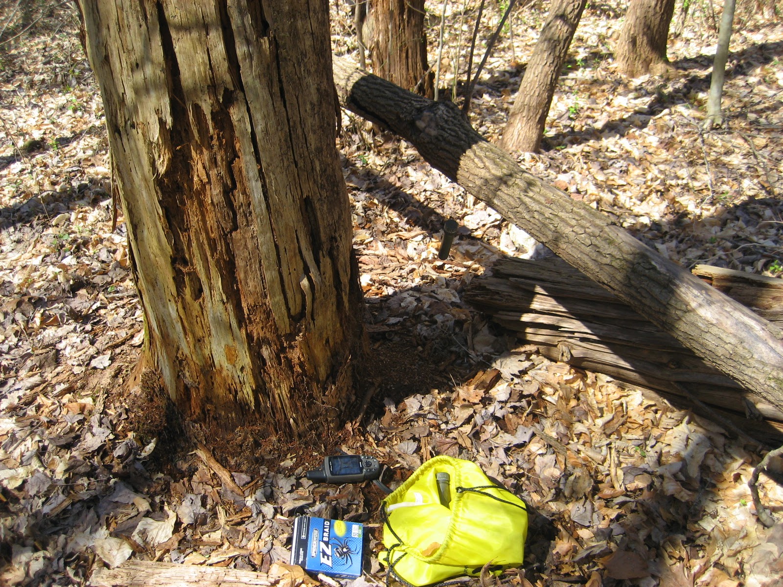
After spending a day trailbuilding on the CT, I drove down a scenic country road into the Cove Creek Wildlife Management Area to find a few out of the way caches. Two of them were quick easy finds. and have been found quite a bit recently. The last one, GC1H6NH, hadn't been found in over 4 years, and didn't even have a logged attempt. Turns out the cache was buried under 6 inches of rotted wood and dirt, but was in otherwise pristine shape. My guess is that cachers have stopped to look for it during these past 4 years, but not found it didn't bother to post a DNF. Finding a cache like this one makes me especially happy, it's like finding a lost treasure. It also reminds me that caches can and do become buried with time. Just one reason that caches "go missing" in remote locations.
The "6" that now look more like 4

I've already done some serious digging and removing a rotten log at this point,

AHA! The cache reveals itself.

Original logsheet. Last entry January 2011.

Friday, April 17, 2015

Seeing your own cache through someone else's eyes

As a CO I love getting nice logs and hearing about other's experiences on my caches. It's just one of the things that makes placing caches fun for me. What is rare for me though is to actually be with other geocachers who are looking for and finding one of my caches. I got the chance to virtually do this for one of my caches recently when a geocacher took a GoPro video of his experience finding the cache. The cache is Bear Necessities, one of my earlier cache placements but also one of my more popular hides in New Mexico. I placed the cache while out camping with my family, and it is way out in the National Forest, so it only gets a few finds per year, and even went all of 2014 without getting a find. But every cacher that finds it really likes it, it's at almost 94% favorite point ratio right now, which for 17 total finds isn't bad at all. If you think you'll ever be in southern NM and wanting to find this cache without spoilers, then do not click on the YouTube link below. Otherwise, enjoy the spoiler video and see what this cache find is like.
One of the things I like about the video is that the geocachers do not find it right off, but search around for a few minutes first, guessing out loud what they think it might be. Also, it is flattering to hear what they say about me as a geocacher. Nice to know I have a reputation out there. I miss geocaching out in NM. So much freedom out there with all the public land at your disposal to explore.

Sunday, April 12, 2015

Unexpected geocacher encounter


My wife's workplace hosted a wildflower hike in the Smoky Mountains today and the unexpected happened, I ran into another avid geocacher, Katarina (or Snövit her geocaching name). I've run into geocachers a few times before, but it is pretty uncommon. What made this encounter especially unusual was that the geocacher was also a scientist that had just attended a 3-day workshop with my wife at NiMBioS. We were waiting for hikers to show up at the NiMBioS parking lot and she overheard my wife talking about my geocaching adventures and immediately came over and said "you know geocaching?". I couldn't help but grin from ear to ear. Here was a colleague of my wife, visiting from across the sea, and she was a geocacher! Needless to say we hit it off pretty well. She had already found a geocache in Tennessee, but was shy about mentioning it around non geocachers so had not had a chance to go caching while here. The one cache she had found she had found on her own and was an urban micro near where she was staying. So when i told her there was a geocache out where we were hiking her eyes lit up and she firmly stated "we must go find it". That had been my plan all along. Except up until we met, my plan was to slink off away from the group and find the cache without drawing attention to myself. Now though, with another interested geocacher, I wouldn't have to be so timid and apologetic for fulfilling my geocaching urge.

The cache that we had to find was actually a virtual, since we were hiking in the Smoky Mountain Nation Park. Still, when we got close to GZ, I gave her my GPSr to let her do the honors of navigating us to the correct spot. The question to answer for the virtual was pretty darn easy. But even with the geocache found and no other caches to go after, we still continued to talk about geocaching throughout the hike. I guess that's just something that us cachers do. If she ever comes back to NiMBioS for another conference or workshop, I promised to take her geocaching for real. What a great treat to run into another geocacher unexpectedly! It's like we share a special bond, despite having never met one another before. 
Snövit near the GZ for the virtual cache