Sunday, March 7, 2021

Paint Creek Hike

  It's been a while since I dragged the family out for a hike. I think my birthday was the last time... so with the carpet just installed, and a bunch of work in the attic complete, I unilaterally decided we were all going on a geocaching adventure in Paint Creek State Park. The area I had in mind is not in the main visitor area though, and is in a corner of the park that does not have maintained trails and is used mostly for hunting and fishing. This area has some natural rock arches and small caves. And geocaches to lead you to all these cool features.


The hike was pretty short, which gave us plenty of time to explore the rock formations. Liz had researched online and determined that the caves were closed to the public to protect the local bat populations. I think maybe her research actually was mistaken, and I was pretty grumpy about this, as I really wanted to explore the caves a bit. I did poke my head in the entrances a little, and spotted a few bats. Liz wouldn't let the kids enter, and didn't want me going in either, so I grumblingly assented.

The rock formations were pretty cool, and we at a picnic nearby and explored them for a bit. All in al, a good outing in a fun area.


Sunday, December 6, 2020

Fugads at 40

  It would be easy to say something to the effect that because of the global pandemic I wasn't able to have a grand 40 year old birthday celebration. But in all honesty, I know I wouldn't have done that anyways. Pandemic or no, I would have spent the day going on a hike, either by myself or with my family. This is what I've done for my past few birthdays, and it is probably something I'll choose to do again on future birthdays. When I get a day to do something of my choosing, it usually revolves around going outside and doing something I really enjoy. This year is no different.

My birthday adventure for this year was a geocaching adventure I found while browsing high terrain geocaches in the area. There aren't many geocaches in Ohio that require the use of climbing gear or rappelling down a cliff, but there are a few and one of them is only an hour away outside of Dayton. Clifton Gorge is a nice State Park/Natural Area that I visited with Levin during one of his school field trips last year. Despite the weather forecast calling for cold an overcast skies, I was excited to head out and do this hike and rappelling with my family.

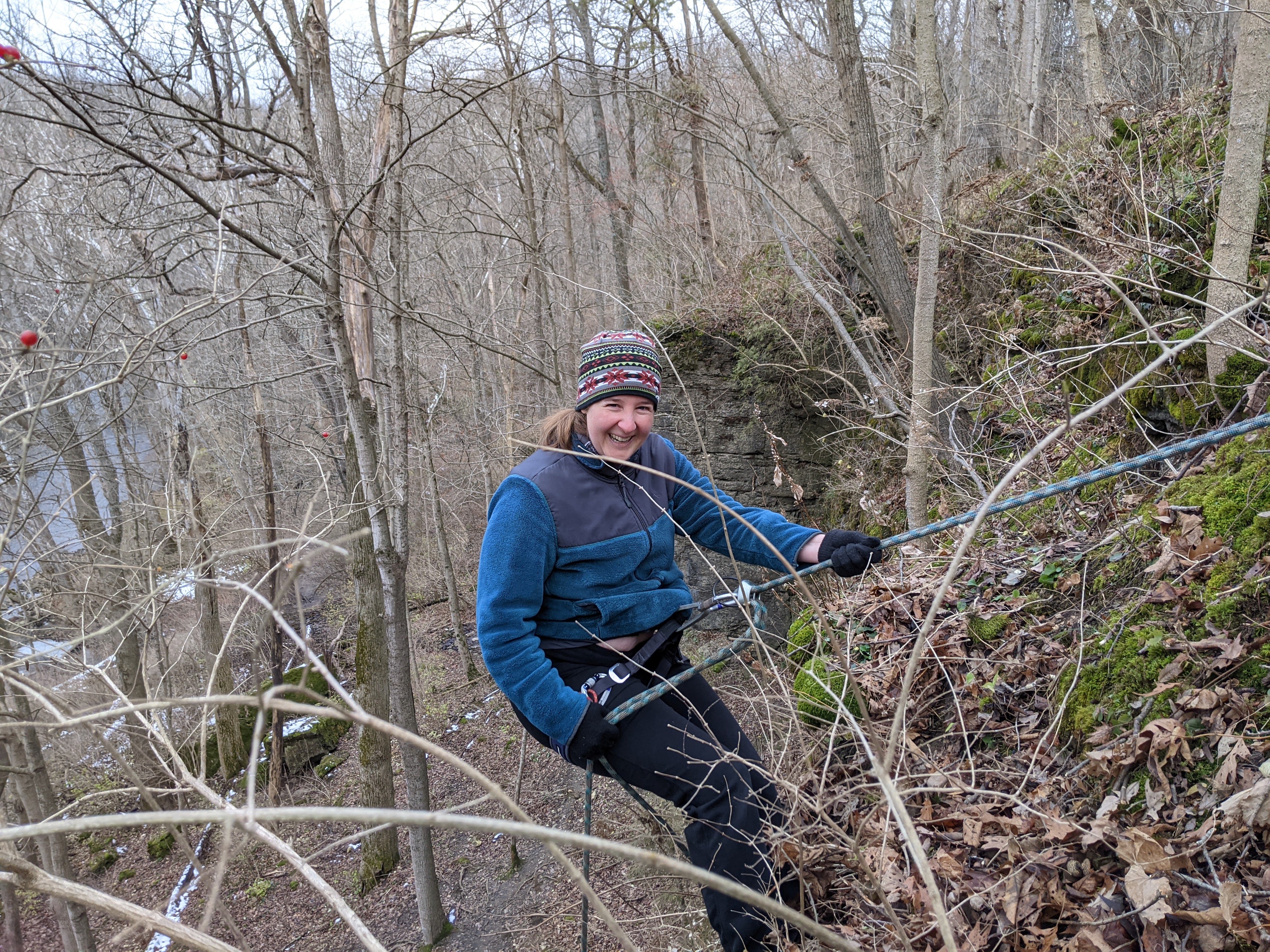
We arrived at the trailhead around 11:00 and there weren't many other cars there. Despite not seeing that many cars, there were still a fair number of people on the trails. This park, in close proximity to Dayton, must be very popular as a weekend hiking location. The kids immediately started complaining about the cold, but once we got hiking they started warming up. We hiked along the rim of the gorge for a short while, then found a trail that descended to the bottom of the gorge, where I was able to find an Earthcache. Then we crossed over the river on a little bridge and made our way to the cliff that contained the geocache I was eager to try to find. The geocache, GC21RPK, had not bee found in about a year. As we approached the cliffs I tried to scope out where the likely hiding sots would be. The GPS coordinates were decent but there was still a nice 50 ft section of the cliff that would need to be searched, about 25ft either direction from my GZ point. I identified a few possible anchor trees from below, and then found the walking path around the cliff t reach the top and threw down the rope for my first rappel.

The cliff was covered in moss, dirt and small plants, and would not be good for rock climbing, at least not until you spent a lot of time cleaning it off. I swung back and forth on my descent, stopping to look in various nooks and crannies. The kids and Liz pointed out possible hiding spots from below, and also shouted up helpful encouragements. While I found several nice hiding spots, I found no trace of the cache or its decoy. So I walked back around to the top and re-set my ropes to try again. This time I set my ropes in a fixed anchor so that I could use jumars to climb back up the rope if needed. That turned out not to be necessary, as I spotted the cache at the bottom third of the cliff on my second descent, and whooped with delight.

After finding and signing the geocache, I re-set the rope to be more friendly for my kids to descend, and they took turns being lowered by Liz down the cliff. Levin is certainly old enough to learn how to rappel, but I didn't try to teach him today. Instead, I had Liz put him on belay and lower him. Same for Ada. This way the kids had more freedom to use their hands, and jump around on the rock. After the kids each took a turn, Liz hiked up to the top and rappelled down too, something she hasn't done in quite  while. Despite it being very cold, we were all having fun playing on the ropes.

After we had our fun on the cliff, we continued another mile down the trail following the river, until we came to another bridge. Crossing this, we then could loop back to our car. All in all, it was a pleasant 4 mile hike mostly along the gorge bottom trails. We found some more geocaches, spotted winter birds including a highlight view of a pileated woodpecker, an chit-chatted the whole way. It was wonderful to be out with my family, all together, enjoying the outdoors.


Monday, May 4, 2020

May the 4th take you Geocaching!

There is a Star Wars themed geocache I've wanted to go after here in the Cincinnati area called Jedi Mind Tricks, The Art of Levitation. Taking advantage of a nice weather forecast for the day... and also that it is Star Wars Day (May the 4th Be with You!), I planned a field trip with the kids to see if we could find this hard to reach geocache.

I was anticipating around a 6 mile round trip hike, on trails I have never visited, so we packed lunch, critter catching nets, binoculars and some extra clothes and set off for the day.

The geocache theme is about the swamps of Degobah, where Luke met Yoda and learned Jedi skills. He had to learn the art of levitation to get his x-wing out of the swamp, and for the geocache, you need to cross a swamp onto an island and then levitate up a tree to find the cache. The fact that you had a few miles to hike and also at least 1/4 mile off-trail navigation to reach the Degobah swamp adds to the adventure. The kids aren't always so keen on these kinds of geocache adventures, so we also had critter catching nets with us, and binoculars and made several stops to look for salamanders and birds.  We were pretty successful on both accounts. Near the start of our hike, a birder passed us and gave us a hot tip about some Blue-winged Warblers a bit further down the trail.  I pulled up my birding app and we listened to the song for this uncommon warbler, and sure enough a few hundred feet down the trail we heard the distinctive zzzzzzziiiip! sound. The kids then spotted one pf the warblers up in a tree and we got a good look at him. Very beautiful warbler and a new bird id for me! We continued to have pretty good success identifying and spotting birds along the trail, with some highlights being Red-headed Woodpeckers, Scarlet Tanagers, and some Wood Thrushes that let us follow them through the underbrush for a good ways.

Scarlet Tanager.. not easy to photo through binoculars

Critter catching got off well too. The heavy rains from yesterday meant that there were tons of vernal puddles and most had tadpoles in them. A few also had larger egg masses that were probably from a salamander species and in one of the pools we found larval stage salamanders, with there little gills flowing out from the sides of their heads. Maybe these were recently hatched from the eggs in the pools. We also caught a few salamanders at a stream bed, and Levin thinks we caught two species, a Northern Dusky and a Northern Ravine Salamander.


With the stops for birding and looking for amphibians, as well as the overall muddy nature of the trails which meant slow going, it was well into the afternoon by the time we reached Degobah Swamp. Levin was immediately critical, "it doesn't look like Degobah swamp at all".
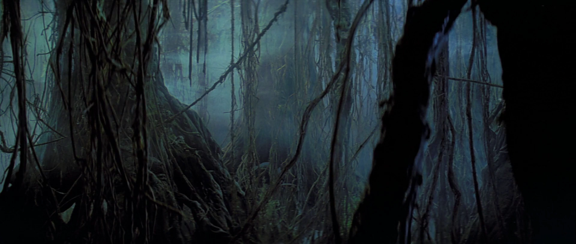
What Levin was expecting
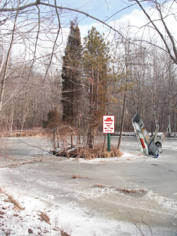
Far from being dark, damp and scary looking, it was a bright cute little pond with a tiny little island off to one side of it. Frogs were hopping along the banks, and Ada spotted a snake as the kids immediately fanned out to catch critters.
What it actually looked like
I prepared to use my Jedi tricks to find this geocache. I had swim trunks on under my hiking pants, and brought a quick dry long sleeve shirt to wear which would hopefully keep me warm in the water. I slowly waded in and pretty quickly started to sink up to my waist in the mud. I was getting deeper and deeper every step, but instead of maintaining my straight path to the island, I noticed a submerged tree to my right. Angling towards that, I was able to get up onto it and balance on it with my two walking sticks. The log went all the way over to the island and let me reach it without sinking into the mud, or getting wet past my knees. Once on the island though, I still had to find the geocache.


The first thing I noticed was what appeared to be shriveled up white balloons in a little mound in the middle of the island. Looking up close, these were old goose eggs. Probably hatched last year, this island would make a nice little goose nest. No geese around this year though, at least not yet. Maybe they didn't survive the migration, or maybe they just haven't made their way back north. The geocache proved harder to find than I thought it would be. There weren't that many places to look, and I also knew it was up in a tree. I even climbed 10 ft up a tree and couldn't spot the geocache. Levin, back on shore, started looking for hints in old logs, and shouting what he found to me. I looked and looked, and finally noticed the geocache, a tiny plastic vial, cable-tied to a branch only a few feet from where I had already climbed up and looked. How did I miss that? Well, it was pretty small, and was not the hanging bison that I was expecting. Still, I probably should have spotted it sooner. I climbed up to it, pencil in my mouth, ready to sign the log, only to find that the log sheet was no longer there. Now Ada came to the rescue, tearing off a strip of paper from her field journal. I then had to balance across the submerged log to get this strip of paper, and it looked like so much fun, the kids decided to come with me to the island. Since the water wasn't that cold, I figured there was no harm in this. Stripping down to underwear we all balanced across the submerged log, Ada holding onto my waist band for balance. Somehow none of us fell in and we all got to enjoy being on this tiny little island. I signed the replacement log and climbed up the tree to put it into the lid-less container. Hopefully it will last a little while, maybe for the next geocacher. Who knows. On our return trip to the shore, Ada and Levin both took little slips into the water, getting wet up to their waists. Nothing too bad though. They were both thrilled about the adventure. Levin even is saying this is his favorite geocaching adventure ever. I am definitely pretty happy about that.
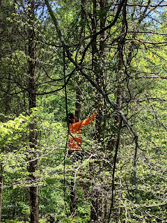
Up in the tree


As an added bonus, Ada found three geocache containers that surely must have fallen out of a geocaher's backpack. Since the last visit to this geocache was a year ago, and the last find nearly two, this stuff was probably sitting here for a while.


The hike back from Degobah was quicker and less eventful. By this point shoes were muddy and we were all less careful about walking around the giant mud puddles. We also were getting tired, low on water, and were wanting to get back home for a yummy dinner of hamburgers on the grill. So there were far fewer stops to look for birds and critters. We did stop to find a few more geocaches along the trail though. All in all, the kids had a great time, and so did I. A good May 4th Adventure.


Blue-grey Gnat-catcher Nest we found on the way back

Monday, March 16, 2020

Buzzardroost Rock Hike and an escape from the pandemic


Today was the first missed school day due to the Corona Virus Pandemic, and we made i a good one. I took the kids on a hike 80 miles or so from Cincinnati, in an area called the edge of Appalachia. Specifically we hiked Buzzardroost Rock an easy 4.5 mile out and back trail to a nice overlook. Considering how far it is from urban centers, I was counting on there not being many people out there... and I was right. We only saw three other people all day, and had a very enjoyable hike.


The trail was recently re-built an here is anew parking area and signage. One consequence of this new trail though is that the geocaches that were placed out here in 2006 and before, are now no longer on the trail's path. instead, to get to the geocaches, we needed to descend a steep hillside where the old trail used to be. The kids were game for this and we had fun scouting out the location of the old trail and finding the old geocaches.


Eventually, the old trail climbed back up the steep hillside and rejoined with the newer trail on the ridge-top. We made our last geocache find up there, an oldie from 2002, and one the kids really enjoyed pawing through the trade items (Ada scored a first aid kit!). A quarter mile more hiking and we were at the overlook, where it was cold and a bit windy, but we still had a good appetite for our picnic lunch.
What's that we're spelling?


There weren't too many signs of spring out here, and overall I think it was colder here than it is in Cincinnati, Spring probably lags here by a few weeks. But Levin did spot a pair of blue birds, and there were some small trout lilies starting to bloom. I expect in a few weeks we'll start to see a lot more signs of spring.

Some trip stats:
Miles hiked: 5.5
Time: 5 hours
Geocaches found: 5
DNFs: 1