Saturday, August 27, 2016

Going Bald in Santa Fe?

It's surprising really that I'm not bald yet. It's in my genes, both my uncles are bald, and my younger brother has a nice bald patch on the back of his head. But my dad isn't bald, and maybe I'm following his example, since so far no bald spot has appeared on the back of my skull. But this post isn't about hereditary male pattern balding. It's about hiking and geocaching up Santa Fe Baldy, the prize peak outside of Santa Fe and one that has been calling to me since we moved here.
Santa Fe Bald as viewed from Penitente Peak
There is a standard route to Santa Fe Bald is from the SF Ski Basin and is about 14 miles round trip. This looks like a fine route, but after looking at maps and geocaches in the area, I settled on a longer loop hike which would take me up a couple other peaks and by 3 alpine lakes. It looked to be more like 20 miles of hiking, and I needed to finish early enough to pick up my kids from school, so I set the alarm real early, got up at 4:30 am, was out the door before 5 am and was hitting the trail at 5:22 am. I started at the Santa Fe Ski Basin on the Winsor Trail. The trail was dark and spooky, and I only had brought a small LED flashlight with me which really didn't provide much illumination. Thoughts of stumbling upon bear, skunks, porcupine or elk flashed through my head at each turn up the switchbacks. The trail was eerily quiet though. I reached the first ridge where the Pecos Wilderness boundary is and the sky was noticeably brighter there. The moon was providing some nice illumination and I tried, rather unsuccessfully to snap a few shots of the night sky. Then I kept marching up Raven's Ridge to my first geocaches.
Early morning selfie

Sunrise on Raven's Ridge
The first three geocaches up Raven's Ridge were tribute caches for a local Albuqueque cacher who goes by Thoehn. Each cache was for a different 10k geocaching milestone, which is just mind boggling to me. I geocache quite a bit, and have been for over five years now, but still am nowhere close to 10K geocaches found. To think that this fellow has found over 30K?! Incredible. Thecaches themselves were small affairs, although the 30K was noticeably nicer, in both container and location. Perhaps when Thoehn reaches 40K it will be an ammo can? One can speculate. The higher I got up on the ridge, the colder and windier it became. It felt like it was in the 30's and I spotted at least a few small patches of snow. Fortunately I had brought a warm layer, so it wasn't too bad, but to think that it is so cold in August up here makes me think that the window for hiking these high peaks is drawing to a close. Or maybe I just need to plan on more winter like clothing for these hikes. Next time, I bring thermals. I gained the summit of Lake Peak a little past 7 am and made a phone call home to make sure the family was getting up and ready for school. They were just getting out of bad, and I had already hiked 3 miles and gained 2,500' elevation. Now that's a morning!


There is a nice group of caches up around Lake Peak, which is quite rocky and rugged, requiring a bit of scrambling to reach. I was finally getting sunshine, but it was still quite chilly. The caches were all in decent shape, and where they were big enough I added my signature wooden nickle and a few kids toys. There was one cache near Lake Peak that I decided to skip, which I hate doing on hikes like this. Usually, I try to find every cache I hike by, but this one, GC1DX1Z, would require almost a 1/4 mile descent down a ridge in a direction I didn't intend on continuing. I would have to re-climb lake peak after finding it, and it seemed like a lot of extra effort. Not that I am opposed to extra effort to nab another geocache, but I had my sights set on a different geocache which was still a long hike away, and I needed to budget my time. So skip this one I did.
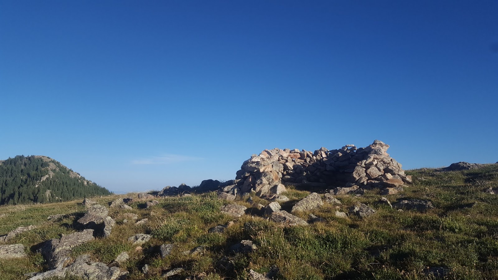
The skyline trail was fairly rough descending down the east slope of Lake Peak, but then I reached the most beautiful alpine meadow and the flank of Penitente Peak, my next destination. This peak is also a Bald, in that the summit is completely treeless. It doesn't even have very many rocks, consisting mainly of a huge alpine meadow. The views were amazing. The summit had a small wind-break constructed from rocks and I took a little break there, a welcome respite from the cold morning wind. The Skyline Trail, which is the one I was on now, almost completely disappeared in the meadow up there. Not that a trail was much needed, you could easily walk in any direction for a good long ways. I checked my map to see which direction I was supposed to go and simply started walking. The open meadow stretched on for a half a mile and I finally found the trail as it approached the forest below.
Penitente Peak Wind Break

SF Bald viewed from Penitente Peak. Wonderful trail on this peak.
Skyline trail meets up with the Winsor trail below Penitente Peak. If I had wanted to take a quick route up Santa Fe Bald, I would have turned left at this junction and stayed on the Skyline trail, which heads up to Santa Fe bald next. But I had other ideas, and turned right onto the Winsor trail. A few miles away was an unfound geocache at Stewart Lake. It was definitely out of the way, adding many more miles to my hike, but it would also take me up to Lake Katherine underneath Santa Fe Bald, and by an old Weeds19 geocache that I wanted to find. So the extra five miles or so was worth it in my mind. I just needed to make sure I could hike all those miles and still get back to my car in time to go pick up the kids. For once, i utilized the trip computer function on my GPSr, which computes my moving average and stopped time. So far I was making pretty good time, and the Winsor trail was easy hiking. I was averaging 2.8 mph while moving and was only stopped for about 25% of the time. At that rate, it looked like I would be able to reach Stewart Lake, then backtrack up to Katherine Lake in a few hours. I gave myself an hour to make the steep climb from Lake Katherine up to the top of Santa Fe Bald, which would put me right around noon. That left me only 3 hours to get back to my car, but along the main trails, I thought that would be doable as well. So off I went at a brisk pace down the trail.
Winsor Trail Moss
At Spirit Lake, I met my first hiker for the day. He was standing by the shore of the tranquil lake drinking something hot from a mug. The scene was so peaceful and serene that I almost didn't want to say hi as I walked by, but he heard me approaching and turned to offer a good morning. He then asked me where I had slept, and I told him I was a day hiker coming from the Ski Basin. He looked at least a little surprised by this, since it was still quite early in the morning and the Ski Basin was a long ways off. He had slept right there at the lake. We chatted in hushed tones about summitting Santa Fe bald, which was my ultimate destination. He decided not to go after SF Bald the day before due to thunderstorms, but he said they didn't really come in until 2pm. My plan of peaking by noon sounded pretty good. After saying goodbye I briefly lost the trail since there were numerous little side trails leading to campsites in this area. It is an ideal camping destination, a serene lake far away from anything. I'll have to come back some time and spend a bit more time relaxing there. But not on this day. I still had miles to go, and schedules to keep.
Stewart Lake
Stewart lake was about 600' in elevation lower than Spirit Lake and didn't have quite the same alpine charm, but it did boast a nice view of the mountains behind it. it also appeared to be stocked with fish, as I saw a few ripples while I was there looking for geocache, GC6Q8HV. This cache was only recently published and was a big reason I made this hike as long as I did. I did get the FTF, locating the nice clean tupperware under a log and signing the blank log. There wasn't any spectacular FTF prize, just the satisfaction of getting out in the mountains before anyone else.
FTF at Stewart Lake
 My next stop was an old Weeds19 geocache, Hidden River, a cache that has only been found 8 times in 10 years. A nice lonely one, it is easy to see why it is not found often. Not only is it a long hike, but you need to travel off trail for 1/4 mile and then the coordinates for the cache are known to be about 70' off. Considering it is hidden in a large boulder field with hundreds of possible locations, it's no wonder it doesn't get found much. Although there aren't any DNFs posted, so perhaps the bad coordinates aren't so much of a hindrance to eager cachers. it took my close to 20 minutes to find the cache, making my longest stop for the hike. The coords were indeed 70' off for me, but once I started thinking about how it was hidden I got away from the bad GZ and started looking in the right areas. It was very cool to find this old cache and see some of my favorite cachers signatures way back on the log sheet.
Hidden River Logsheet

Hidden River Cache Area. The water flows under the boulder field
From the Hidden River it was a slog up to Lake Katherine, gaining back much of the elevation I had dropped earlier. I reached Lake Katherine at quarter past 11, meaning I was behind schedule. That meant I couldn't sit and relax and enjoy one of the finest lake/mountain views around.
I did add a bit of water to my water bottle though, since I was pretty low. Perhaps foolishly, I didn't purify the water even though I had a filter with me. The water in the lake looked so clear and cold and clean, and I was feeling in a rush to gain the summit (storm clouds were gathering in the east) that I took a risk and simply took the water as is. So far no ill effects, but this wasn't a great idea.
Lake Katherine Clean Water... hopefully

Storm Clouds building east of Lake Katherine
At Lake Katherine I was back on the Skyline Trail, which skirts around the south of the lake and then climbs over the southern ridge of SF Bald. Taking the trial up to SF Bald would mean quite a bit of hiking, and there was "faster" [shorter] way. I could skirt the lake on the North, then ascend a steep heather-filled slope to the ridge North of SF bald. It looked very steep, but not too bad, so off I went. I heard many Marmots and Pikas while making my way up the heather, and saw many burrows, but didn't actually set my eyes on any of the little mammals. The going was slow, but I made the ridge top right before noon, and found another wonderfully lonely cache, Lake Katherine Overlook, found only seven times in eight years. This one is another Weeds19 cache, and he tucked it down an exposed rocky ledge. At least one cacher had been turned back by the exposed downclimb needed. I wan't so bothered by the exposure, but I was bothered by the booming thunder from the storm cloud out over the Pecos River to the east, a bit too close for comfort. I quickly found the cache using the spoiler picture, signed the log and was on my way to tag the summit and then get to lower ground.
My route up SF Bald. Steep heather.

Near the cache Lake Katherine View
The summit and associated geocache, GC2AV55, gets visited quite a bit it seems. It is indeed a proud hike for anyone in the area, with no easy way up, but views that are rewarding beyond all the efort expended to reach there. But I didn't linger long, those clouds to the east looked mean, and were rumbling quite a bit. The last place to be when there is a thunderstorm is on top of the highest mountain around, and that's exactly where I was. I wasn't too worried though, the storm looked to be quite a ways off to the east. The ridge-line on the other side of the Pecos River valley was getting drenched, but SF Bald was high and dry as was Pecos Bald and the Truchas Peaks to the north. Truchas however was quite white with snow. I was thankful that SF Bald was not snow capped as it would have made the going down much slower and slipperier. I snapped some photos of the summit to show I was there, then was off down the well worn spur trail on the south of the mountain.,
Picture Perfect Alpine trail above 12,000 feet. Looking South towards Lake Peak and Tesuque Peak.
 I made great time on my descent and was soon off the ridge and away from any perceived threat of getting struck by lightening. I ow had an "easy" 6 miles of hiking down the Winsor trail back to my car. I was already very exhausted from over 5000' of elevation climbing and 15 miles of hiking though, which made the return trip a bit less pleasant than it would normally have been. Fortunately, there were a bunch of micro caches for me to find along the trail back, and I stopped at each finding nearly all of them. I ran into a few more hikers too, some heading up to Lake Katherine, and one just out mushroom hunting. I had noticed that bollettes had started fruiting, and there was also a ton of fresh Amanita muscari, or Fly Agarics for you non mushroom people. I had a nice little chat with the mushroom hunter, and learned that the fruiting of the A. muscaris wa a good sign and meant that lots of other good stuff would be sprouting soon. I'll have to bring a suitable mushroom collecting bag on my next hike.
Skyline Trail junction with the spur trail that heads up to SF Bald.

A. muscari

Meadow near junction with Winsor Trail
 My time allotment of 3 hours to get from SF Bald back to the car seemed to be pretty accurate. I was exhausted and maybe a little dehydrated, but I kept a good pace down the trail and the miles flew by. I stopped to filter some water at the junction with the Nambe Lake trail, dehydration is no fun and I was out of water. I was able to find all the geocaches on the trail except one, and skipped another that was on the parallel Rio Nambe Trail. Maybe if I had a bit more energy I might have been tempted to go after that multi on the Rio Nambe trail, but I was beat. Now at least, I have a good reason to return to these trails to mop those up.
Feeling Beat after 20 miles of hiking
I made it back to my car at 3:15 pm, missing my target return time by only fifteen minutes. Not too bad, I still had plenty of time to drive down into Santa Fe and get the kids... and then collapse on the couch the rest of the afternoon. It was an awesome hike, and I'd definitely do it again, but maybe without the schedule pressure. A few extra hours to mosey would have been appreciated.

Some final stats:

  • Geocaches found: 18
  • Geocaches DNF'd: 1
  • Geocaches skipped because they were too far out of the way: 2
  • Miles hiked: 20.0
  • Elevation gained: 5360'

Sunday, July 10, 2016

The Himalayas of New Mexico?

360 View from one of the Truchas peaks (can't recall which one now)
 This is not what I used to associate with New Mexico mountain hiking. I've hiked and climbed lots of peaks in New Mexico, but always in the southern half of the state. The peaks are dry, barren, and sometimes jagged. But they never really look alpine, at least in the true sense of the word, which associates with the Alps. The Sangre de Cristo mountains are different, and I suspect a bunch of the other ranges up here in Northern New Mexico are similar. These are high peaks, above 12,000 ft, and they get enough rain such that they host meadows and alpine flowers, snow fields that persist all year long, and beautiful alpine lakes.

I had an ambitious hike lined up for these mountains. My goal was to summit all the Truchas peaks, cokmpleting a long circular ridge-walk way up above 11,000 ft. The quickest approach is at a trailhead that requires special permissions to access, and a serious 4x4 vehicle, so I opted for a longer hike which started on the San Leonardo Lakes trail. Hiking up to the lake at 6am was quiet and quick, and I was soon at the lake before the sun had even crested the mountain ridges.
San Leonardo Lake
I was dreading the climb up to the ridgetop above the lake, thinking it would be up scree slopes, or involve 4th and low 5th class climbing, but it turned out to not be bad at all. I was able to follow steep alpine meadows the whole way. The hardest part was trying not to step on all the beautiful flowers. Once on the ridgetop I began making my way around, collecting geocaches as I went. What, geocaches?! I know, a real surprise that there are a number of geocaches I was targeting on this hike. There were 6 unfound caches either on the ridge, or close enough for me to make small side excursions to get (I Touched the Sky, The Himalayas of NM, El Norteno, A thorn in my hoof, It's All About the Hike and Meadow of Solitude). They were all about 9 months old, and yet no one had gone after them yet. On top of those, there were two pretty lonely caches. One on South Truchas peak, GCQ39M, claims to be the 2nd highest peak in NM and has only been found 6 times in 11 years. The other cache was on Middle Truchas peak, GC3XCCB, had only been found once in 4 years. These lonely caches were my main targets. The FTF caches along the way were bonus finds.

 The views from up on the ridge were fantastic. I took many panorama shots. The terrain was usualy not too bad either. Yes, there were a lot of ups and downs as I climbed each peak, and then descended to the next. But mostly the going was easy walking in alpine meadows, or stable rocky surfaces. Only in a few spots, especially around North Truchas, did the terrain get into 3rd and 4th class scrambling. This was also the area that I ran into a small family group of Mountain Sheep. Watching them dance along the rocky terrain was something special.
I took a nice lunch break a little before noon, at a high saddle/highpoint between Middle Truchas and South Truchas. There was a lovely outcropping of quartz up there that I could sit behind and it was somehow sheltered from the wind, which was blowing pretty steadily else-where on the ridge. After many thousadns of feet of elevation gain, and several miles I was pretty darn hungry.
Lunch on high

Meadows on the Flank of South Truchas

Gap in the ridge near the summit of Middle Truchas. South Truchas visible off to the right.

 My alpine circuit had taken me past 5 of the 6 unfound caches, and both the older lonely caches. There was still one more unfound cache within reach, but it was way down in the emadows beneath the Truchas peaks, at the headwaters for Rio Quemado. Going after it would mean a big descent and then climb back up the ridge to get over to San Leonardo. But if I went back along the ridge, I'd probably have just as much descent/gain just from going over all the various peaks and bumps. So I dropped down the NE ridge of Middle Truchas and grabbed the meadow cache too. Once down in the valley again, I decided I might as well hike down the trail a mile or so to Quemado Falls.

Quemado Falls
HIking down to Quemado Falls didn't add more length to my trip, since it was going in the right direction toward my car. In fact, it put me fairly close to a spot on the ridge that I had marked earlier with my GPS as a potential saddle/gap that I could drop down onto San Leonardo Lakes. I was a bit worried that climbing the forested ridge would be really tough and bush-whacky, but it turned out to be a pretty open forest. Just steep. Once i reached the gap in the ridge I was faced with a terrifying chute to descend. Well, terrifying to some I suppose. To me, it looked just like some of the narrow gullies that I'd scamper down after climbing peaks in the Organ Mountains. There was one small (20') section of low 5th class down climbing, and lots of steep gravelly choss, but I made it down in one piece. Once at the lake, it was an easy 3 mile stroll back to the car, which I made it to at 5pm. Not bad at all!
At the top of the chute above San Leonardo

Saturday, July 2, 2016

I am an Author!

Several months ago, I heard about a geocaching writing "competition" in which folks could submit geocaching stories and if their story was accepted, it would be included in a compilation book to be released at Geowoodstock XIV. Someone on the TVG facebook page suggested I submit something. I guess I have a small reputation for writing, perhaps owing to my sometimes lengthy logs, or perhaps this blog. So I put together a story for the competition. I had my brother-in-law, who also geocaches under the user WildWes, edit it for me since he is an English major. Then I hit the submit button. Months went by, but when I finally heard back, my story was accepted. I had to do a little bit of editing, but nothing major.
As this nice promotional graphic states, the book is available at Amazon. I get a free copy sent to me since I was a contributing author, but I also have ordered 3 more copies to send to family memebrs who i think would appreciate the book. or at least my small part. I'll have to check with Kimberly Eldredge if I can repost my story here on my blog now that the book has published. not sure if that is kosher. But for now, yippee!

Sunday, June 26, 2016

Cutting my teeth in the Pecos Wilderness

We've only been in New Mexico for a week, and already my head is full of hiking possibilities. Lonely caches, remote wilderness peaks, unfound caches in obscure wilderness canyons... m,an I live for this stuff. So with our house mostly getting settled, I took a day off from moving in to go out and tackle one of my new nearby wilderness adventures. There were several hikes/caches I was looking at, but the one I settled on was a recently published cache called North Macho Falls. It was placed only a month ago, mid may, but nobody had gone after it yet, and there was no one watching it. I could tell why, the description talks about a brutal off-trail trek up and down a wilderness canyon. It talks about needing to have expert route finding skills, and repeatedly stresses the rugged nature of the area. Yeah, that sounds like something I'd be into. I packed up my kit and got up at 5am. Made a quick coffee and was on the road soon after, on my way to adventure!
Sunrise on my drive into the Pecos
Just driving to to the starting point for this cache had some hiccups. I totally missed the turn off for forest road 123 and lost nearly a half hour of time doubling back. Then driving up FR123A was slow going in my CR-V. Luckily the road was passable for my poor little SUV, which is more like a mini-van than an adventure mobile. I crawled my way up several steep rocky sections, and eventually made it to the coordinates that the CO had given for one of the starting points. It was 7am. I wolfed down a banana and hit the trail.
An easy meadow for the start of my hike
All smiles at 7am
There wasn't a trail really, I was just following a drainage/creek down until I reached Macho Creek. And it started off pretty easy, with an open meadow. The meadow didn't last long though and soon I was rock hopping the stream bed, which was choked with willow and other brush. The going got slow, but I forced my way down it, sometimes resorting to climbing up the embankments to escape the lunch vegetation of the stream bed. I reached Macho Creek in 50 minutes and was delighted to immediately see a pool full of trout. They were roiling the water every step I took, fleeing from my shape. Most were pretty tiny, but in the bigger pools I caught glimpses of bigger fish.
The descent down to Macho Creek
The going was slightly easier in Macho Creek, it being a bigger drainage, but it was still kind of slow. A short ways upstream though I came across an old mining camp, and from the camp was an old road bed leading up the canyon. This provided only a short 0.1 miles of easy walking before the road disintegrated and it was back to boulder hopping and brush-beating. I passed a really large and nice swimming hole, which had to be passed on the right by climbing up a steep crumbly slope. I made a mental note that I could swim here on my return, but plowed ahead.
Mining camp

Nice swimming hole in Macho Creek
In a short while I came up to the North Fork of Macho Creek, which was where the cache lay. The intial foray into North Macho Creek involved a steep climb over a few waterfall pools, where much to my dismay I discovered poison ivy. I thought I had left that behind in Tennessee! Apparently not. And to add insult to injury, at one of my rest stops I felt something crawling on my leg and discovered a tick! What! I thought we were done with those when we drove out of Tennessee. Two big disappointments all in one hike.
Rock formations near the confluence of North Macho Creek

TICK!
North Macho Creek seemed to have a whole lot more waterfalls, carved into the granite like bedrock. The trout continued up the creek as well and I was in awe about how they could have migrated up beyond some of the waterfalls I had circumnavigated. I began to suspect that they had been "seeded" higher up in the creek, but this theory was shot through when I reached a long dry section of creek-bed, and then encountered not a single trout beyond that point. It seemed unlikely that there would not be trout upstream if they had been seeded from up on high, so perhaps that means that the trout really have jumped up the many waterfalls at the start of this creek.

I can't say what the main macho Creek looks like, but the North Macho Fork was just wonderful. I lost count of how many waterfalls and pools I had passed (I kept better track on my way down, marking each one on my GPSr).  Often the going would be slow around these waterfalls, or in the thick growth that often choked out the bottom of the ravine. but at other times there were open meadows, and easy walking. I had a few miles to go up this creek bed, and I cherished those miles, taking in the various sights and sounds. The warbling vireos were going full blast this morning,a s were tanagers, warblers and thrushes. At one point I flushed a grouse but rather than fly off to get away from me, it tottered a little ways off and did a broken wing display. I suspected there was a nest or young nearby, so I cautiously crept up the slope to where the grouse had flushed. I couldn't spot anything, I climbed up onto a fallen log and peered around some more. The mother hen kept displaying, trying to lure me in her direction, but I was scanning for a nest or some young. i took a step down off the log and a baby grouse exploded from practically under my foot, a flurry of brown feathers arcing away from me across the gorge. The other soon let up her feint, and made her way over to where the baby had flown.


I made it to the coordinates for the geocache at 10:20 am, and found the cache almost immediately. The coords were actually pretty good considering the canyon walls, and the cache isn't that well hidden. But how many people would stumble their way down this canyon. my guess is that unless a forest fire sweeps down/up this canyon, this geocache is good and safe for decades to come. I wasn't at all surprised to see a blank log. I took a few minutes to compose a log entry, then rehid the cache and sat down to eat my sandwich lunch. The waterfall that the cache was hidden by was not flowing nearly as much as the pictures the CO had posted showed. It made me appreciate how much more difficult the route was only a month ago, with volumes more water to contend with


Falls near the geocache, not much water right now
The CO had hidden this cache on a one-way route from the ridge-top in front of me, but I was going to backtrack down North Macho Creek. While I wouldn't be covering new ground, I was looking forward to taking a dip in one (or more) of the many pools. I also wanted to see if I could catch a trout with my bare hands. Some of the trout I had passed were in tiny shallow pools and it seemed like I should be able to corner one and scoop it up. I also kept track of the waterfalls on the way down, marking each one with my GPSr. I'm not sure how consistent I was with marking them, and may have counted some small cascades as waterfalls, and missed others. But in general it gave me a good idea of how many cool spots there were along this hike. Here is what the route looks like:
North Macho Creek Waterfalls
The waypoint named "Trout Limit" is the extent furthest extent up the stream that I saw trout. beyond that point, the stream was fish free, much to the enjoyment of the water striders. Not that there is one section of very dense waterfalls. This section looks like this:
Section of many waterfalls and pools
this section was especially nice, with cascade after cascade, each with lovely little pools that would be perfect for bathing in. At each waterfall, I would create a waypoint with the Code WF# with sequential #s working down from the geocache waterfall. I also added the approximate height of each waterfall.
Section of dense waterfalls
Once I got down to where the trout were, I set about trying to catch one by hand. The trout seem to be adapted to this kind of hunting style, either by bears or racoons, and would immediately scurry to dive head-first under rocks where they would wedge themselves out of sight. Unfortunately, some of them were too big and in too shallow pools to get completely out of sight, and I spent some time chasing them about the shallow pools until I finally landed a couple. Somehow, it felt reassuring knowing that I could catch fish with my bare-hands out here, like I would be able to forage my own food if needed and live out in the wilderness.

As I made my way down North Macho, it finally began to get hot. The moringin had been cool and enjoyable hiking weather (although I wish I had worn pants instead of shorts for all that bushwhacking). I se tmy sights on one of the best swimming pools, WF13 as marked on my GPSr. This pool wasn't very wide, but plunged to a nice depth of 10' or so and had both a nice jumping off ledge, and a convenient shallow exit point. Just perfect for cooling off.


I water was cold, but not overly so (like little Chasm Falls on the Rio En Medio trail a few days ago) and I could have relaxed there for quite a while if it hadn't been for the thunderstorms. The massive grey clouds seemed to come up out of the north and practically out of nowhere. First just a few faint rumblings of thunder up on the ridges above, but growing steadily until the canyon nearly roared with the noise of thunder reverberating up and down its walls. Kind of scary stuff, although I felt safe from lightning strike down in the canyon. There was the hazard of flash flooding though... So I hastily put my clothes on and started rushing down the canyon. I took a bit of video of the storm chasing me, and while I pretty much suck as a vlogger, the video is amusing enough, and is good enough to close out this blog post.
Approaching storm

Abandoned mine, a safe place to take shelter? I think not,

Back to the CuRVy by 2pm. Not too shabby for my first Pecos wilderness adventure. May there be many more to come.