Saturday, February 1, 2020

Hocking Hills Superbowl Hike


On a rainy dreary Saturday, I joined my friends Tom and Kim, better known as Sequoia and Kim-Possible, for a day of hiking and exploring in the Hocking Hills. This area has been on my radar since we moved to Ohio, it is known for interesting geologic features and beautiful trails. Sequoia was hosting his third annual Superbowl Hike Event out here, but unlike his event in Berea, this one was less focused on finding a lot of geocaches, and more about hiking and exploring some of the hidden places in the Hocking Hills. Sounded good to me.

After a nice early start, and a breakfast of waffles off the interstate, we met several other geocachers at the trailhead to Balanced Rock. The morning was foggy and damp, but not all that cold. There were a few large icicles hanging from some of the cliffs on the hike up, but they were melting fast. Balanced rock was a fun hoodoo like formation that looks like one strong gust o wind could knock it over. It reminded me a lot of rock formations around Los Alamos. We hung around here for a while, taking some pictures and chatting about geocaching. Two of the geocachers had to leave after this short hike (only 1/2 mile!).
Group Picture for the Event
One precarious rock

Doesn't look as precarious from this angle
From the same parking lot, we hiked north to Chapel Cave and Chapel Arch, a bit longer hike, but still pretty short. We visited the Chapel Cave first, which was aptly named, it felt like a wedding service could be held in it. The nearby earthache at Chapel Arch probably would have been overlooked entirely if it wasn't for the geocache listing bringing us there. Compared to the Chapel Cave, it was a pretty small feature tucked away on a small rock bluff, but it was pretty cool in its own way. There were two entrances a small cave chamber, connected by a very narrow fissure. I tried squeezing myself through the fissure without success at first, but then got down on my belly and crawled through a wider gap at floor level. Good fun. A rich reddish iron oxide gave the location some wonderful color contrasts to the vivid green mosses growing around the caves.
Chapel Cave

Chapel Cave from afar


Group picture near Chapel Arch


we completed both of these hikes before lunch, but the real treat was still in store for us. Sequoia had contacted park officials and got us special permits to visit two locations that are not open for regular access by visitors. We gathered up our lunches and headed over to the first spot called the Salt Peter Caves, only a short ways down the road. In my opinion, this was the coolest spot we visited. The rock bluffs here form a series of multi level cave shelters. The caves are deep enough where a flashlight becomes necessary, which also make them suitable for bats to roost in. Makes sense, since Salt peter, which is essentially bat guano, was mined here once. The first cave we came to I immediately went back as far as I could, which required stooping low, and sure enough, there were a few bats hibernating. I counted 7 in that first cave, not a lot by any means, but it was good to see them utilizing the cave. We were careful not to shine lights directly on them or get too close an disturb them.

We were all pretty hungry, so we sat down in the soft dry sand in this first cave and ate lunch. Well, most of us did, two cachers, MetalHead and half of the BoydFamily somehow got split up from our group and while we ate lunch we could see them far below at the edge of the river, trying to figure out how to get to us. The first cave we were at was less obvious to get to then the other caves and the had missed a faint turn off. By the time they got back to us, we had finished most of our lunch and were ready to explore the other 3 caves. I get so giddy exploring caves, at each one I was immediately going as far back as I could, and looking for any tight passages to squeeze through. There were a couple fun little belly crawls that connected different parts of the caves, but none of the caves was deeper than a hundred feet or so from their broad entrances. They were all really nice spots to hang out though. Sequoia set up a few more group photos as we monkeyed around the caves and small waterfalls.

LadyB and LandisB at Cave #1

Group Shot at Cave #4


Exploring the depths

Cave #2


Cool ice stalacmite


Dew covered bat
Our final hike was to Rocky hollow, a spot where there was some old growth hemlock forest. There was a nice trail cut through an area of clear-cut that was thick with small trees and thorny briars, and then a decent trail down into a ravine, but then the trail just stopped, and we were exploring the hollow as if it was virgin territory. We went upstream a short ways to an impressive waterfall, and spent some time scrambling the slippery rocks around its base. Th hemlocks here were massive, and the moss was thick and deeply verdant. A very peaceful place that probably gets few visitors.


A curious rock in the hollow


Curious rock from another view


Zen Moment
While these afternoon hikes had no geocaches on them, they were definitely the highlight for me. I think the rest of the group agreed, although most of them had previously found the earthcaches at the other spots. Hats off to Sequoia for getting us access to such wonderful spots. It was nice to meet som other Ohio cachers too, ones not from the Cincy area. I chatted with Boydfamily, ArmyMom and Metalhead about caching in Dayton, and the possibility of finding some old Weeds19 hides. LadyB and LandisB, from Columbus, I had met before from MOGA events, and there is a chance that we'll team up this year to compete in the 4-man.

The ride home had a couple detours to pick up a few caches that Sequoia needed for a challenge he is working on involving ancient civilization monuments. The most notable stop was at Hopewell Culture National Historic Park, which was a recreation of Hopewell Mound constructions. Stopping there was just the cherry on top of a great day exploring Ohio. It was a day out with geocachers, but it certainly wasn't about geocaching. That said, after this trip I am now sitting at 4,999 finds. Next one is a big milestone, and hopefully I can find an equally big adventure cache to find for it. Maybe international....?

Sunday, January 19, 2020

A frigid hike in the Jefferson Memorial Forest

Lost love Letters

My friend Tom invited me on a geocaching hike near Louisville, and I was keen to go as it is an area I haven't explored yet. I also enjoy caching with Tom and Kim, two of the geocachers that I met through MOGA competitions. A few days before our planned hike, the weather forecast was for temperatures in the teens, and a biting wind to make it feel even colder. We could have decided not to spend all day out in the cold, but as my cousin Ali likes to say, "There is no bad weather, only bad clothing." So off we went.

The Jefferson Memorial Forest (JMF) touts itself as being the largest city park in the US, a claim that requires a bunch of caveats. I remember the Franklin Mountain park in El Paso also making this claim, and a quick google search reveals that there are several large city parks that could also make claims to this title. Not that it matters much, as long as we can go geocaching out there. JMF is cache-saturated, meaning that the hiders in that area have placed geocaches in nearly every available space in the forest. This means you can spend a day hiking and easily get 40+ geocaches, which is what we did. Tom and Kim have gecached down there often, but it seems that three are always some areas that have new caches, or spots they had missed previously. They had a list of caches the were targeting, but for me, I was just happy to be out and find whatever caches we happened to pass by.

We pulled up at the trailhead at about 8am, and met two other geocachers there, Bucknuts who is moving to Louisville, and BuffaloBob, from nearby Indiana. Being a party of 5 meant we wouldn't be hiking too fast, but we would also have a much easier time finding geocaches. The more eyes looking the faster things get found. The area we were hiking w a remote corner of the JMF, with no maintained trails. Winter is definitely a good time to geocache this area, as we were usually hiking cross-country and I bet the bushwhacking in the warmer months is pretty brutal. There was some nice ridge-top hiking, and something of a trail along the ridges, but we were only on the ridges part of the time. I was constantly cold though, the layers I chose for the hike were not quite warm enough. I think I was counting on more strenuous hiking to keep me warm.
Earthcache, Errosional Fissures

Most of the hides were pretty average, simple pre-forms on a tree or in a nook. There were a few challenge caches I qualified for, and some I didn't, but those were not interesting hides. The best hides were a letterbox, and some hides requiring climbing up in trees.   GCZM2N, GC83JAB, GC8476R and GC83HM9 all had fun little climbs associated with them, as well as nice page write-ups with a good sense of humor. Most were by the same cache owner, JeepStaff, who the others in our group know well, and who has quite a reputation for fun and creative hides. I'll have to keep an eye out for his hides in the future.
BuckNuts at Oh Deer! not Here!
BuffaloBob at Sky King's Plane

We ended up hiking around 10 miles over the course of 10 hours, and visited 43 geocaches, 40 of which I was able to claim as found. The only DNFs we had were ones where the CO had given permission to leave a replacement, so we left new containers at those spots. Three challenge caches I signed but do not qualify for, and may never qualify for as they require pretty big numbers.
Kim-Possible at a hide in JMF

As for my overall impressions of JMF: There is a ton of geocaching to be done there, and some fun hides, but the hiking was pretty average in my opinion. No real great views, or neat geologic formations. If it weren't fun the geocaching fun, I wouldn't recommend it as a destination. But there is plenty of geocaching fun to be had there, so I might go on another trip or two.

Friday, January 17, 2020

Earworm Multi Cache GC70M9E

One of my favorite hides of all time was GC70M9E.  What made this hide particularly fun was the final contained a digital voice recorder and I encouraged finders to record the earworm song stuck in their head on it. Unlike most of my hides  Santa Fe, decided to archive the cache so I could keep the DVR, and perhaps re-create a multi cache like it in my new home of Cincinnati. I am thikning about how to do that now, but in that process, I have pulled the recordings off of the DVR and compiled them int a Youtube Video. I had over 8 minutes of recorded material and it was fun to hear what people left.


I am looking forward to figuring out how to recreate this hide in some way.

Saturday, December 28, 2019

Berea Forest New Years Hike


While not technically on New Years day, this hike was close enough to the new year to call it such. My friend, Tom aka Sequoia hosts an annual hiking event in the Berea Forest, usually involving hot drinks at one of the scenic overlooks this park. This year's event, was to be held at Buzzard's roost, and would involve a nice 2.5 mile hike in and hot cider. I made sure to get the day free to head down and join in the fun.

The Berea forest boasts 12+ miles of trails and several rocky overlooks, and it has an active geocaching community that maintains (and flips) hides in the park. A dozen or so new caches were published on the day of the event, and if one was to hike all the trails, you could find over 50 caches. Which got me thinking, why not try to find every cache in the forest on my day hike? Tom said it would be tough, but doable. So I packed light, and left Cincinnati early so as to have a good start to finding as many of the caches as possible.

I started my hike at the West Pinacle trailhead, not the one most of the geocachers attending the event would park at, since it is further from Buzzard's roost. It was still dark as I started, but that played to my advantage as there was a night cache right at the parking area that I was able to find. The first few caches hidden up the trail took a little longer than normal in the dark, but I managed to make the finds and made decent time up to the West pinnacle. One of the better caches on the way up was GC80F9N which involved lowered the cache from a lofty perch.
GC80F9N
With all the caches I stopped at along the way, I missed having sun-rise on West Pinnacle, but still had the rock to myself for a glorious morning view. The day was unseasonably warm, with a forecast for the mid 60s, and it made for perfect hiking weather.
West Pinnacle
 With most of my elevation gain already underfoot, I made a retty quick ridge walk over to the Indian Fort lookout, which also had amazing views. As I approached a trail junction and started searching for a cache at a rock formation called Devil's Kitchen, I hear voices and ran into the first hikers of the day... my geocaching buds from Cincy! They were on their way up to the event along with some Kentucky cachers and we joined forces for a couple of the fun hides around Devil's Kitchen.  The letterbox, GC8G5CQ was my favorite cache of the day, with the directions leading you to a small cave where the cache was tucked way down in deep. It was especially fun to find this with the group.
GC8G5CQ from within

Devil's Kitchen

Hiking to Devil's Kitchen
From the Devil's Kitchen over to the event, even more geocacher's joined up with us, until we were a big mob of geocachers ambling down the trail, finding everything in our path. Tom left us behind as we found caches outBuzzard's roost, but when we showed up there, he had his stove out and was heatingg cider for us to enjoy. We hung out at buzzard's roost for quite a while, enjoying home made donuts, hot cider and swapping geocaching tales. I met dsms99 who had done my Frozen head Whereigo and we chatted a bit about some of the more challenging hides around southern Kentucky and the Cumberlands, like Caver's Plunge. I might need to revisit that   e one of these days. I'm sure I could get folks interested in taking the plunge. Another cacher had a quadcopter, and he flew it about taking videos and pictures. His video was posted and provides a pretty cool view of the area.

After the event, I stuck with a large group of cachers that were hiking north to Robe and Basin mountains, the furthest trails from the parking area. It was good fun to find geocaches in the company others, but after a while I  witching to head off at my own pace so that I could also hike to the other s of the forest. So after getting to the last geocache basin Mountain, a gem of a cache at the End of the Rainbow, I split off to hike on my own.
Finding caches with the group

One of the more interesting hides, found by Scouter James

Crevice you need to climb to access Basin Mtn

Pretty walls around Basin Mountain

View from The End of the Rainbow

Headwall of Basin Mountain

Great hiking day in Berea Forest

What happened next was a comedy straight out of my MOGA competition days. I would hike up to a geocche on Robe mountain, and then not be able to find it. After 5 minutes or so, the rest of the group would catch up, and give me a gentle ribbing for being slow to find the cache, which they would typically find right away. Then i would strike off at a fast hike again to the next cache and this would happen all over again. So much for finding caches at my own pace, I would have been better off just sticking with the group. But after the basin mountain caches were found, I really did have a chance to split off, since I was heading over to the Eagle's Nest and East Pinnacle, and everyone else was heading back to the parking area. As I made my way to Eagle's nest, the number of hikers I passed starting increasing. I guess a weekend at the end of the year, with absoultely stunning weather, would be a popular day to be out on the trails, and now that I was getting closer to the main parking arrea, there were a lot of people around. This made finding some of the geocaches along the trail a little trickier, only because I didn't want to call attention to myself. maybe I should not have been wearing blaze orange then... Oh well.
Eagle's Nest

The cache at Eagle's Nest was great, and there were only a few other hikers there when i showed up, but the East Pinnacle was thronged with people. Someone even had a guitar up there and was belting out country songs. It was a festive kind of atmosphere, by somehow I like finding solitude on my hikes rather than a party of strangers. So I didn't linger long even though the views were fantastic. I did make a mental note to come back here with my family. This whole area would make for a great family outing.
Near East Pinnacle

After tagging East Pinnacle, I couldn't believe my luck. About 40 geocaches found, and not a single DNF. Sure some containers were in rough shape, with soggy log sheets, but every one of them was there and findable. Pretty amazing. Kudos to the local COs for keeping all these hides active. On my way down the main trail, I ran into Tom and we found a few caches together while hiking down to the East Pinnacle parking lot. He offered me a ride back to my car at the West end, but I declined, since there were a handful of caches along the bike path that I wanted to find on my way back. I managed to find these and was back at my car around 5pm, for a 10 hour hiking day of a bit over 12 miles. Not bad at all.  And I just about managed o clear out all the caches in this park. I missed 4 caches near a dead-end trail called Davis Hollow, which I had skipped early in the day so as not to be lateto the event. Maybe I should have grabbed those while I was nearby. There were also a couple challenge caches that I didn't qualify for, although I signed one of them anyways.  final find count, including the event, came in at 53. Not bad at all. but even better, the hiking was just awesome. Beautiful terrain, rocky cliffs with towers, caves, crevices, overlooks. Not too much elevation change, but enough to keep things interesting. My kind of day hike.
Sunset over Kentucky Hills

Saturday, July 20, 2019

Paddle Mixer on Guist Creek Lake


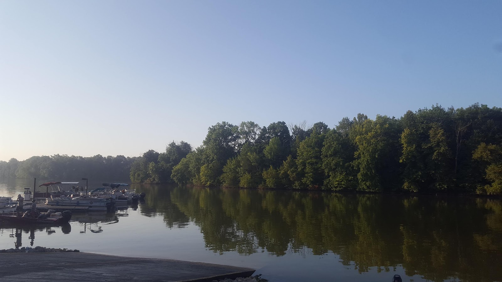
We've only been in Cincinnati a few weeks now and I already attended my first paddle mixer event. Not sure if these are a regular thing, though it appears this one I went to in Kentucky is held annually and draws geocachers from a few states away. The event was called, GCL Geo-Art Debut and attracted about 50 geocachers to paddle around the lake looking for 86+ geocaches placed for the event. Being new to the area, I don't have a paddle-raft, but luckily was invited to borrow a kayak from my friend and fellow MOGA competitor, Sequoia. He and Kim-possible drove down from Cincinnati with three kayaks, all I had to bring was my own PFD, which I picked up the day before the event.

Guist Creek lake is a reservoir near Shelbyville Kentucky, about a two hour drive from Cincinnati. The town of Shelbyville made me think of the Simpsons, a show I haven't watched in ages. I doubt there is any connection, but it made me smile all the same to think of tyhe rival town that was always derided in the show. I arrived at the event just as other geocachers were showing up and introduced myself to a bunch of people. I felt a little weird introducing myself, but then I always do at a an event in a  new area where I don't know anyone. People were friendly enough, and I ate a donut and waited around for Kim-possible and Sequoia to show up with the kayaks. They pulled up and tyhen I busied myself with getting ready for spending a day out on the lake. putting on plenty of sunscreen, making sure all my electronic devices were in ziplock baggies, and that my lunch was packed and ready to go.


Our group was actually one of the later ones out on the water. Kim and Tom know a lot of the people at the event and were catching up with many of them. once on the ater we set off at a lesidurely pace to the North part of the lake, where the Rubber Ducky Geo-Art was hidden. Caches were spaced every .1-.2 miles apart along the shores of the lake, tied to overhanging branches and roots. Right off the bat, we almost couldn't find the first cache, a small camo-painted tube zip-tied to a branch. Searching for caches from a kayak is a bit of a challenge, as you are bumping into other boats, and it is hard to look around all the different angles of the branches. But generally, the hides were done in such a way that they could be accessed by someone in a boat, and with several sets of eyes looking, most caches were found quickly. One thing I hadn't seen before was the log sheets, which were done on plastic surveyors flagging. While these are hard to write on with most pens, they don't get soggy and destroyed the way paper logs do, so for this area they are probably a good material to use.

I was paddling with Tom and Kim, but we quickly joined up with some other cachers, GeoFairy, GeoFlash, SpngeBobCachePants and ScouterJames48. GeoFairy I knew already, but the others were all locals that were happy to chat about the geocacing scene around Kentucky. There is a lot to explore around here and I got recommendations for other places to paddle, hike and explore. The hours ticked by and we slowly progressed trough the geo-art. At one spot, there were a few traditional hides up a muddy tributary that weren't part of the geo-art. the water level in the lake was low enough wher you couldn't paddle to these, but Kim was up for a little muddy adventure, so she we shoved our kayaks as far up the muddy creek as we could get, then abandoned them in place and slogged through the shin-deep mud towards the caches. The mud was soft and mostly free from sticks and stones, and it felt good on my toes. But in the back of my head, I was thinking about the story of the cachers in TVG that sliced open their foot while doing a similar thing. They were closer to an urban area though where pollution and glass was more of a problem. This tributary seemed pretty clean. We made it to the cache, which Kim found easily and were happy to find a blank log sheet. FTF! Then we made it back to the boats, and the paddle group without slicing up our feet. Even better.


The day got hotter and hotter, but we kept a relaxing pace and it felt good to be relaxing and chatting our way up the lake together. Seems like these events, an geocaching in a group of kayaks, is a pretty laid back affair. No one was hard-up about signing every log. in fact, no one even seemed to think it necessary to open up the cache containers. Simply spotting the container and laying a hand or paddle on it seemed sufficient for the group. In a way this makes sense, the more people that open and close the containers, the more likely one of the zip-ties gets broken, or a cap comes off, or a log sheet gets dropped in the lake. But it also seems to be contrary to the main geocaching ethic of signing your name in each log sheet. Not that the COs would care, but it is the power-trail mentality that has never seemed quite right to me. But then, I've never been a huge fan of power trails. I was happy enough to just be out with a group of people, relaxing on the lake, and chatting about geocaching, so i y resernto myself.


It took us nearly 7 hours, but we finally completed the Rubber Ducky Geo-Art. Some folks were up for doing the other geo-art too... and if you were properly motivated and moving quickly I suppose you could visit all 86 caches in a day of paddling. but I was content to call it a day. Kim and Tom were done too, so it made sense for me to pull out my kayak and part ways then. Plus I would get home in time to have dinner with the family.

Sunday, April 14, 2019

CITO along the Santa Fe Rail trail: Hobo Camp Cleanup


It's been a while since I hosted a CITO event and I decided that for the Spring CITO season (where Groundspeak gives souvenirs for attending CITOs) I'd try it again. I didn'tant to do anything fancy, so one day while I was out jogging along I noticed an area along the trail had a bunch of trash and decided I'd host an event there. The Santa Fe Rail trail is an urban bike path along the rail tracks, and extends for miles through town. The CITO would be easy enough. Cachers would meet me at a spot along the trail, we'd clean up as much trash as we could find, I'd haul off the trash and we'd all be happy. Or something like that... GC7W17C was published.

My last CITO was kind of a bust. I had high hopes for it, and had coordinated with the City parks to make sure trash pick up was arranged. Only a couple geoachers showed up, and I ended up snowing the night before, making it impossible to see any trash on the ground. This time, almost ended up th same. the day before he event, it snowed in Santa Fe. I only had a few "Will Attend" logs. It could have been a repeat. But then the weather cleared, and a bunch more people posted that they would show up. So it looked like we'd have a bit more success.

My son and I showed up a few minutes before the event started and already a bunch of geocachers were there. I had picked up a bunch of pastries and baked goods from a nearby bakery, but everyone declined to eat some. What's up with that? I mean, who doesn't like pastries? Oh well... more for me I guess. We had about a dozen people and after chatting for a little bit, I handed out trash bags and we all started fanning out to pick up trash. The area I had picked didn't look as trashed as I remembered when i ran by a few months back. I bet other do-gooders clean up along the trail, it is very popular with walkers and bikers. Where we did find trash, and tons of it were a short ways off the trail in a nearby arroyo. There were signs of several hobo encampments, and the trash associated with these is gargantuan. I'm glad my son was using a trash-picker, some of the trash was pretty nasty. We hauled out two very gross mattresses, with their springs filled with sand and mud. There were soggy dirty jackets, bedding, a ripped tent, shopping cats, and tons of assorted food wrappers and drink containers. By the looks of it, this encampment has been abandoned for a while, All the stuff was soaking wet and full of dirt. But then, maybe that's always how hobo camp look? I'm not an expert in this stuff. Even if that's the case, I doubt anyone would care we took all this stuff out. In fact, they may even appreciate that we cleaned up the area and now they can bring in "new" mattresses and tarps and junk.
Before...
... After
We used the whole hour of the event to pick up, but next was he real challenge, hauling out all the trash. Because I hadn't arranged anything with the city, we would have to figure this out on our own. one of the geocachers, Jimmaggi had a truck and offered to take a load to the dump. We spent the next 15 minutes using the shopping carts, one with a missing whee, to cart all the trash down the trail and to Jim's waiting truck. We filled up the pickup bed with the trash bags, and then put the old mattresses on top, tying everything down with rope. This left only a wooden pallet, the two shopping carts, and a mess of old bedding. We dumped the bedding in a nearby public trashcan, and left the carts and pallet next to it too, hoping the city workers who empty the trashcan would pick this up. Then I followed Jimmaggi to the Santa Fe dump to get rid of the rest of our haul. Of course, we stopped for a geocache on he way....

Jim was hoping he'd be able to talk the attendant at the dump to waive the fee for us, since we were ding a public service and had picked up trash off of City property. No such luck. The attendant simply said they were not associated by the city, and run by a company, and that they could not waive the fee. I was bummed about this, but Jim promptly paid cash (it came to $9.45) and we went in and unloaded the truck. I owe him big time. I kept saying I would make it up to him, or pay it back, and he dismissed all my attempts. Nice guy, Jim.

Sunday, April 7, 2019

MOGA 2019

For the fourth year in a row I competed in the Midwest Open Geocaching Adventure or MOGA. Unlike previous years (2016, 2017, and 2018) this year was not a mega-event. I don't know any of the details, but somehow the people that have been putting on these events every year decided that all the production needed for a mega event wasn't going to happen, at least not this year. In fact, there were even rumors that 2017 would be the last MOGA event ever. But that didn't happen. Instead the theme for this year was "Going Back to the Roots" and the event was put together much as it was for the very first MOGA. It would be about the competition and it would take place at a large reservoir in Missouri, Mark Twain lake.

As the winner of the Feldmeier cup at last year's MOGA, I felt compelled to compete. I really do enjoy the fun of competing in the race, but it is also hard for me to separate out how much of that enjoyment is rooted in me placing very well. Ok, I'm being modest, every year I've competed I've won in some category or another. And each year, I need to think long and hard about how to justify flying myself out to the event location (or driving... but recently that's been too much to ask), staying in a hotel, spending time away from work and family for this event. For a long time I convinced myself that it was actually a pretty major geocaching event, a mega event, that it meant something to geocachers. But this year's attendance made me rethink this. The event was well attended, likely with over a hundred geocachers. But it had the feeling more of a regional event, that mostly just locals would attend. And I bet their are plenty of other mega events and races I could go to that would seem more... significant? Is that the right word? Should I look into other adventure races that maybe wouldn't require such a long trip? Are there other geocaching related races that are bigger (someone mentioned one in Texas, and also something called the West Bend Ca$he Ba$h where there are cash prizes). Should I look into those as an outlet for my urge to run around the woods and find geocaches? Serious questions to ponder as I reflect on MOGA 2019... but I'll let those questions sit idle for now. There will be time to ponder this later.

As with last year, I chose to fly out to the event area and stay in a hotel/B&B. That meant flying into St. Louis and renting a car and making the 2 hour drive up to the competition area. A bit more travel time than last year, but still reasonable. I took a day off work Friday as my travel day and got an early flight out of Santa Fe, connecting through Dallas, and made it to St. Louis by noon. Rather than find any caches along my drive up to the competition area, I decided to book it as fast as I could North so I could meet up with my 4-man team. I would be reuniting with Lostsole, Sequoia and Kim--possible for the 4-man comp, the same team that won the cup back in 2016 and came in second in 2017. Geofairy76 was there as our cheering squad. Team TKO! Never mind that the "T" from TKO was no longer applicable as I didn't hail from Tennessee anymore, we were sticking with that name. I was looking forward to seeing them again as they are really fun group of cachers. They had planned on doing the new MOGA geoart starting around 2:30 and if I made good time I'd be able to meet them out there for some caching before the registration event. The drive up was pretty boring. I've never been to Missouri before, but it felt like there was never anything all that interesting to look at on the drive. The landscape was mostly flat, with a lot of farms and woods. The towns I passed were tiny, aging rural spots. I kept looking for an exit with a good supermarket but was soon way out in farmland and the small towns I passed barely had anything. Eventually the little town of Perry had a small-town grocer and I stopped in to see what kind of race fuel I could get. Forget cliff bars, and energy goo and coconut water...you wouldn't find any of that stuff out in this little store. I opted for snickers bars and sports drinks. Probably just as good as the more expensive race fuels. Snickered up I kept driving and finally reach Mark Twain lake. By the time I reached the lake, it was already 3pm and I knew I would have to catch up to my fellow team-mates, who were on the other side of the lake. So I indulged myself in a geocaching stop at the Birthplace of Mark Twain, which was on my way around the lake. Snapped a quick picture of the Feldmeier cup, got the answers to the Virtual Cache, and was on my way around the lake.

I met up with Marty, Kim, Melodie and Tom at the Indian Creek Campground. I was working on completing  a WhereIgo cartridge when they pulled up. They were probably 2/3s of the way done with the Geoart,but I hopped in the jeep with them and got to complete the rest of it in good company. The Geo-Art was a roadside one, so we drove short distances and then hopped out to find the caches. There was one geocache outside of the Geoart that we decided to walk to called the Monolith. It was a 2001 inspired hide from a previous year's MOGA. A very cool hide, but hiking out made us realize that we would get pretty beaten up by the underbrush. Most of the underbrush looked like small knee-to-thigh high saplings, but mixed in were some brambles. Running through it would guarantee you got scratched up. And also... we soon found ticks crawling up our legs. Man I hate ticks. It's been so nice not to have to worry about them for the last few years.

Finishing up the Geo-Art (I got the M and part of the O), we then headed over to the Friday night registration event. I turned in the Feldmeier trophy and signed up for both the Individual and Team competitions the next day. The visitor center where the event was held had a nice scenic overlook out over the reservoir. I saw a few familiar faces, but not too many. And those that I did see I couldn't always remember their names. There was the guy with the full sized Skeleton Trackable, there was a guy from St. Louis that I recognize from every year and say hi to but never remember his name (I think it is Steve?... and his geocaching name Forest-Ghost). There was the husband-wife team that dominated the puzzle competition the last few years. And numerous other people that said hi and threatened to break my ankles to keep me from winning this year. I was getting psyched to compete.
Looking out over Mark Twain lake

The MOGA trophies ready for the comp

Kim had researched an Air B&B for us to stay at in Hannibal, so after a little bit of socializing we headed to Hannibal, about 40 minutes away and got settled in a cool little historic house near downtown Hannibal. The owner of the B&B had a restaurant next door, that was a mix of Turkish, Mediterranean, French and American cuisines. A fun eclectic spot to dine, and the host was very kind to us. We tried to explain the geocaching race to him. Not sure how seriously he took us, but he told us if we won a trophy to come back and he'd take our picture. Tired from traveling all day, caching and a good meal, I crashed out right away.

I got up before the dawn to get ready for the competition. Kim--possible was also competing in the Individual Comp this year so we drove out to Mark Twain lake together and got out in the chill morning air to get the race details. 30 punches spread out over the tip of the peninsula where the campground was. None of the caches were further than 3/4 mile from the race start/finish, so it looked very doable to get all 30 punches in the 2.5 hour time. I plotted my route and shared my thoughts with Kim, who decided to try the same approach as I was. There wasn't a whole lot to decide about running the course, there was a very logical path connecting all the punches in what appeared to be the most efficient way. The only real choice was, clockwise or counterclockwise. I chose clockwise. The sun was rising in the sky and the morning was getting warmer. All the competitors gathered for a group photo and the race officials explained the rules, then we were off!
Individual Competition Start

Kim and I headed off in the opposite direction as most of the competitors, along the road to the west, skipping the closest cache and heading for punch #5. I soon outpaced Kim and was heading out through the woods to find my next punches. A couple of the hides took me longer than I was anticipating though. One in particular I searched for maybe 5 minutes before spotting it way up high in a sapling. I had to bend the tree over to punch my card. 5 minutes may not seem like much time, but when it only takes a couple minutes to run between locations, 5 minutes feels like a long time. I passed Kim on my way back to punch #6, which was the first one that really took me a while. Another pair of geocachers joined me looking for this one and I finally spotted it buried in some leaves along the base of a rotted stump. The next several punches went by quickly but I got stalled out when I reached punch #15. A few other geocachers were looking for this one already, and then more joined us. Kim eventually caught up to me here, and there was quite a large posse of us combing the hillside looking for this elusive cache. I must have spent 20 minutes here, maybe longer. I thought about skipping it, but with the course being as small as it appeared, if I skipped it there was a good chance that it would be found by the large group, then someone else would finish the course with more points than me. So I hung around, hoping it would turn up, and that I would have enough time left over to run the rest of the course. I was a little over half-way through the course, and had made good time on most of it, and if I could keep that up after this one, maybe I would be ok. But the other cachers were also talking about how some that they had come from were hard to find also, and I worried that I'd get stuck on another punch later. After what felt like forever, punch #15 was found buried in some leaf litter by the base of a little tree and we all crowded around to punch our cards and get going again. It felt good to be off and running again but I was having to really watch the time now. I cruised through the next few caches and then got stuck again at Punch #13. This was one that others had mentioned as being tough to find. There were a few large downed trees near GZ and I looked and looked, and spent another good 15-20 minutes looking for this cache. But time was quickly passing and I couldn't look too long. I made the tough call to skip this cache and make sure I could finish the rest of the course in the allotted time, hoping that no other cacher would be able to get all 30 punches. Or if they did, that they would come in after the 2.5 hour time limit. Immediately after punch 13 I hit another obstacle at Punch #12, another tough hide. This time, a fellow cacher was there looking for the cache so I had some company. I searched around desperately, wanting to make a quick find, but also not wanting to leave any stick un-turned. I kept checking the time remaining, and was beginning to worry. The other cacher decided to give up and as he started heading away I spotted a tiny bit of the metal cable that attached the cache to the base of a small tree, and shouted "found it"! I had 4 caches left in 20 minutes. Doable, but it would be close. I ran hard to each one and luckily, found them all without too much search time. I pushed myself hard to finish strong and plopped my card down with 10 minutes to spare. Rats, I could have searched for #13 more! I spent the last 10 minutes of the race waiting to see if anyone else would finish with all 30 punches. There was one particular pair of cachers that worried me, the husband-wife puzzle cachers from Ohio. But it was also possible that Kim would complete the course with all 30 punches. I sat there sipping on my sports drink and waiting to see who would come in. Kim came in with a few minutes to spare, and completed the course with 27 punches. With 2 minutes remaining, we spotted the Ohio couple, and they were looking beat. The race official shouted out, 2 minutes left, and they started hustling to the finish line. They managed to slap their punch card on the table with just seconds to spare, and then collapsed on the ground. Did they finish all 30 punches..... NO! They skipped punch #5 in order to make it back to the finish without getting penalized. Turns out they had made a blunder towards the end and think they could have gotten #5 if they had altered their route slightly, but they had noticed that they had missed #5 too late.
Individual Competition Map

The rest of team TKO had arrived and we had a bit of time before the Team Competition started so we drove over to the Mark Twain Birthplace so that everyone could get the Virtual Cache there. Lucky for us, a school group was just leaving and they had tons of extra sandwiches which they were offering up to anyone who wanted one. I was famished, and grabbed a nice big deli sandwich to fuel me for the rest of the day. One of the cool things we saw at the overlooks and trails near the birthplace museum were signs showing how high the water had reached in the 2008 floods.

We drove back to the team competition area, a mile or so up the road from the previous competition. A throng of geocachers were milling around, getting the course maps and downloading waypoints into GPSrs and phones. Our team got our maps and sat down to strategize. Again, dividing up the course looked pretty straightforward, with four quadrants each having roughly the same amount of punches. Marty and I would take the quadrants that were further away and would entail more running. Kim and Tom took the closer caches. We checked to see that our text messaging worked ok. Cellphone reception at the lake wasn't reliable, and sometimes our group messaging wouldn't go through. But if we made person-to-person text messages or calls our phones seemed to work ok. Based on the morning competition, we knew me might be faced with some hard to find caches, and we had a plan to contact the team member in the neighboring quadrant to ask for help if needed. All set to go, we lined up with the other competitors and soon the race was on.
Team Competition Map
My quadrant would take me east and I had an option to run out there on roads, but I could save a lot of distance by cutting through the woods, which I did. I ended up passing by one of the punches in Tom's quadrant and punched it to my card, just in case. Mostly I just got into a nice rhythm of jogging through the underbrush. I had a mile to go for my first punch. Unlike the individual competition, the team competition caches were spaced out a little more, with roughly 0.2 miles between caches. This meant more running between finds, but since we were dividing up the 30 punches between the four of us, we had less to find. The first two punches in my quadrant that I went to were #48 and #49, both of which I found without too much fuss. They also gave me some nice views of the lake. The next one gave me fits. #50 was on the edge of the woods near a playground, and I searched for a good long while. Eventually another geocacher showed up and started looking too, but after 15 minutes or so, I decided that I should finish the rest of the caches in my quadrant and then return to this one to see if I could find it when maybe more geocachers were around. The other 4 geocaches in my quadrant were pretty quick to find and I soon found myself back at #50. Searching every nook and cranny, digging through the leaf litter, going up to 90ft from GZ. Other geocachers showed up and joined me in searching, but all of them gave up after some time. I must have been there for 30 minutes, at least that's what it felt like. The text messages I received from my team told me that they had completed their quadrants, and that they were already back at the finish line. All that was left was #50. That and I would need to run the mile back to the finish line as quickly as possible. I still had a good amount of time remaining in the competition, but again I was faced with the decision of choosing to pass up on this punch and risk our team getting less points than another, or waiting too long and allowing another team to beat our time. Ultimately, I decided that I had spent enough time looking for #50 and it just wasn't going to be found. All the other geocachers that had stopped by it also had given up, so I was betting that no one would find this punch. That left me with one final push to run back to the finish line. My knees were scratched and bleeding from running through the brambles, and I was tired and hot, but I pushed hard and powered to the finish line where my team was waiting for me. We put all our punch cards together and slapped them down on the race official table, who called out our time: 1 hour 41 minutes. We weren't the first competitors to turn in punch cards, but we felt pretty good that we were the first team back that had visited all 30 punch locations. We didn't stick around to cheer the other teams though, we wanted to drive back to Hannibal to get cleaned up before the awards ceremony that evening.
Team TKO just after finishing the race

After showering and making sure we got all the ticks off of us (I had received a handful of tick-bites, all on my right leg for some reason), we had a bit of time for some caching in downtown Hannibal. We were able to visit two of the Virtual Caches in town before heading back out west to Monroe City where the award ceremony was held. The MOGA organizers kept the award ceremony brief, the briefest of all the MOGAs I had yet attended. They called out the winners in each category, sometimes poking fun at categories that didn't have very many contestants. One woman placed 3rd after finding only 1 punch in the individual competition. The level of competition certainly was less than it had been in any previous MOGA I had been to. But the room was still crowded, with over a hundred geocachers listening to the results of the competitions. As I had expected, I won the Feldmeier cup again for the Individual Competition. The 4-man awards were announced and another team had completed 29 punches, but with a slower time than TKO, so we were once again crowned the winners of the MOGA cup!

We celebrated with a hearty meal at the Fiddlesticks restaurant and a pitcher of beer which we poured into the etched pint glasses my wife had made for our team, each displaying our team name and geocaching handle. We also made sure to stop by at the Bistro where our Air B&B owner worked to prove to him that he had the winning-est guests! Not sure how impressed he was, but he played the part well.

Sadly, I had to leave early the next morning so that I wouldn't miss my flight back to Santa Fe. It would have been fun to hang out some more with TKO and find some more interesting caches in the area. Next year perhaps. MOGA 2020 will be at Mark Twain Lake again, and we have a title to defend.


I made good time back to St. Louis and had enough time to spare for a little geocaching, mainly a stop by the Gateway arch. The downtown was very nice, especially on a cool and quiet morning. Not a bad ending to my first trip to Missouri.

The plane I was in gently lifted off from Lambert Field, I had a nice sense of satisfaction from my trip. It may look like a foolish thing for a middle aged man to fly out for a weekend trip to the middle of nowhere and compete in a relatively unheard of competition. But to me it felt just right.