Sunday, April 16, 2017

One last training run for MOGA

Panorama view from Tetilla Peak
I had a chance to do one more training run for the MOGA comps coming up, and much like my last training run, I chose a geo-art out in the deserts west of Santa Fe. This one was called the Bajada Arrowhead, and consisted of 18 caches out in cholla filled plains. The hides were much easier than the Geo-circle, all PVC pipes sticking out of the ground and for the most part very obvious to spot. So the training was mostly just me running around in the desert for an hour. After completing the art, I decided to hike up the nearby Tetilla Peak.  This made for a nice little finale to my training run, but was actually pretty tough on my dog. I forget how she is getting older and has a much harder time on rugged off-trail terrain. She was absolutely wiped at the top, and I ended up taking a different route down that was longer, but on more roads/trails. Poor girl.

Monday, April 10, 2017

Passover Geocaching

Nearly every year we visit the Washington DC area for our family Passover gathering. I always try to find a few caches while there, and this year I was able to rope some other family into helping me find caches including my brother and his wife, and my nephews.
My son and his cousin at one of the geocaches we found
Mainly, wee just needed some outside time in the nearby parks to allow the kids some time to blow off steam, and run around in the woods. The fact that I scored a set of water-pistols from one of the geocaches was just a lucky happenstance.
My bro climbing through thorns to look for a cache we couldn't find.

My son near a cache at the base of an abandoned fire tower.

The kids monkeying around at Meadowside Park

My intrepid caching companion

Friday, March 31, 2017

Earworms!

Sometimes, an idea for a geocache just hits you and you think, "I have to do this somewhere". That idea sits around for a good long time, and you think about different ways of execution, come up with improvements, and generally dream about how cool this geocache is going to be. And time slips by... For one reason or another, the right place, and right time, and right equipment doesn't present itself. But the idea persists. And eventually, you get it together: the parts, the location, the theme. Everything falls into place and the cache is published, and it is awesome!

One of my most recent caches was this idea, GC70M9E. If you happen to live in Northern New Mexico, and don't want to have this cache spoiled for you since you may actually go find it, then read no further. However, I'm gonna blog about it anyways, just cause.

SPOILERS BELOW KEEP SCROLLING IF YOU WANT TO SEE THE REST OF THIS POST.
***
***
***
***
***
***
***
***


***


***


***


***

***


***


***
******
***
The idea that struck me some time back in 2013 had to do with a song that was stuck in my head.
Miles from nowhere
I guess I'll take my time
Oh yeah, to reach there
 
Look up at the mountain
I have to climb
Oh yeah, to reach there.
 
Lord my body has been a good friend
But I won't need it when I reach the end
 
Miles from nowhere
I guess I'll take my time
Oh yeah, to reach there
 
I creep through the valleys
And I grope through the woods
'Cause I know when I find it my honey
It's gonna make me feel good, yes...
Maybe you recognize the song, an old Cat Stevens one. It got stuck in my head while I was out geocaching. I can't remember exactly where I was, but I was probably, miles from nowhere and climbing up a mountain in order to find a geocache and make me feel good. This song has geocaching written all over it. And it would get stuck in my head over and over as I was out hiking towards geocaches. It occurred to me finally that it would make a rather nice multi cache. The verses are broken up in such a way that you could have a verse for each stage. Ideally, it would be placed on a remote mountain top, miles from any nearby town, and requiring a good long hike, say 15 miles round trip. This was my original concept for a pretty straight forward multi cache. And at the time, I was living in Southern New Mexico where there are mountain ranges that are very remote, and were just perfect for a cache like this. But then I got some more ideas... what if I put a small voice recorder in the final so that when someone found the cache, they could hear the entire song, and also record their own song. This idea really grabbed hold of me, despite the fact that it requires a bit more investment in materials. How cool would it be to hear what songs get stuck in other people's heads?

I was starting to look at materials to make this cache a reality when we found out that we would be moving to Tennessee. The last thing I wanted to do was place more caches in an area that I wouldn't be able to maintain once we moved. Also, I wouldn't be able to come back and hear the songs people left. That was one of my prime motivators. So I sat on the idea. In Tennessee, the landscape just didn't seem to be right. Yes there were mountains, but they weren't as big, nor were they as easy to see from far away, nor were they miles from nowhere. There are a lot more little towns in the east.

As luck would have it, we recently moved back to New Mexico, so I started thinking about the idea again. I purchased a DVR (digital voice recorder), and a good final container, and I began scouting maps for a good place to hide this cache. Originally, I wanted this cache to be really remote, a true "miles from nowhere" kind of cache. But the more I thought about it, the more I wanted to make it somewhere that I could check on frequently. My sights turned to one of Santa Fe's local hills, Moon Mountain. Located right in town, but apparently a location that has never had a geocache on it. It wasn't really "miles from nowhere", but it was a decent little mountain, requiring a couple miles of hiking, and I would be able to run up and check on it really easily. Plus, being in an urban location would give it a bit of a better chance of actually getting found, and with the investment I was putting into this, I really wanted it to be found more than just a couple times (like my Organ Saint series, sigh....).

The final push for me to get this idea out was when another geocacher published a cache on Moon mountain, scooping my spot! GC70D5M was published and my first reaction was to assume that my spot was gone, and that I had waited too long. But on closer inspection, I realized that there was room enough on the summit of Moon mountain. So got my containers together, put together the geocaching.com listing and my Earworm Multi was born! GC70M9E! So far it has been found by two geocachers, and I have already ran up to the summit to listen to the earworms that get stuck in other people's heads. Awesome! Now that it is in the real world, I am even more excited about it than when it was just an idea in my head.

Friday, March 10, 2017

Consolation Hike

A few weeks back I was contacted by DesertRomantic about going after a really cool, and yet unfound, canyoneering Geocache, GC5WZF4. I've been eyeing this cache for a while, so I jumped at the opportunity. The day came that we were to head out for this adventure. i had all the gear I thought we would need: 50m of rope, etriers, ascenders webbing, rappel device, plenty of biners... We were set for hopefully anything this canyon would throw at us. At least that is what we thought. Turns out there was one thing we hadn't counted on. Roads. The turn off from the tiny town of Galina was on French Mesa Road, also known as FR 8. Not even a mile up this road, we encountered quite a bit of snow on the road. And the sections of road not covered in snow were thick mud from recently melted snow. I drove my CR-V through a few patches of this but stopped short at a particularly muddy section. Checking the GPS, there was still >8 miles of this road to go. It was clear to us that if we continued, there was a very high probability that we would get stuck. As much as we didn't like to, the best option would be to turn around and leave this cache for later in the year, when the roads are better.

So what to do? We were far from home, and rearing to go do ... something. One nearby destination immediately sprang to mind, Cerro Pedernal.
Cerro Pedernal in the Distance. A striking peak.
I first saw Cerro Pedernal last summer when the family was visiting Abiquiu lake. It is uncommonly pictaresque. And I knew I wanted to hike up it. Luckily DesertRomantic also wanted to hike it, so it became our Consolation Hike. The road up to Cerro Pedernal, FR 100, was in fine shape, and we were soon at a point where we could begin the ~3 mile hike up to the summit.
The one scrambly bit

Below the headwall
Cerro Pedernal is actually a misleading peak. From afar it looks like it should be a huge mesa top. But in actuality, the summit is a narrow rocky ridge, basically a 200-300 ft high rock wall that tops off the mountain. From some angles it doesn't look like a mesa at all, rather a rocky spire. When we got up to the final headwall we weren't too sure which way to go around the summit wall to find a way up. We started off heading around the north side, only to get stopped by deep snow. So we back-tracked to the south side where we found an easy scramble through the headwall and up to the top. The summit is about a third of a mile from end to end, and offers some incredible views. We ate lunch on the east end, gazing out at the Rocky Mountains in the distance.

We completed the hike in good time and still had a bit time left in the afternoon, so we did one more little hike in the area. I had wanted to go after some unfound caches placed by Desert Romantic, but he had a better idea, to hike up the Rim Vista Trail across from the Ghost Ranch. This trail had a handful of very lonely geocaches and ended up being a fine late evening jaunt.
Rim Vista Trail

Pastel Cliffs near the Rim Vista trail
I still really want to visit Big Canyon, but considering we weren't able to do that, we ended up having a pretty good hiking day.

Saturday, February 11, 2017

Training for MOGA 2017

I registered to compete at MOGA again this year. After last years smashing success, I feel like there is some pressure to perform well again this year. MOGA 2017 is in Manhattan Kansas, about a 10 hour drive away. It's actually the furthest west that a MOGA event has ever been. I think if it had been further east I wouldn't even have considered going. I'll be teaming up with Lostsole, Sequioa and Kimpossible again and we'll be attempting to defend our title. So better get training....

Just outside of Santa Fe is a nice geoart series in the shape of a geo-circle that seemed like it would be a perfect training run. The art consists of 25 caches spread out over about 6 miles of hiking/running. The terrain is hilly, juniper scrub and without many trails to utilize. Trying to find all these caches in the 2.5 hours given for a MOGA competition event would be my challenge.

I began my run at 7:25 am on a warm winters day. My first decision was to decide how to run the route. A classic traveling salesman problem. But no fancy algorithms for me. Just gut intuition. The distance between each cache was usually .12 miles, which was just enough for me to get winded. The geocaches themselves were all bison tubes in trees, mostly junipers. These are not always easy to find and I spent as much time stopped at geocaches, searching, than I did running. The experience reminded me a lot of MOGA 2016 actually. Each cache on this geo-art is labeled Geo-#. The order of my finds was 20-21-22-23-24-25-9-10-6-5-1-2-11-12-13-14-15-8-7-16-17-18-19-3-4. It ended up taking me 2 hours and 22 minutes. On two of the caches I spent too long searching for the cache though. #17 I spent about 14 minutes searching for and finally found it. if this had been a MOGA competition I would have probably skipped it so that I would have more time to find other punches. And #4 I flat out didn't find. I initially spent 5 minutes searching before skipping it and going on to Geo 3. Then on my way back to my starting point I stopped and spent another 19 minutes searching. Those little bisons can be super elusive!

All in all it was a good training run for MOGA though. I'll have to find another art to train like this again. One major difference though is that I expect the terrain in Kansas not to allow straight line connections between points. The juniper scrub out here is relatively open and without much real bushwhacking. Kansas will eb adifferent story and I will have to plan my routes to follow existing trails more... probably. That's what I did for MOGA 2016 in Ohio at least.

Thursday, December 29, 2016

Exploring the Cerillos Hills and finding treasure

A couple days ago, while the in-laws were still here visiting for the holidays, we drove down to Cerillos Hills State Park to explore a new area with them. While there we started the multi-cache, GCJ4WQ, but after finding the last re-director stage, realized that the final was a further hike than anyone was willing to do. The area was pretty neat though, and perfect for winter hiking, so I was determined to come back. I got that opportunity pretty soon, the kids and I had to take off and leave my wife free to do some work at home, so I planned a day-trip back to the area with the kids, this time with a focus on geocaching. We stopped at several caches along the Turquoise Trail, State Highway NM 14. We were pleasnatly surprised that a bunch of these roadside caches weren't the typical tiny micro cache, but actually something large enough that they contained toys for the kids to trade.

In the town of Cerillos, the cache GCVEJ9 brought us to a cool spot with a small petting zoo. This spot ended up being one of the highlights of the day for the kids.


In one of the other caches in town, there were some pieces of real local turquoise, and the kids thought this was amazing. We definitely traded for a piece and my daughter now keeps it with her other treasures. Our hike brought us into the low hills and mines around the town. The trails were very kid friendly, and the cache was in excellent shape.
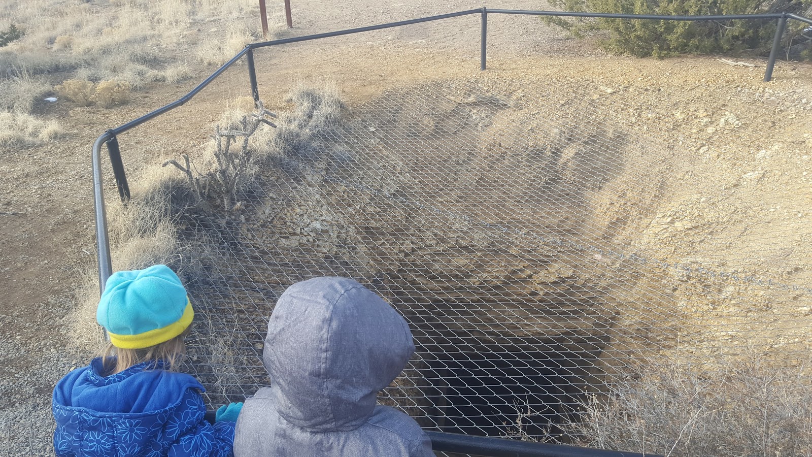
Abandoned mine in Cerillos Hills SP

Ada with her piece of Turquoise

Turquoise Treasure!


Ada near one of our cache finds

One of the deeper abandoned mines we encountered
 This cache (GC4WQ) had a Haiku theme, encouraging finders to write a haiku in the logbook. I came up with something that I thought sounded poetic, but probably is pretty silly sounding. But one particular log caught our attention and is now one of the kids favorite poems. It goes like this:

Snake snake snake snake snake 
I don't want to see a snake
OMG Hiss Hiss 

 It felt really nice to spend the day out caching with the kids. We used to do this kind of outing quite a bit but recently it seems that I do most of my geocaching trips on my own (and with rugged hikes). Maybe a combination of the kdis losing interest in geocaching, or rather having more interest in things like Pokemon GO. Regardless, we all enjoyed the day and I think we'll be doing more of these trips in the future.


Sunday, December 18, 2016

Back into the LCP game


One of the tings that I was sad about when we moved from NM to TN was that we would no longer live in an area covered by the Lonely Cache Project (LCP). That site had been a strong motivating factor for my geocaching, getting me to visit very remote and lonely caches,a s well as encouraging me to spend hours trying to crack some of the harder puzzles. The leaderboards in particular were fun for me, especially the ones where I was somewhat competitive. One of my favorite was the NM Year's Top Back Country Cachers leaderboard. In 2013 I was in a tight race for the top spot, a race that ended up coming down to the last few weeks of the year. This year, I was at a disadvantage having only moved back to the state in July, but I was going to make an effort to place high. After a few very remote FTFs, I was able to get in the top 5.

To help propel me a bit higher I planned a tough winter hike up Caballo Peak. That cache, as well as some of the ones along the way would be worth quite a bit, as well as knock down the points of the current leader, wolf11469, who also happened to be the cacher I was competing against back in 2013. That was the plan anyways. The day we went turned out to be one of the coldest of the year, and there was fresh snow along the trail. Not that this would normally be a problem, but I made the mistake of bringing my dog and she ended up having some issues with the cold and ice that I did not anticipate. Balls of ice would form between her toe-pads making it hard for her to walk, and she would constantly stop to chew at these, eventually causing her feet to bleed. We made it as far as GC4BQE1 before I decided that we should turn around. Only half way to Caballo, and without having found either of the big high LCP caches. There was one puzzle cache that would have been a high LCP find that was at the trailhead, but we couldn't find it under all the snow and ice.

Despite not being able to go after those high LCP caches, I had a back-up plan, going after the FTF of a remote desert hike near Espanola, Window Rock. A hike that would be at lower elevation where we wouldn't have to worry about the snow and ice, and the dog could happily run along the arroyos and mesas chasing rabbits.


 I will be back to go after Caballo, but not in 2016. And despite not reaching my LCP goals for the day, I am happy to be back in the LCP region. No doubt there are some high LCP caches around ehre that I will be targeting over the next few years.